
Les Pierres a Cupules will in English translate as Cupstones. A cupstone is a stone or rock surface bearing a cup sculpture. Cupstones are associated with places of worship and is believed to have been used as altar stones in prehistoric European religion. They are usually found close to glacial erratics, viewpoints and dangerous alpine trails.
This walk in the woods of St. Jean de Gonville is one I think many of you may have heard about. However, when people ask for hiking directions, I rarely see it mentioned.
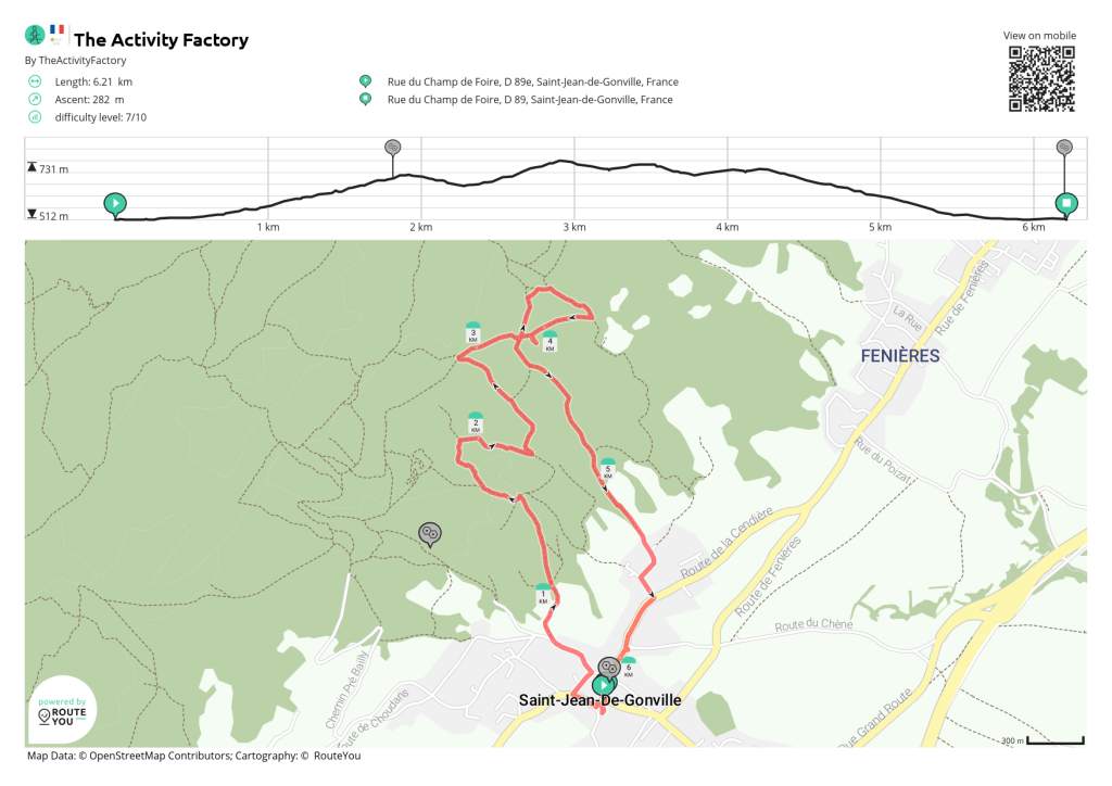
I did this walk many years ago with my family and thought it would be easy to find the way. Coming by car and finding a parking space was really easy. Lots of parking is available around the church of St Jean de Gonville. For those not equipped with their own car, the buss from Divonne to Bellegarde stops in St Jean de Gonville. To check the timetable click here. If you are coming from Geneva, the F bus and the 68 bus from TPG will take you across the border into Pays de Gex.
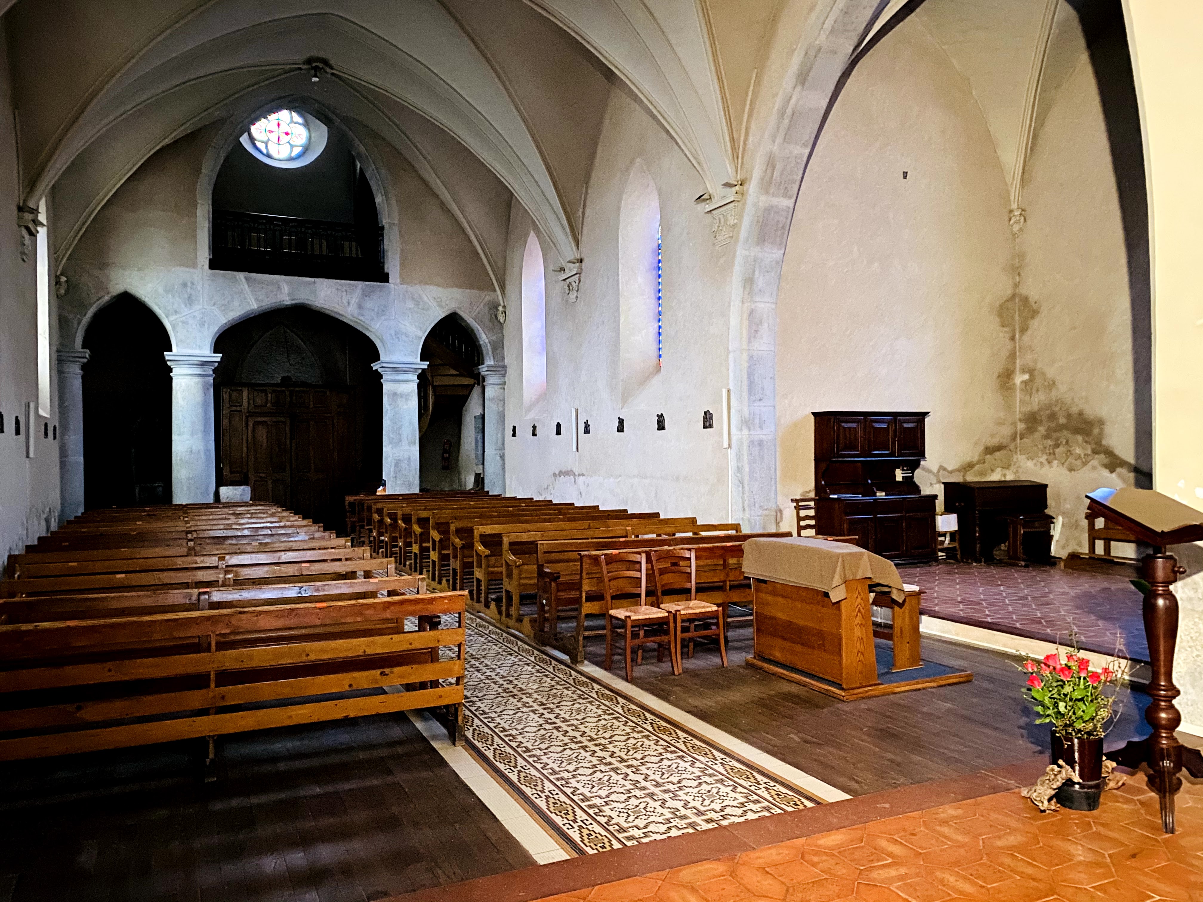
The church was open, so I walked in to have a look (this is the reason for all the doodles on the map). The church was constructed in 1090 on an ancient cemetery by the Clunisien priory of Saint Victor de Geneve. These small parish churches are of cause not as impressive as the cathedrals you will find in big cities, but remain pillars of Christian devotion in their local communities today, same as a thousand years ago. Their simpler architectural lines can be both peaceful and relaxing. If the church is open, I’ll advice you to have a look inside.
OK. Let’s move on to the walk. I would have thought there was a signpost indicating where to find these famous Cupstones. But no, nothing of the sort. At least I could not see any signs in the village indicating the starting point for the walking trail. I personally think that the commune should put a few Euros aside in their next budget to finance some signpost to indicate where this walk starts.
Right. When you have the church right behind you, walk a few meters up Rue de l’Eglise. Turn right on Rue Charriere and then left on Rue Gachet. After you pass a fountain, continue for another 10 meters or so and you will see a path on the right that eventually takes you into the woods.
The path is quite wide, and takes you on a gentle climb up (ignore the side paths and move on uphill). Soon you will have a good view of the area around, including Satigny and Geneva.
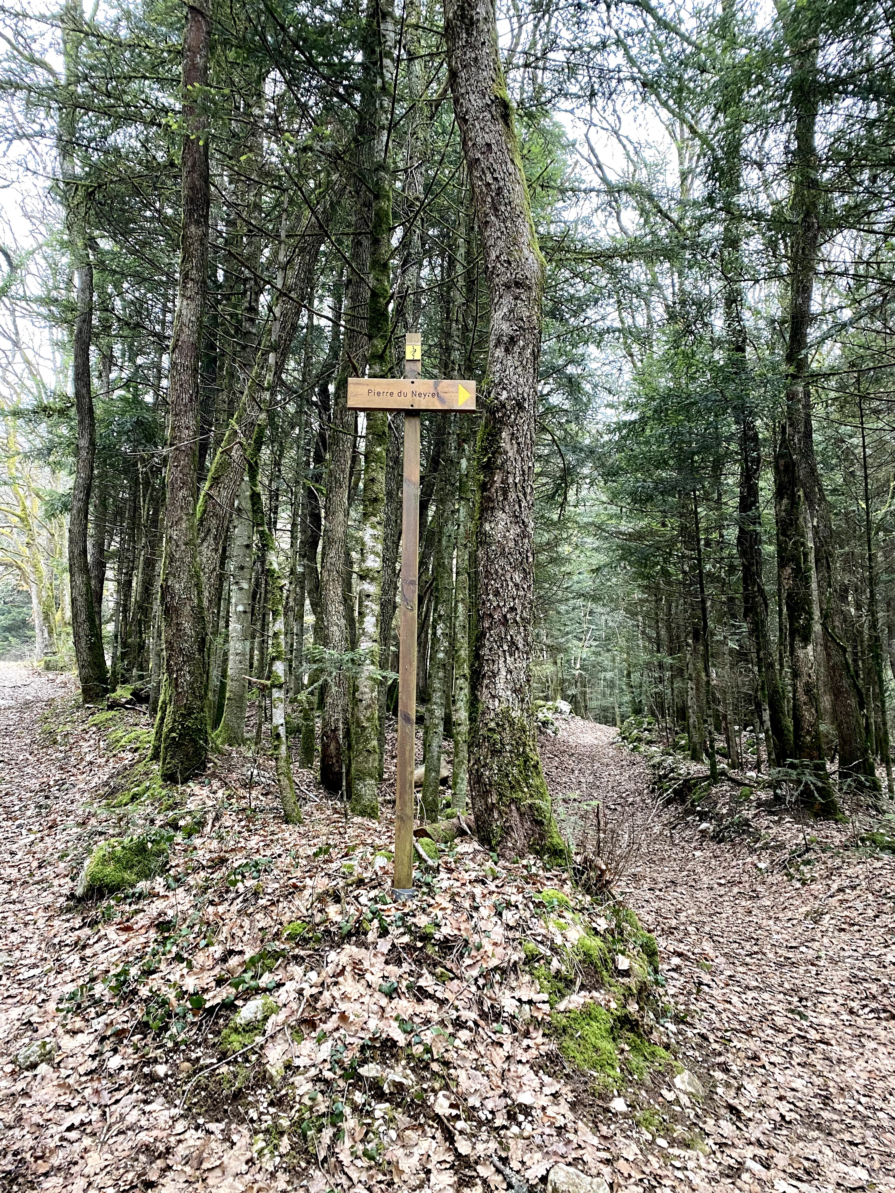
After a few minutes, you will come to the only signpost signalizing that you are on the right pathway to Pierre du Neyret.
The Pierre du Neyret rock, transported by the glacier from the Alps, is very impressive. In comparison to the Pierres du Parrey it could not have had the same importance because Pierre du Neyret has no engravings. When looking at I can’t help thinking it looks like a giant stranded whale. If you bring children along, ask them what they think this rock resemble. I’d be curious to know.

Walking on and up, you’ll eventually reach a barrier. From here, the path will take you slowly down to meet another path. At this crossroads, or crosspaths, walk to the left. Finally we’re going up again, this time on a path with a nicely built stone fence on either side. (Farmers today should really take the time to build this kind of fence instead of putting up the ubiquitous and dangerous barbed wire).

When you see the Maison Driset on your right side and this sign in front of you, the fastest route to Les Pierres du Parrey is to walk to the right.

On the map below you can see that I continued walking up; this is because once again it was not very clear to me where exactly in the woods I would find these rocks.

After just a few minutes you will come to a clearing in the forest. This clearing is impressive today and I think it must have been even bigger before. Now, the forest is growing freely since there is very little use of the land for agricultural purposes.
Standing in the middle of this field, you’ll have the Jura Mountains behind you, and a stunning view of the Mont Blanc, Geneva and the lake in front of you. This place must be a perfect place for an evening picnic in the summer, when the Covid curfews are history and we’re again allowed to move around after 6pm here in France.
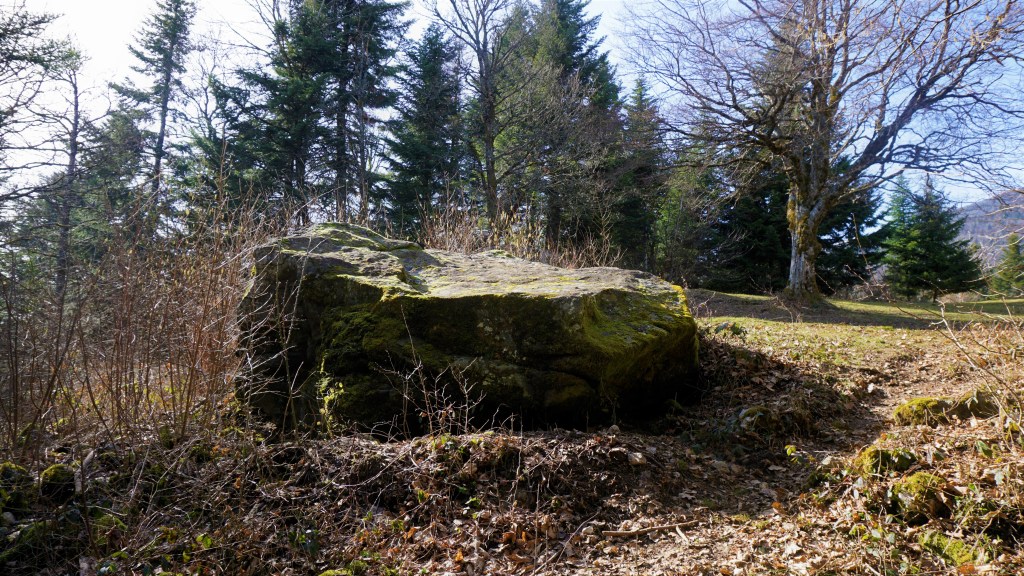
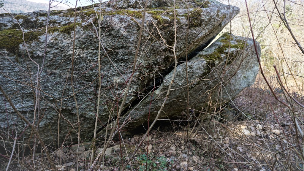
The first of the rocks is made of granite and has a flat surface, which with its more than 5 meters diameter is quite impressive. It rests on a smaller rock, which almost creates a little hut underneath.
The lower rock is made of chlorite shale and has been covered in engravings of crosses and channels.

After you have admired the rocks, you can chose to do a little loop by continuing upwards on the path you walked on coming up to the clearing. On this loop you will be passing the rocks again before you head back down.
To walk back to St Jean de Gonville, find the path that took you up to the clearing, and when you see Maison Driset do not walk to the right but continue straight on down towards the little Hameau de Mornex.
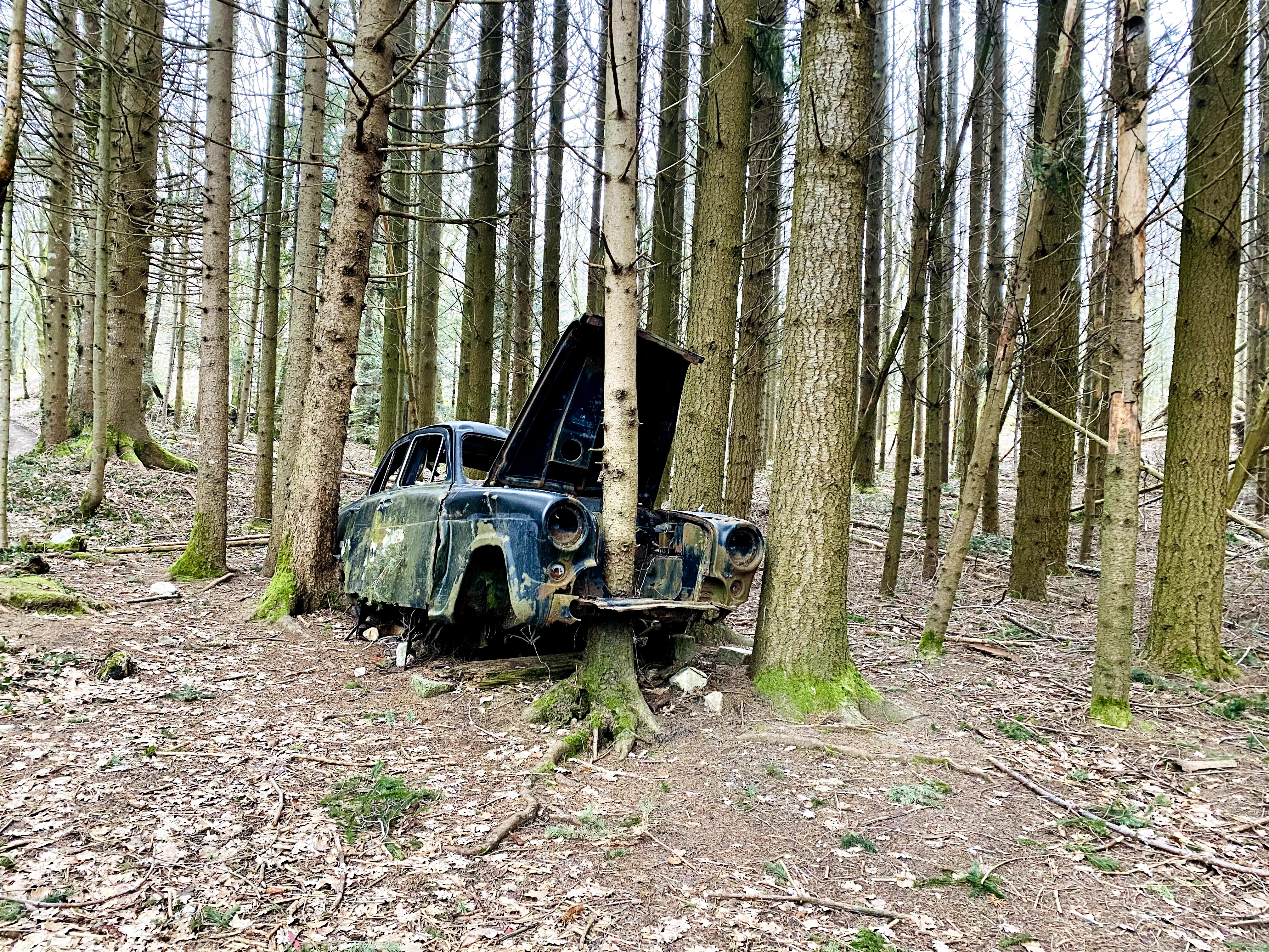
There’s a surprise waiting for you: On your way down you will all of a sudden see the remains of an old British car, deep in the middle of the woods. I really wonder how it ended up exactly here. I have read there are people traveling across Europe documenting old car wrecks found in the most bizarre places; however, I haven’t found any information about this car in particular. If you know the story of how it ended up here in the woods of St Jean de Gonville, please leave a message in the comments. I am sure there are many of us who are curious to know the history.

Passing the old houses in the upper part of Hameau de Mornex, the charm of ancient times is very much present. Walk down to the big road and look for the church tower. The church tower will lead you through the streets of St Jean de Gonville and back to your starting point.
Enjoy walking, and feel free to share!

