All posts by Berit Pedersen

France: Circular walk from Mont Mourex to Mont Mussy

When I was a newcomer to the Pays de Gex, this walk was the first I tried.

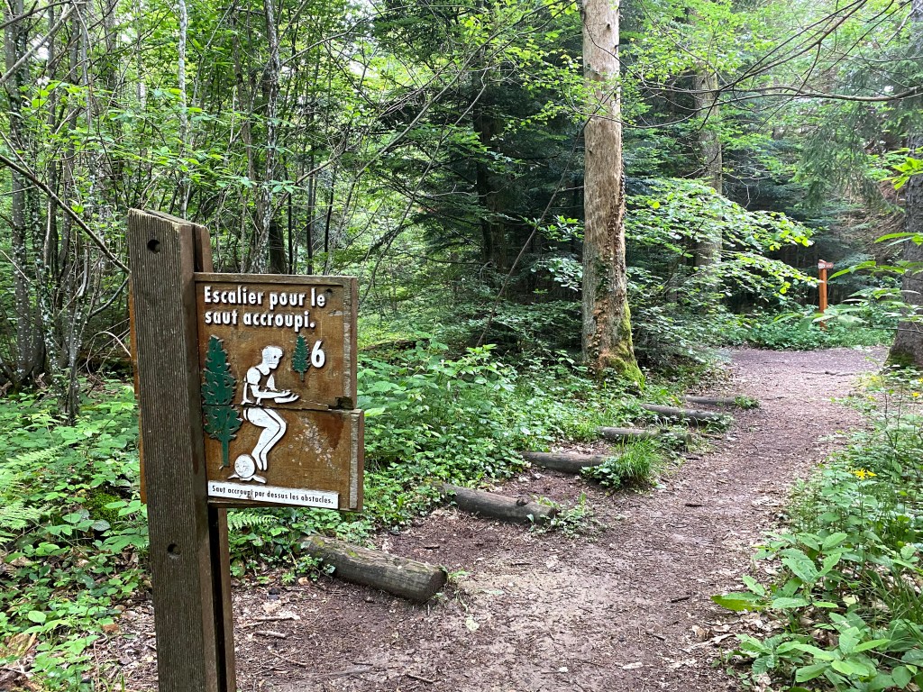
I see that whenever people ask for suggestions, this walk is always the first to be mentioned. Once you have been to Mont Mourex, you will understand why. Apart from high altitude I think it covers everything: forest, open pastures, and a superb view of the lake. You will also find an exercise circuit trail and special paths for mountain biking.

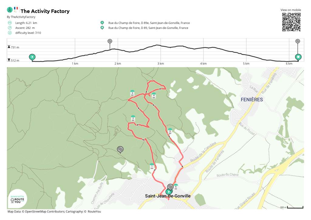
Doing the full circuit walk will take an adult not walking too fast just over an hour.

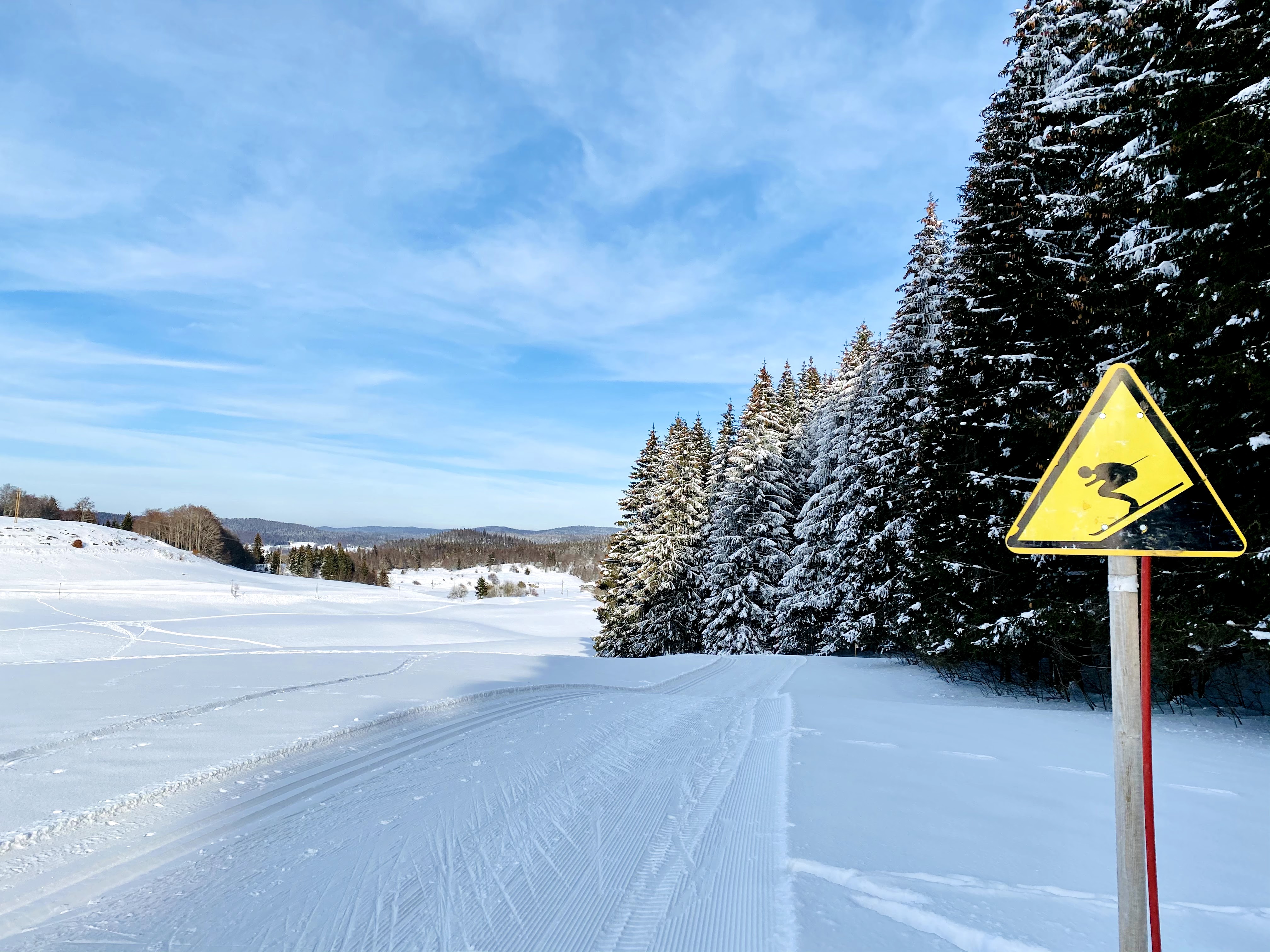
This walk can be done the whole year around. Over the years I have done this walk in the summer, spring, autumn, and winter. The track tends to get muddy so I will avoid putting on my newest white shoes unless you do the walk in the middle of the summer when the weather has been good for a while and the ground is dry.

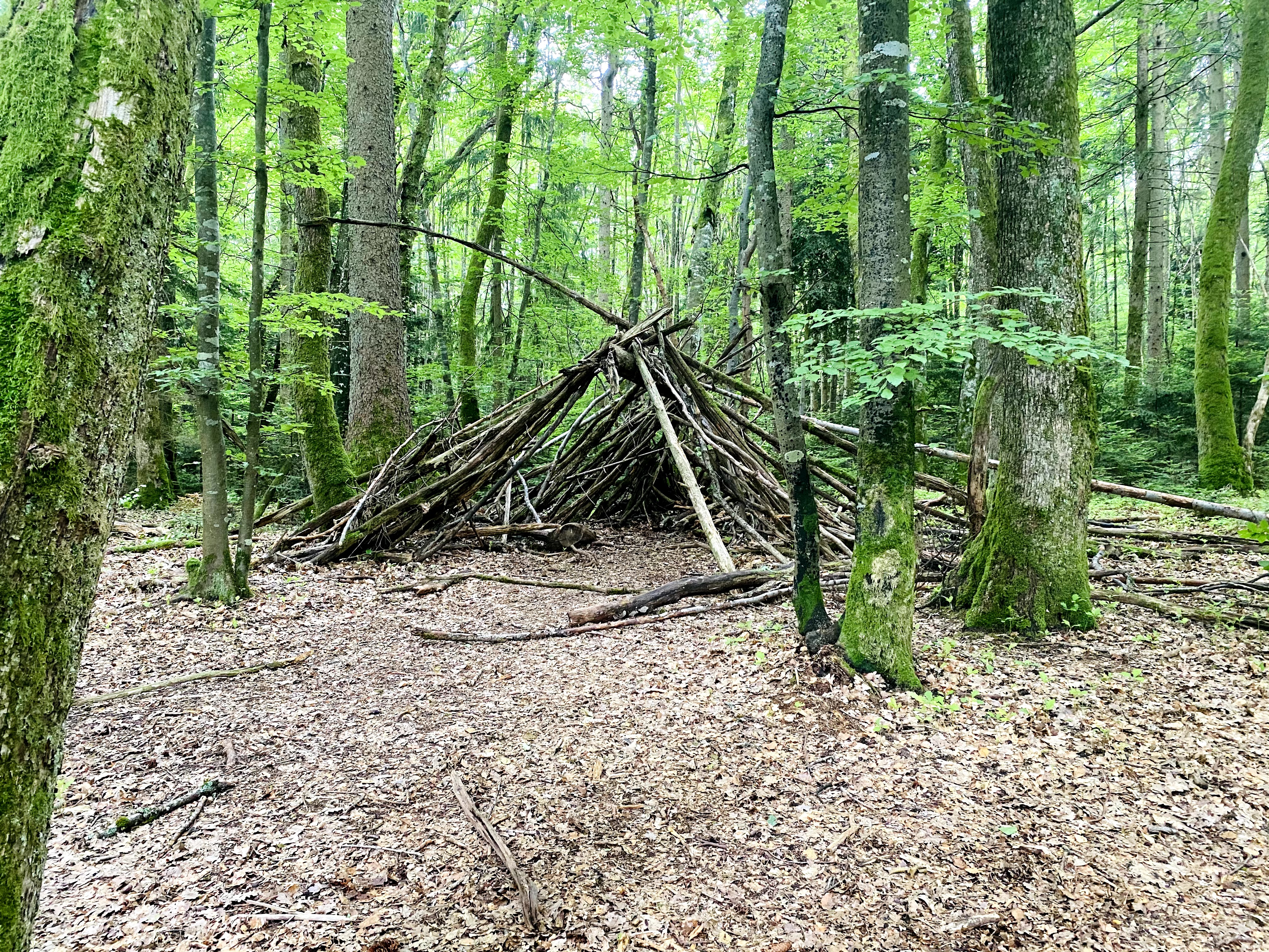
When my children were young, I sometimes brought them along with friends to play in the forest on a hot summer day as a change to going to the pool. Being sheltered in the forest, they would play for hours in a hut made by branches and make animals from pine-cones.

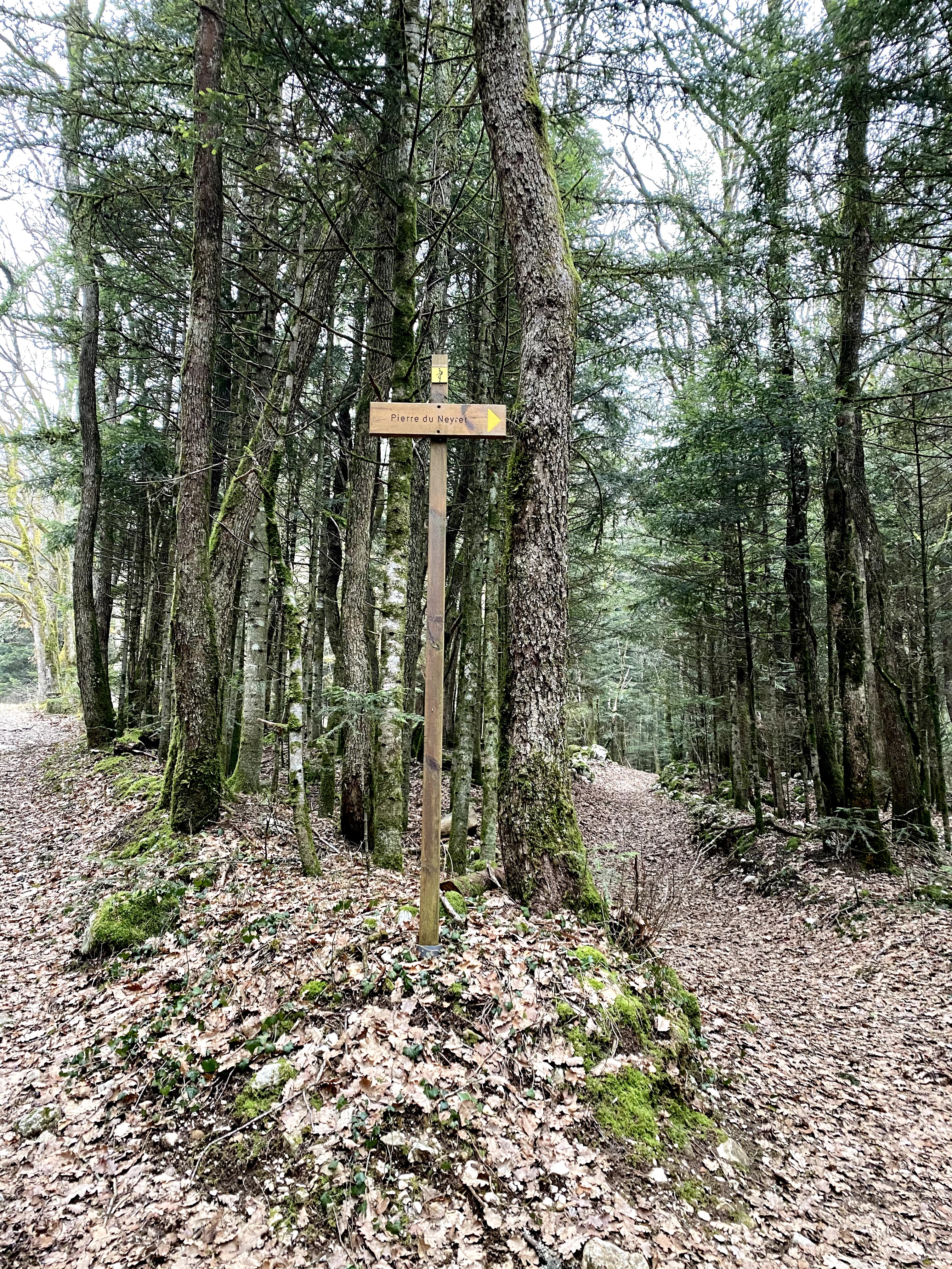
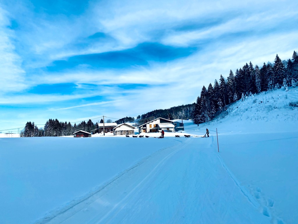
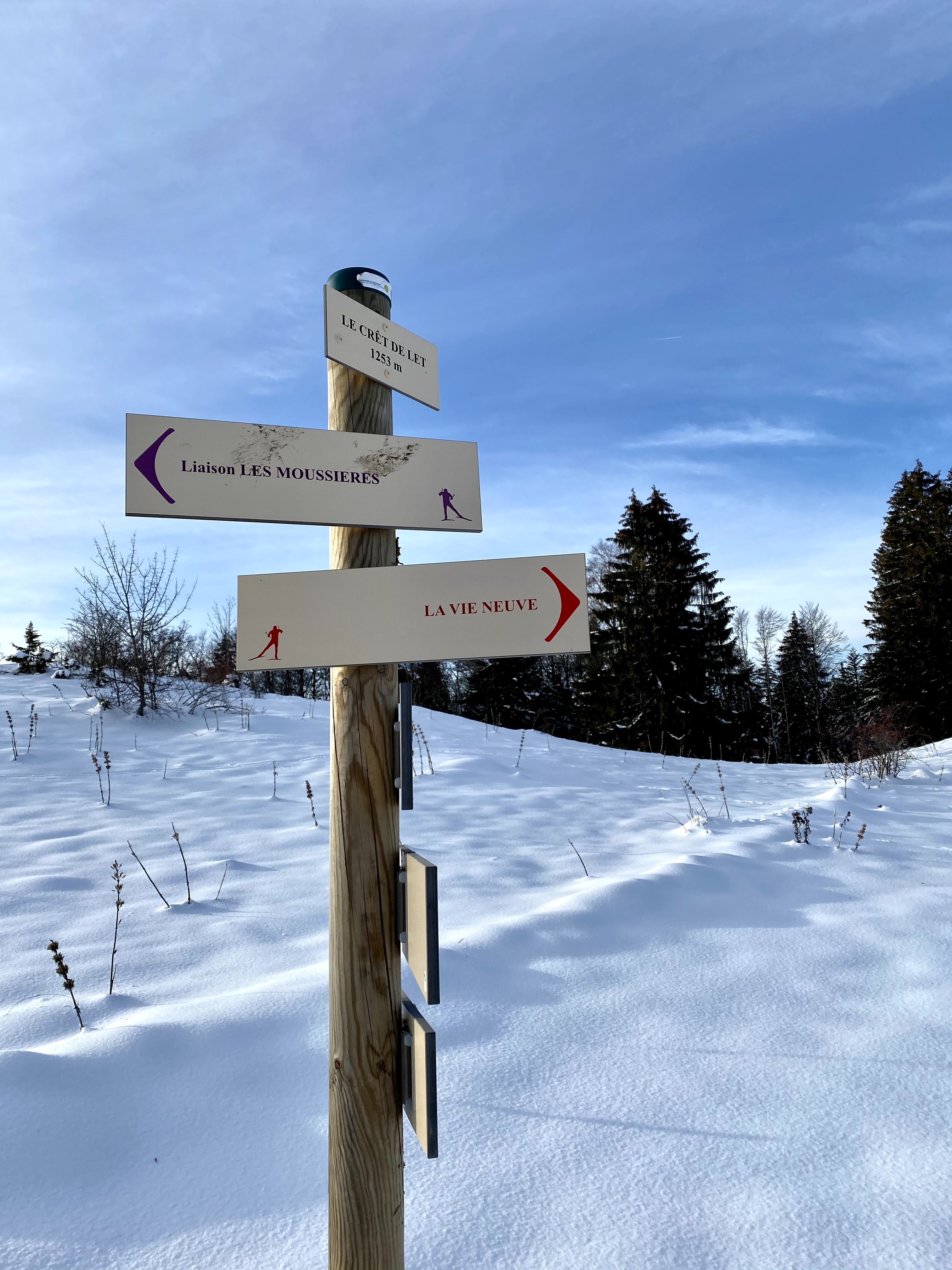
You can start this walk from the Divonne side (Mussy) or from the Mourex side. Both sides offer plenty of parking possibilities. I always start this walk from the Mourex side. This is mainly because Mourex is closest to where I live, but also because Mourex village is so beautiful. Driving up from Grilly, turn right when you see the big iron cross. Then follow the sign to Mont Mourex. Go slowly with your car the last hundred meters; the last stretch is very bumpy. If you start from the Divonne side, just drive up the Chemin de la Ferme Mussy. For exact details see the map at the bottom of this post.

From the Mourex side you start with a very gentle little climb. The total climb for the full circuit is just over 100 meters so fairly flat.

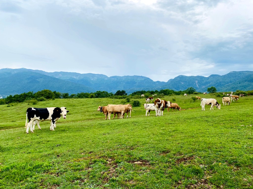
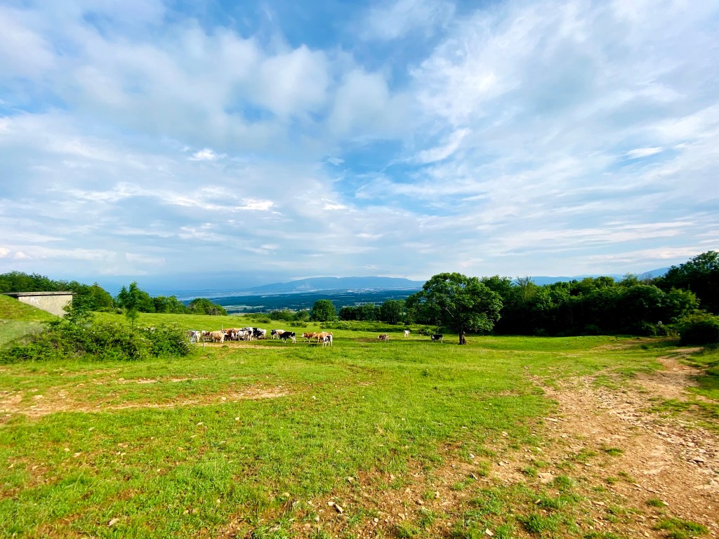
In the spring and summer, you might meet the cows out grazing like I did just the other day.

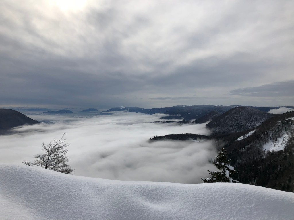
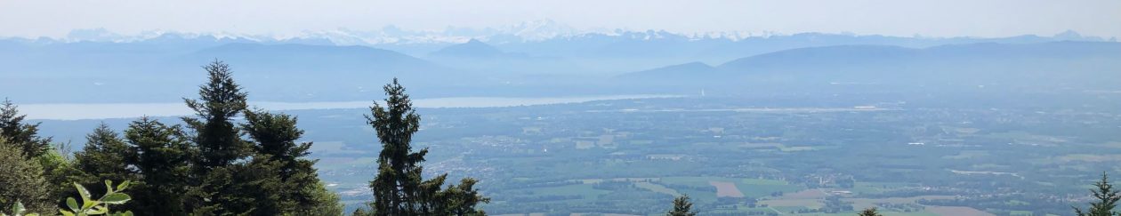
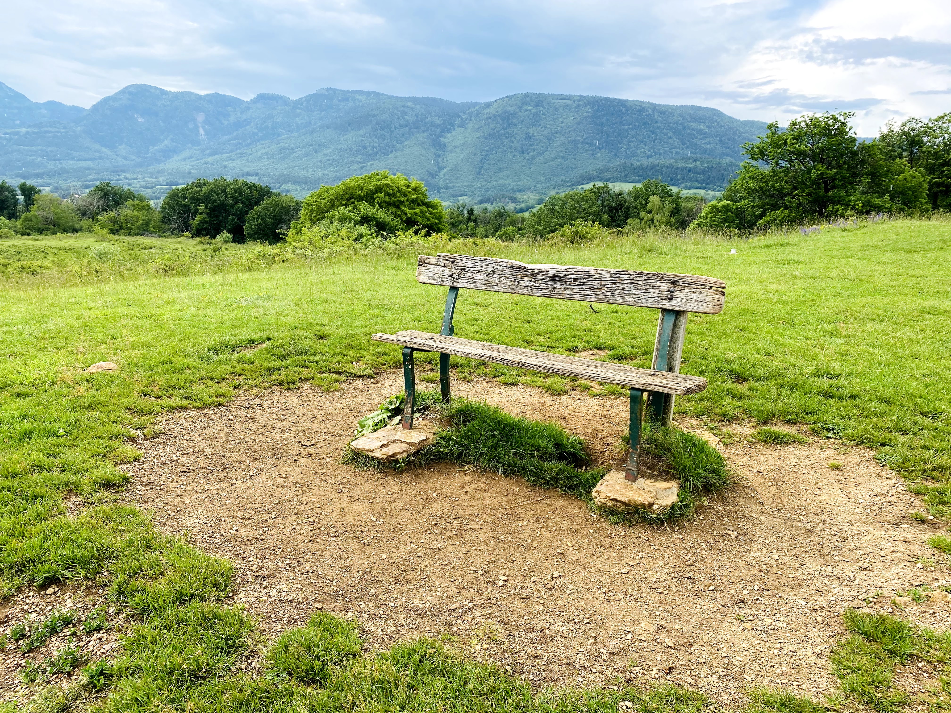
You will quickly reach the summit of Mont Mourex, where you will have a fantastic view on the lake, Geneva, and the Alpes. There is an orientation table put up that will help you locate Mont Vuache, Saleve, and Mont Blanc from all the other hills and mountains in sight.

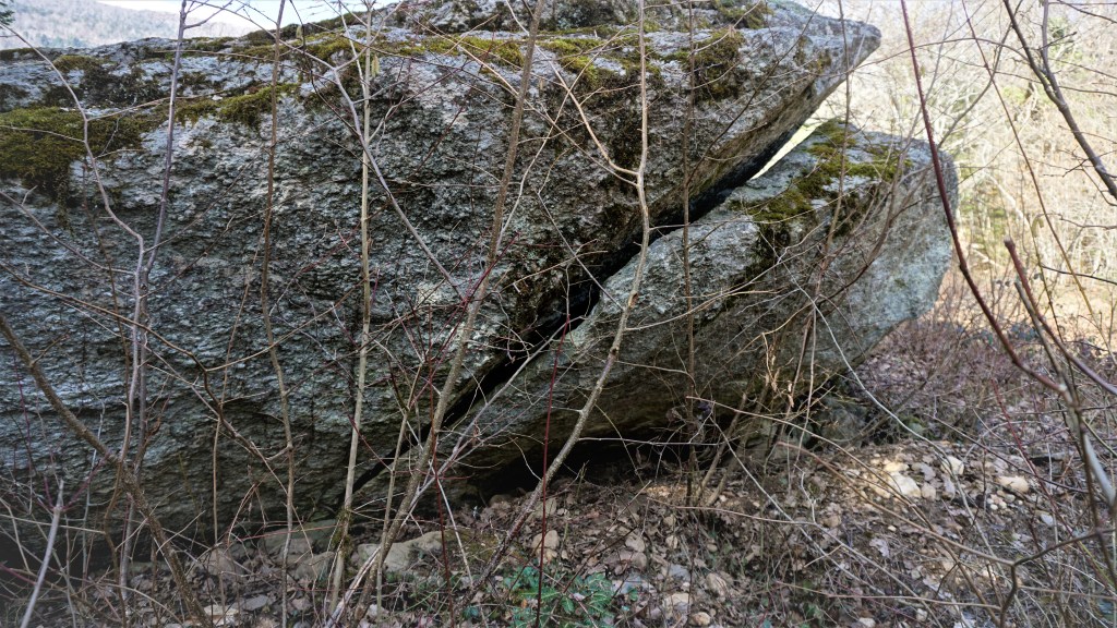
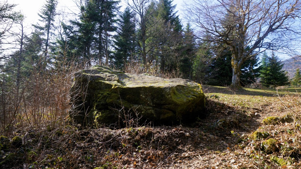
Close to the orientation table you can see a menhir stone. Facing Mont Blanc, it would have been a place for worshipping the sun. The menhir you can see is believed to have been part of a circular cromlech arranged in a large 47-meter diameter circle. If that is the case, it might have been destroyed at the beginning of the 20th century when a signal for the geographical service of the army was constructed (P.Delacretaz,Pierres mysterieuses,page 113).

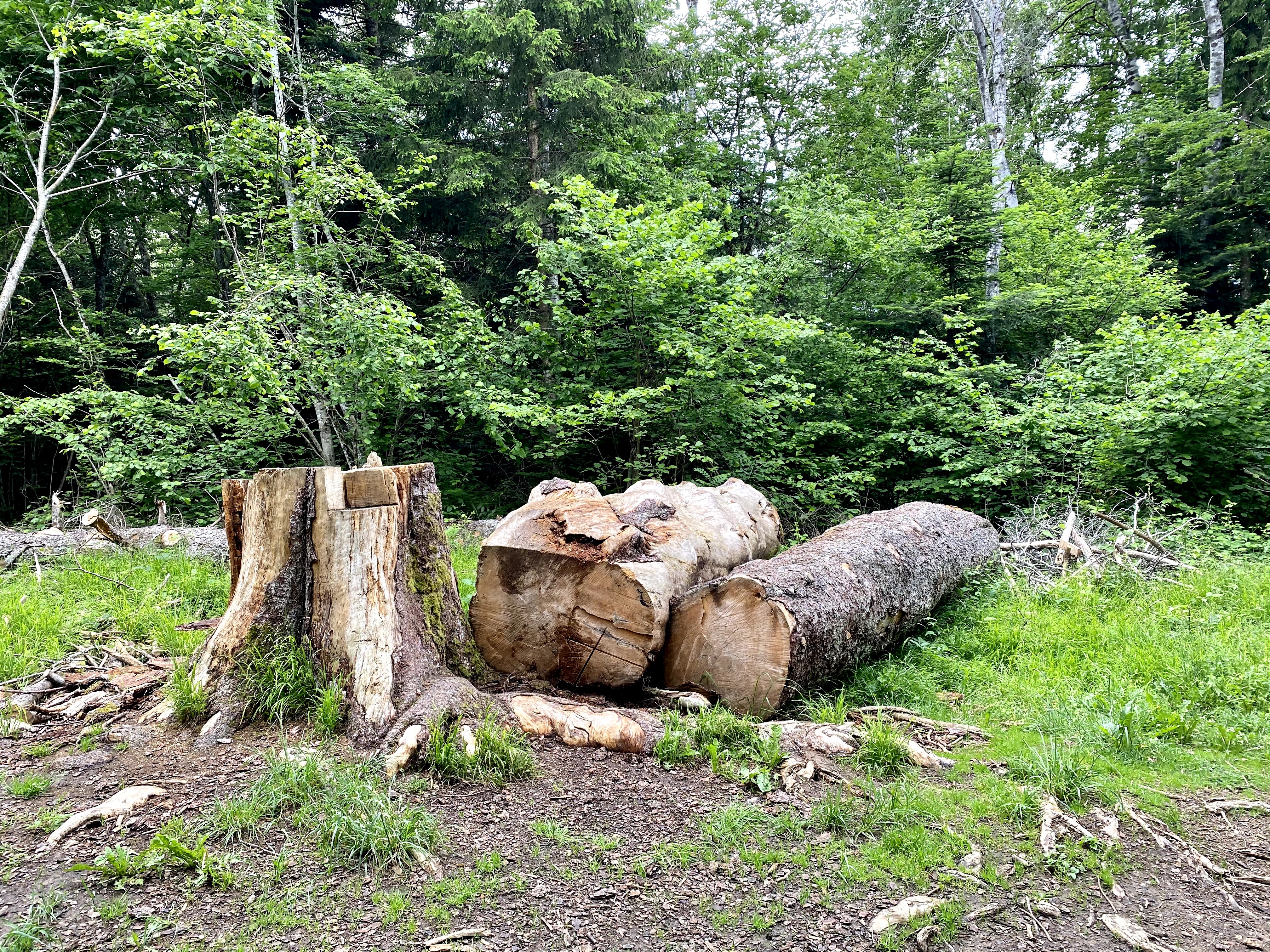
Communal wood harvesting dates back from the Middle Ages where the Lords would grant village residents the right to cut down trees to use for firewood. On your walk through the wood, you will see that forest workers have cut down and stacked up a lot of wood. To keep the forest healthy, early thinning creates tougher trees that can endure climate change. If the forest is too overgrown the threes can get “stressed”, and stressed threes are more susceptible to droughts and insect attacks. Today, this work is done by professional workers from the National Forest office.

With the wide tracks which are well marked with signposts you should have no trouble find your way to the other end of Mont Mussy whichever parking you chose to use as your starting point.

Enjoy your walk, and feel free to share!

Switzerland: Museum to Museum in Geneva, Switzerland

Museum to Museum, a different Sunday walk in Geneva

On those days where you don’t want to travel very far, a walk around the city can be a good way of getting some fresh air and exercise. To add in a history lesson or two is just a bonus.

I came across the Geneva Culture Trails last year when I picked up a leaflet just before the pandemic closed our borders between France and Switzerland. Since Geneva was out of limit for those of us living on the French side, I forgot about it, but still kept the leaflet because I still hoped to use it one day.

The Canton of Geneva has done a really good job mixing walking with culture and history. There are several trails available to download or you can pick up their respective leaflets in many local museums. The best part is that you can also install an app on your phone that will explain the sights you pass on your walk in English. You can find and download the app by searching for Geneva Cultural Trails in your preferred app store. Each audio explanation of the different sights that you walk past is two to three minutes long. Listening to these on your phone while you observe whatever is being explained with your own eyes makes the whole experience interactive, fun and educational.

The different walks take you around the United Nations area, the old town, and Plainpalais. On my first Geneva Museum to Museum walk I decided to try out the walk that explore the Plainpalais area.

I have been to the Parc de Bastion several times, and it is the starting point of this particular walk. Using the app with explanations in English made me see the Geneva Library and the Reformation wall  with fresh eyes, and it was almost like exploring them for the first time. Even for people living in and around Geneva and knowing the history of the city it must be nice to have a little history lesson every now and again.

The walks also take you to some of the more hidden parts of Geneva – or at least they were for me. As an example, I did not know about Cimentiere des Rois, which is Genevas answer to the famous burial place Pantheon in Paris. Contrary to Pantheon, the Cimentiere des Rois is outdoors, which make each visit special depending on the weather, season and light. I had to ask my son who has been exploring Geneva with his friends for years if he knew and had visited this extraordinary place. He had not, so I assume this is a hidden treasure a little outside of the more known tourist areas.

Along the way was a museum I had no idea existed, The Museum of the Fire and Rescue Service. I wish I had known about this when my son was younger. Along with the Natural History Museum, I’m sure this would have been a favourite.  My son is a young adult know, but as a good mum I will take him with me to explore this Museum next time he comes home. It is never too late to bring your kids to a museum!

The walk along the Rhone was so nice on this sunny Sunday, so I deviated from the marked trail on the map. I walked all the way to La Pointe de la Jonction. Seeing the different colours of the River Rhone and the River Arve is extraordinary. The best spot for seeing the colour differences in the rivers merging at Jonction is the big bridge that you see in front of you.

For those old and young with an interest in trams and buses, you will find the Transport de Geneve (TPG) depot interesting. You won’t be allowed to enter, but you can walk past the huge garages they have for trams and buses and peek at them through the windows.

Just around the corner is the Usine Kugler, which is an old faucet foundry turned into a Gallery for visual arts. Since the opening in 2011 over 400 artists have had this old faucet foundry as their workplace. Usine Kugler is the place to look for art exhibitions, festivals and workshops for both children and adults, especially when Covid is over, and we get back to a normal way of life.

Back on the marked trail all museums are open, but there is a limit on the number of people allowed inside, so for the moment be prepared to line up, be patient, and keep your distance to people that are not part of your cohort.

The market stalls selling food and clothes on Sundays were still in action at Planpalais, but maybe not in the same numbers as would be normally.

Enjoy exploring Geneva!

France: Les Pierres des Cupules in St. Jean de Gonville

Les Pierres a Cupules will in English translate as Cupstones. A cupstone is a stone or rock surface bearing a cup sculpture. Cupstones are associated with places of worship and is believed to have been used as altar stones in prehistoric European religion. They are usually found close to glacial erratics, viewpoints and dangerous alpine trails.

This walk in the woods of St. Jean de Gonville is one I think many of you may have heard about. However, when people ask for hiking directions, I rarely see it mentioned.

I did this walk many years ago with my family and thought it would be easy to find the way. Coming by car and finding a parking space was really easy. Lots of parking is available around the church of St Jean de Gonville. For those not equipped with their own car, the buss from Divonne to Bellegarde stops in St Jean de Gonville. To check the timetable click here. If you are coming from Geneva, the F bus and the 68 bus from TPG will take you across the border into Pays de Gex.

The church was open, so I walked in to have a look (this is the reason for all the doodles on the map). The church was constructed in 1090 on an ancient cemetery by the Clunisien priory of Saint Victor de Geneve. These small parish churches are of cause not as impressive as the cathedrals you will find in big cities, but remain pillars of Christian devotion in their local communities today, same as a thousand years ago. Their simpler architectural lines can be both peaceful and relaxing. If the church is open, I’ll advice you to have a look inside.

OK. Let’s move on to the walk. I would have thought there was a signpost indicating where to find these famous Cupstones. But no, nothing of the sort. At least I could not see any signs in the village indicating the starting point for the walking trail. I personally think that the commune should put a few Euros aside in their next budget to finance some signpost to indicate where this walk starts.

Right. When you have the church right behind you, walk a few meters up Rue de l’Eglise. Turn right on Rue Charriere and then left on Rue Gachet. After you pass a fountain, continue for another 10 meters or so and you will see a path on the right that eventually takes you into the woods.

The path is quite wide, and takes you on a gentle climb up (ignore the side paths and move on uphill). Soon you will have a good view of the area around, including Satigny and Geneva.

After a few minutes, you will come to the only signpost signalizing that you are on the right pathway to Pierre du Neyret.

The Pierre du Neyret rock, transported by the glacier from the Alps, is very impressive. In comparison to the Pierres du Parrey it could not have had the same importance because Pierre du Neyret has no engravings. When looking at I can’t help thinking it looks like a giant stranded whale. If you bring children along, ask them what they think this rock resemble. I’d be curious to know.

Walking on and up, you’ll eventually reach a barrier. From here, the path will take you slowly down to meet another path. At this crossroads, or crosspaths, walk to the left. Finally we’re going up again, this time on a path with a nicely built stone fence on either side. (Farmers today should really take the time to build this kind of fence instead of putting up the ubiquitous and dangerous barbed wire).

When you see the Maison Driset on your right side and this sign in front of you, the fastest route to Les Pierres du Parrey is to walk to the right.

On the map below you can see that I continued walking up; this is because once again it was not very clear to me where exactly in the woods I would find these rocks.

After just a few minutes you will come to a clearing in the forest. This clearing is impressive today and I think it must have been even bigger before. Now, the forest is growing freely since there is very little use of the land for agricultural purposes.

Standing in the middle of this field, you’ll have the Jura Mountains behind you, and a stunning view of the Mont Blanc, Geneva and the lake in front of you. This place must be a perfect place for an evening picnic in the summer, when the Covid curfews are history and we’re again allowed to move around after 6pm here in France.

The first of the rocks is made of granite and has a flat surface, which with its more than 5 meters diameter is quite impressive. It rests on a smaller rock, which almost creates a little hut underneath.

The lower rock is made of chlorite shale and has been covered in engravings of crosses and channels.

After you have admired the rocks, you can chose to do a little loop by continuing upwards on the path you walked on coming up to the clearing. On this loop you will be passing the rocks again before you head back down.

To walk back to St Jean de Gonville, find the path that took you up to the clearing, and when you see Maison Driset do not walk to the right but continue straight on down towards the little Hameau de Mornex.

There’s a surprise waiting for you: On your way down you will all of a sudden see the remains of an old British car, deep in the middle of the woods. I really wonder how it ended up exactly here. I have read there are people traveling across Europe documenting old car wrecks found in the most bizarre places; however, I haven’t found any information about this car in particular. If you know the story of how it ended up here in the woods of St Jean de Gonville, please leave a message in the comments. I am sure there are many of us who are curious to know the history.

Passing the old houses in the upper part of Hameau de Mornex, the charm of ancient times is very much present. Walk down to the big road and look for the church tower. The church tower will lead you through the streets of St Jean de Gonville and back to your starting point.

Enjoy walking, and feel free to share!

France: Giron, winter hiking on snowshoes and cross-country skiing

Because La Vattay is the nearest place for me to go cross-country skiing, it’s where I often end up on a nice and sunny day.

But on those nice and sunny weekends when the sheer amount of traffic up towards Col de La Faucille is just crazy, why not try going to a real local place that offers great trails for both the cross-country skiers and on foot.

I discovered the small village of Giron just a few years ago, and it has since become my preferred resort on those days where I just know I’ll spend more time looking for a parking space at La Vattay than actually skiing.

This year, with all the alpine ski resorts closed and shops being sold out for snowshoes, it feels like the whole of Geneva and Pays de Gex take the same route up past Gex and into the Jura mountains at exactly the same time.

This is why Giron, located in the Ain department, is a good alternative. From the greater Geneva region, it takes you about one hour to drive. To get there, all you have to do is drive past Bellegarde and take the local road (not the A40) towards Nantua. Roughly mid-way between Bellegarde and Nantua, at Saint-Germain-de-Joux, you take right and follow the signpost towards Giron. Another few minutes, and you’re there.

Giron is located 1,000 meters above sea level (it even says “Giron 1000” on the signs) and it’s the highest village in the Ain department. Even so, it is relatively low in comparison to many resorts you’ll find on the Jura plateau. In recent years, with relatively mild winters, the snow have melted earlier there than on some of the more north-facing trails elsewhere, especially those at La Vattay. If you’re in doubt about the current snow conditions you can call the Relais Nordique (0033 676 24 52 12) to check with them whether the trails are open, or you can consult the snow report (unfortunately only in French).

As with most of these resorts in our various backyards, for a daytrip you need to have access to a car as public transport is not really an option. If you go for the weekend, Le Relais Nordique has a pickup service that will collect you in Bellegarde.

Interestingly, Giron is the point of arrival for participants in the 76 km long cross country ski race competition La Transjurassienne. The Transjurassienne is the world’s second longest cross-country ski competition, normally taking place in February every year.

Apart from the weekend when the Transjurassienne takes place, Giron is very much a quiet little local station. You won’t find the same number of trails as they have at La Vattay, but the upside is that it is not as busy. Even on a Sunday, you will find parking relatively easy. In the village centre there’s a rental shop and bar/restaurant, as well as restroom facilities, all in one building. At the counter of the rental shop, friendly staff will help you find the right skis or snowshoes. Whenever the nasty Covid virus decide to pack it in, you should be able to enjoy a nice lunch and hot and cold drinks at the Relais Nordique. Even last Sunday, the smell of hot wine was just divine and very inviting.

In the meantime we have to take a packed lunch with us and enjoy it outside. Which can be very nice too.

In order to check out the map of trails, click here for skis and snowshoes.

If you are not in possession of your own equipment, skis, snowshoes and sledges can be rented at Le Relais Nordique. For prices, click here.

Whether you select the green, blue or red trail, you will be passing Cirque de la Fauconniere on the way back to the starting point. This is a spectacular 150-meter-high cliff wall (you’ll pass the summit). On a nice and sunny day, you will be able to enjoy a spectacular view of the Semine valley from this viewpoint. My photo from last Sunday when everything was covered in mist doesn’t really give justice to this spectacular view.

Finally, on your way back, don’t forget to stop in Saint-Germain-de-Joux to check out the local river and its “marmites”. These rock hollows, carved out by the river over millennia, are accessible by a 5-minute walk from the town centre. Just follow the signs! For a longer walk around the “marmite” you should try this walk that I blogged about last year. The Giant Kettles in Saint Germain de Joux (les marmites de geant) and Combe Michel

I hope you enjoy, and feel free to share!

France: Les Molunes – cross-country skiing or snowshoeing at high altitude in the Jura mountains

Next up in this series of winter activities in the Jura mountains is Les Molunes. Les Molunes is one of those places that can best be described as being in the middle of nowhere, but a very beautiful nowhere. The commune – which is officially known as Septmoncel Les Molunes – is located in the southern part of the Jura massive in the Hautes Combes. The Haute Combes in turns is a plateau that stretches over sixty kilometres, with an altitude ranging from 900 – 1500 meters above sea level. The landscape offers a tranquil scenery of farms spread over a relatively large area with forest and mountains framing it. Many of the farmhouses were built to accommodate ancient forest workers. Due to the exposed landscape and relatively high altitude the weather can be rough at times, especially the wind. This wind is often coming from the south east, which means that the corresponding wall of the local houses is often fortified with special covering. With just over 100 inhabitants, the small hameau Les Molunes is not winning any competitions for being densely populated, which is probably why it was assimilated into neighbouring commune Septmoncel in 2017. However, it does have the town hall placed at the highest altitude in the whole of the Jura department.

There are three cross-country ski trails prepared, one red, one green and one blue. Both the red and the green starts from La Vie Neuve, and the blue one starts from La Simard, which is near the main road going from Lajoux to La Pesse. There are also two snowshoeing trails prepared; both starts off from La Vie Neuve.

Les Molunes is on the Grand Traverse du Jura. You are therefore not limited to staying on the prepared circuit trails. You can continue on to Lajoux and La Pesse, and whenever the liaison to Les Moussieres is open you can connect to the prepared circuit trails over there.

For dog owners, the rules are the same as for Lajoux. Dogs are not allowed on the cross-country trails, but will be allowed to accompany you if you go on snowshoes.

Curiously, I did not see a ticket office for cross-country tickets; I suggest you stop at the Tourist Office in Lajoux or La Pesse and buy your tickets there. Click to see the prices for cross-country skiing and snowshoeing.

If you need ski lessons, the ESF Haute Jura has instructors that speak both French and English.

From what I’ve said about the size of the place, it probably comes as no surprise that there are no equipment rental facilities in Les Molunes. The nearest shops can be found in Lajoux, Benoin Jeannin Sport and Mermet Equip’Fond. In Les Moussieres there is also a Gros Sport renting out equipment, and in La Pesse Michel Sport will rent you what you need of equipment.

In the southern part of the Jura massif, I often see dog sledding when out skiing. I have not tried this kind of activity myself yet, but it’s definitely on the list of activities I’d like to try (even if I am normally scared of dogs). There are several professional dog sledders offering outings ranging from one hour to several days in this part of the Jura Mountain. Les Bois Fous is one of these companies and it could very well be their dogs you can see on these photos, taken a few days ago in Les Molunes.

Because of Covid, all bars and restaurants are currently closed and only offer take away for the time being. At Feodor you can order burgers and very local beer and enjoy it outside. There is a table and benches right at the start of the ski trails. When bars and restaurants open up again, I will surely be going back to Les Molunes to try the food that Feodor cooks on his impressive offset smoker, imported from the US. The menu is very tempting with meat smoked on indirect heat for 10 hours, or even smoked Mont D’Or cheese. Just looking at the menu and having a sneak peak at the cosy interiour makes me want to plan lots of trips back to Les Molunes.

How to get there: As for most places in the depth of the Jura mountains, you’ll need access to a car if you are planning a day trip. If you plan to stay for a few days am sure there are possibilities to be transported from Saint Claude to Les Molunes, but it will still be practical to have access to a car when there.

Enjoy your outing to Les Molunes!