Category Archives: Daytripping

France: Exploring the Ain back waters (Corveissiat, Thoirette and Barrage de Vouglans)

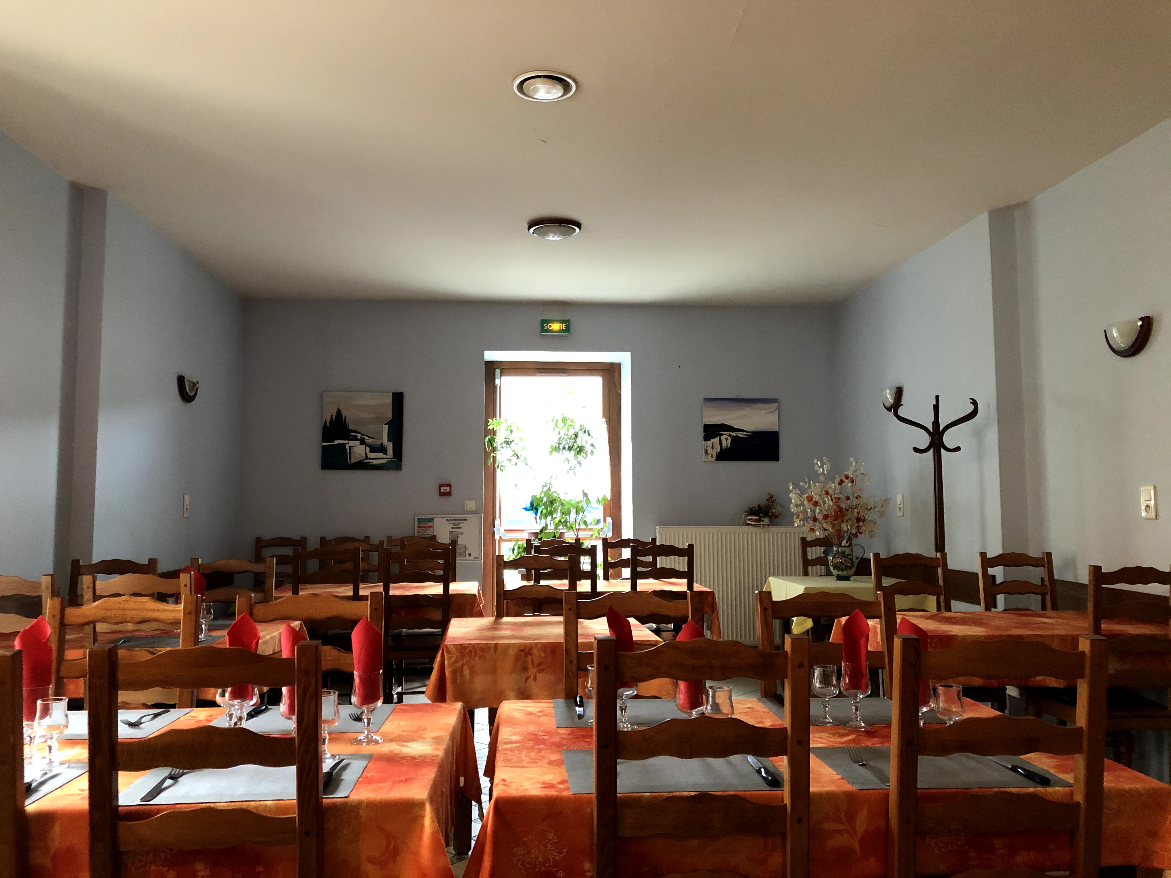
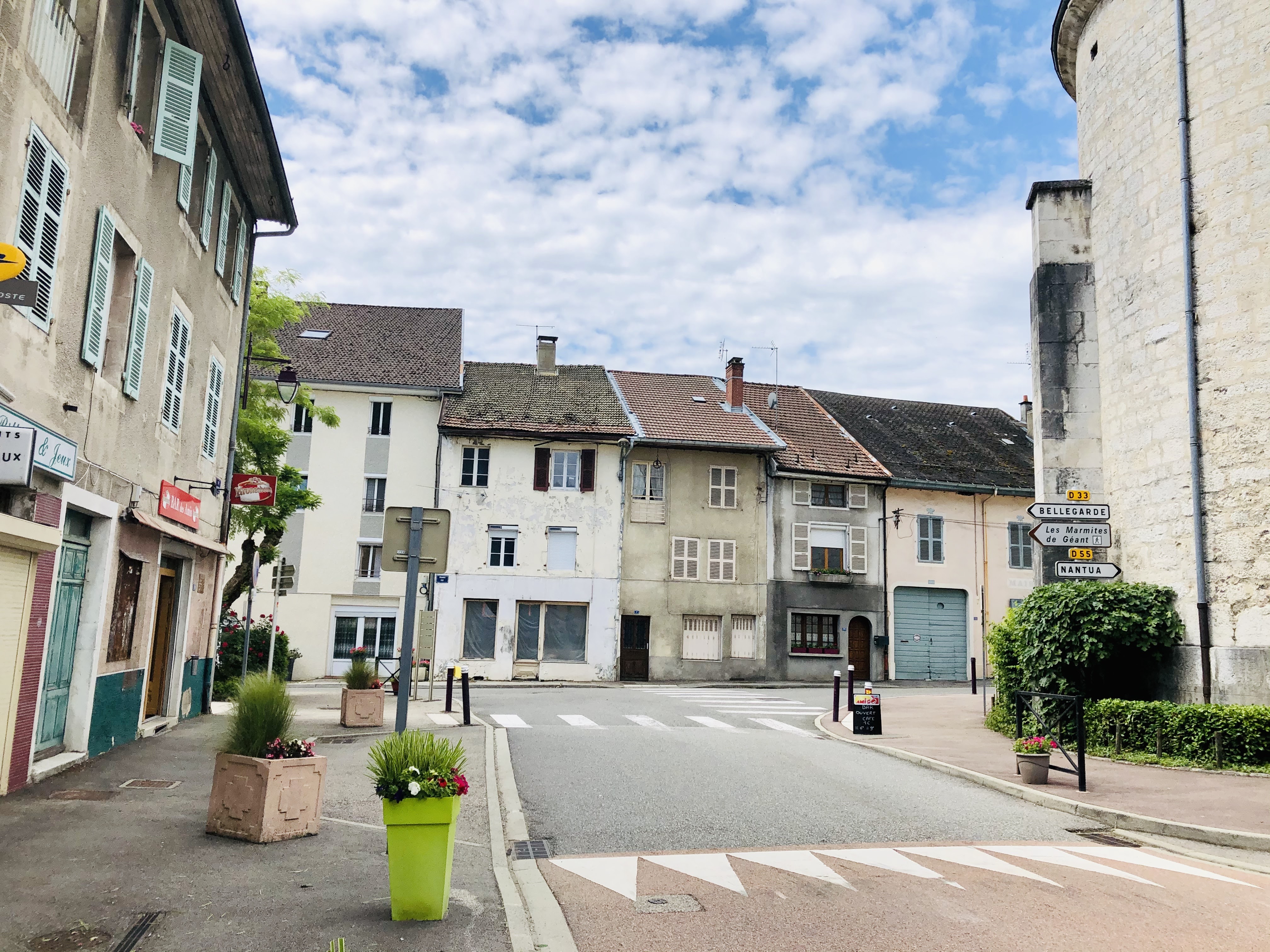
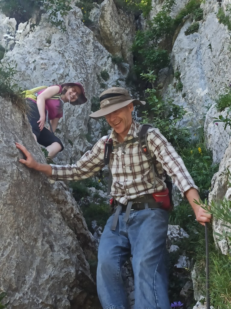
I really enjoy just driving somewhere and exploring what I find without doing too much research before I go. Maybe it all started when my daughter was small and refused to take her naps at home but would happily sleep for an hour or two if placed in her car seat. At least that was how we came across Thoirette more than 20 years ago. For some reason, we remembered the name of this tiny community, maybe because it is similar to Thoiry. I remember it was a grey and rainy day, and apart from having lunch we were not really tempted to leave the car and go for a walk. Not that we would have known where to walk anyway. This was before we had a GPS at hand in our car, and long before we had access to tourist information and maps on our smartphones. What we did find was a restaurant serving up something we’d never seen before, new as we were to France and continental European cuisine. On the menu was something called “Fritures”, which turned out to be deep-fried tiny fish. The restaurant was packed with locals all enjoying this “Fritures” dish, and we asked in our (at the time) very broken French to have the same as everybody else. It was delicious, our little daughter also really enjoyed stuffing small fish into her mouth, and afterward, we talked about going back for years. Indeed, a lot of years passed, and only in the last couple of years did we find the time to go back and start to really explore the area. And, only last year did we find the time to test the restaurant again. In the meantime, the place had been sold, changed its name, and transformed into a cheap fast-food establishment which (luckily) went bankrupt, before being taken over by somebody treasuring local ingredients and proper cuisine. It has now re-adopted its original name and is focusing on local territory food and cuisine. “Fritures” is still on the menu and if you can I will strongly recommend that you to try this special dish.

You can check the menu and opening times for Le Pont in Thoirette here or visit them on Facebook. For weekends I strongly recommend that you reserve a table in advance. We were lucky to arrive early, and we only got a table in the bar area (which is still cool, because you get to see part of the “inner workings” of the place); those arriving just minutes after us were not that lucky.

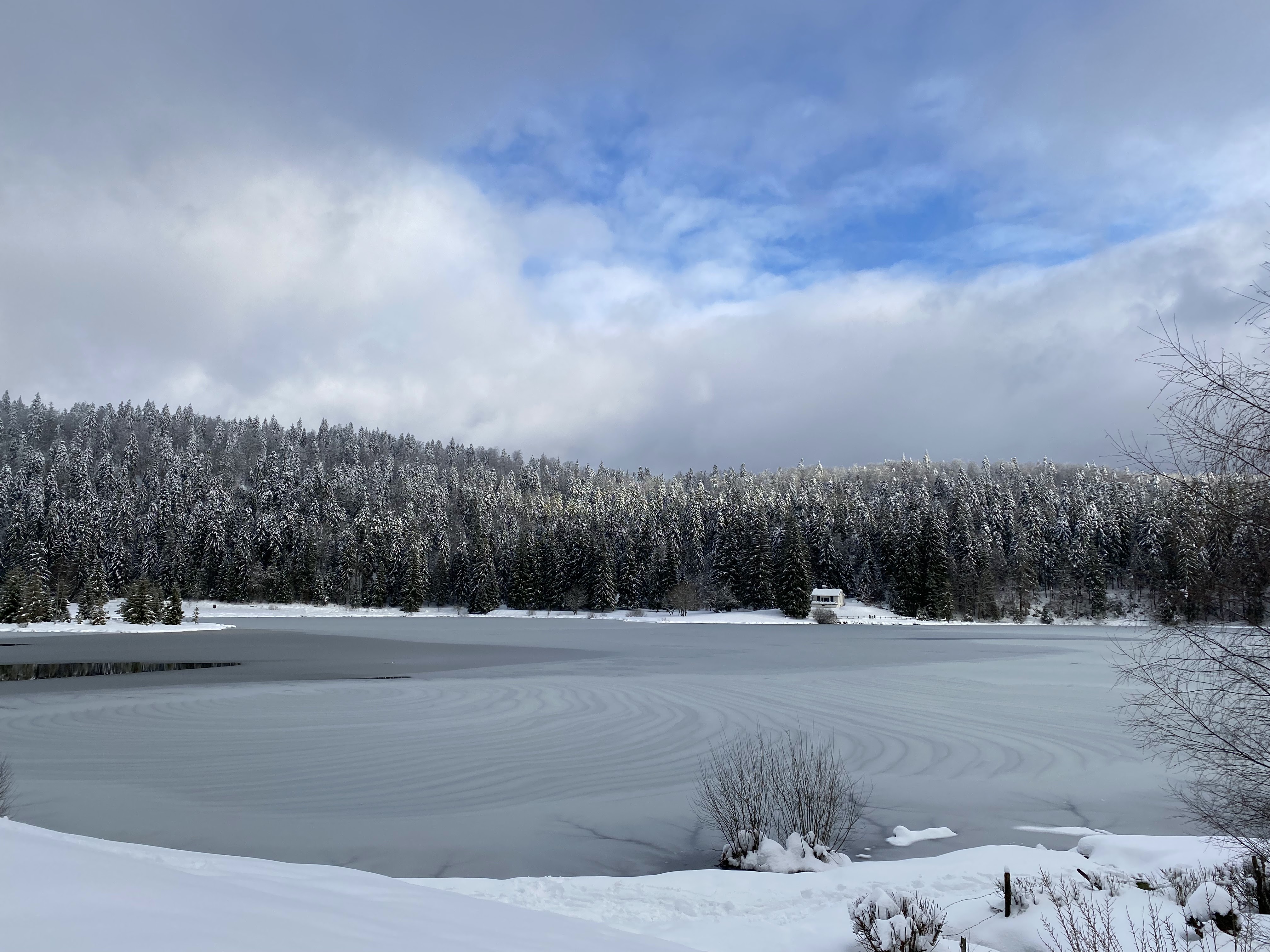
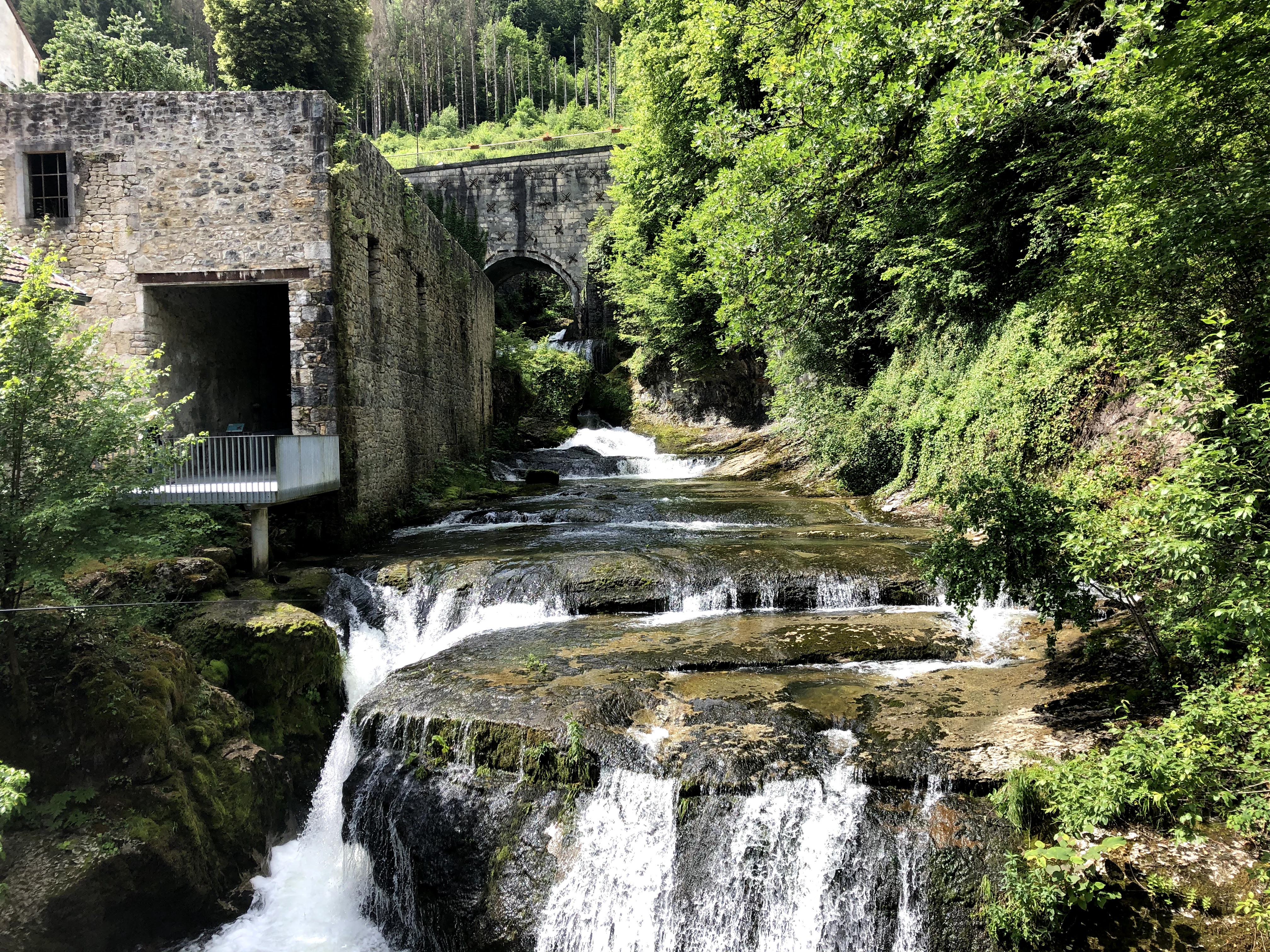
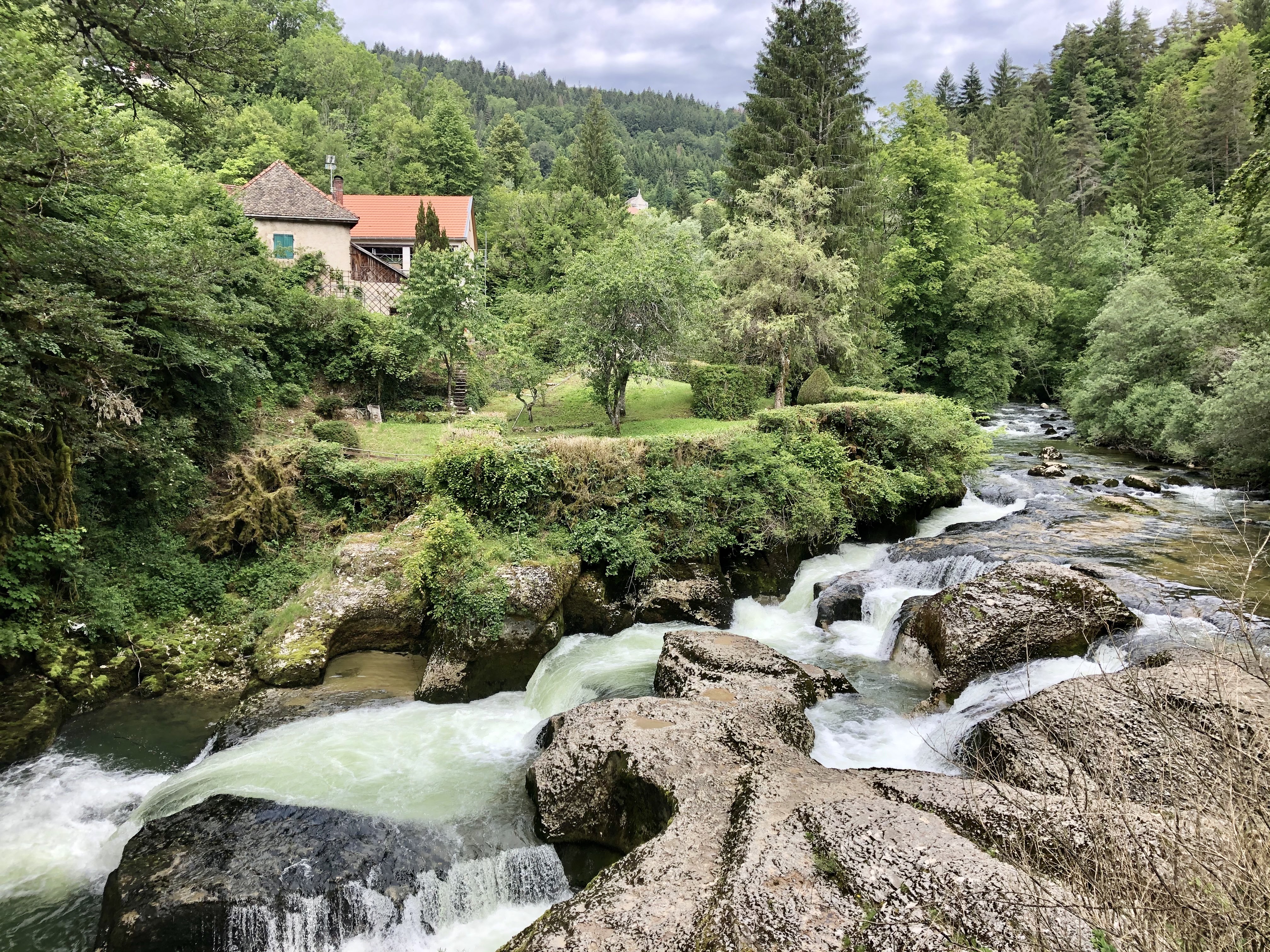
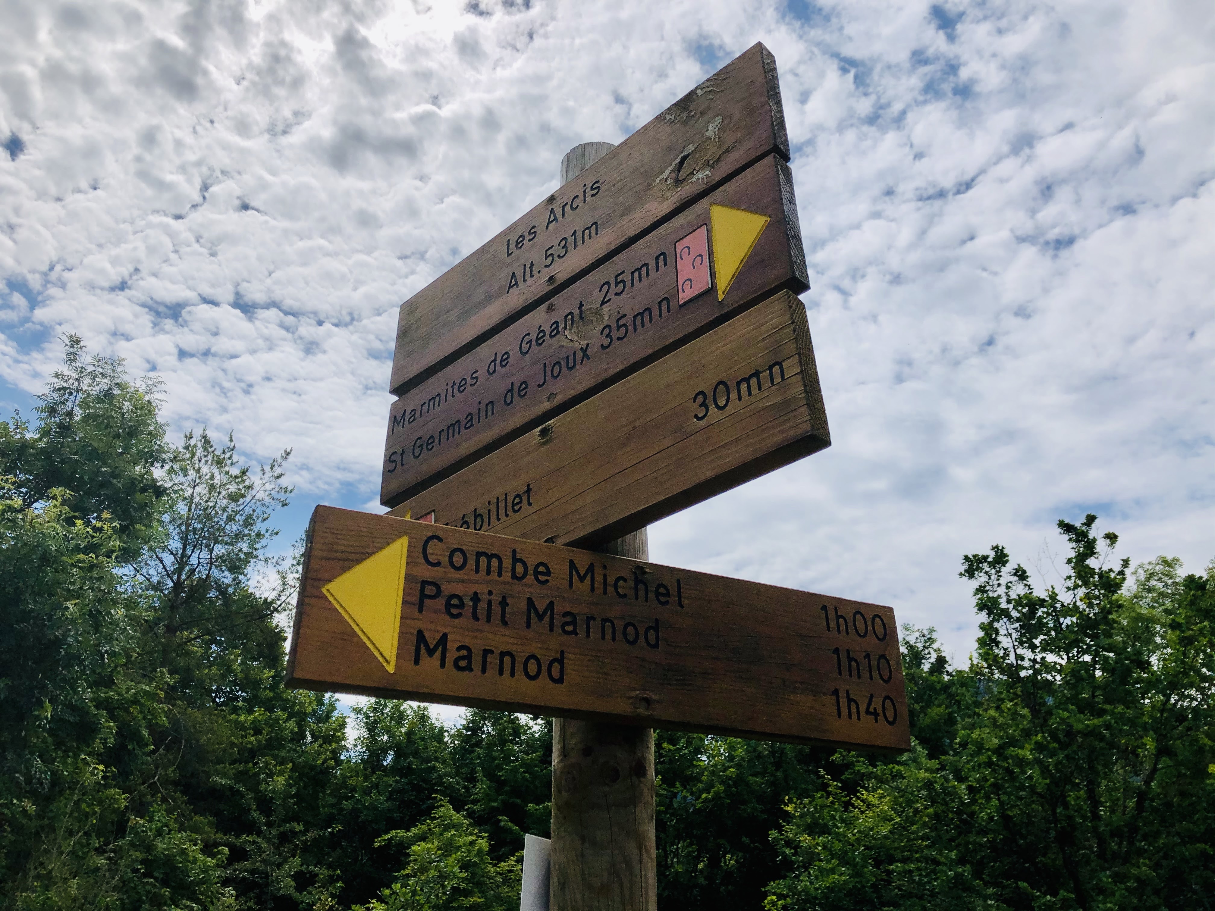
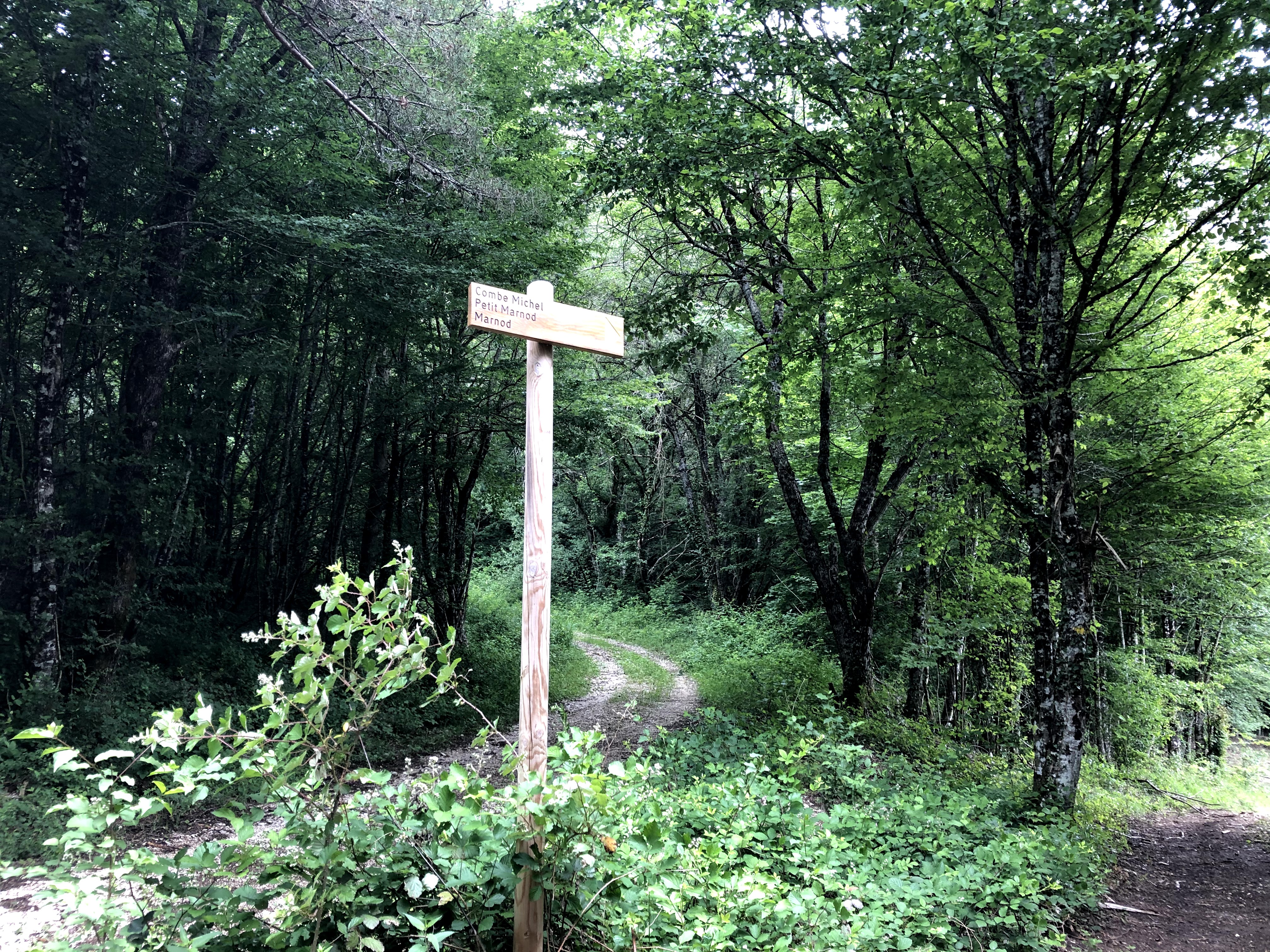
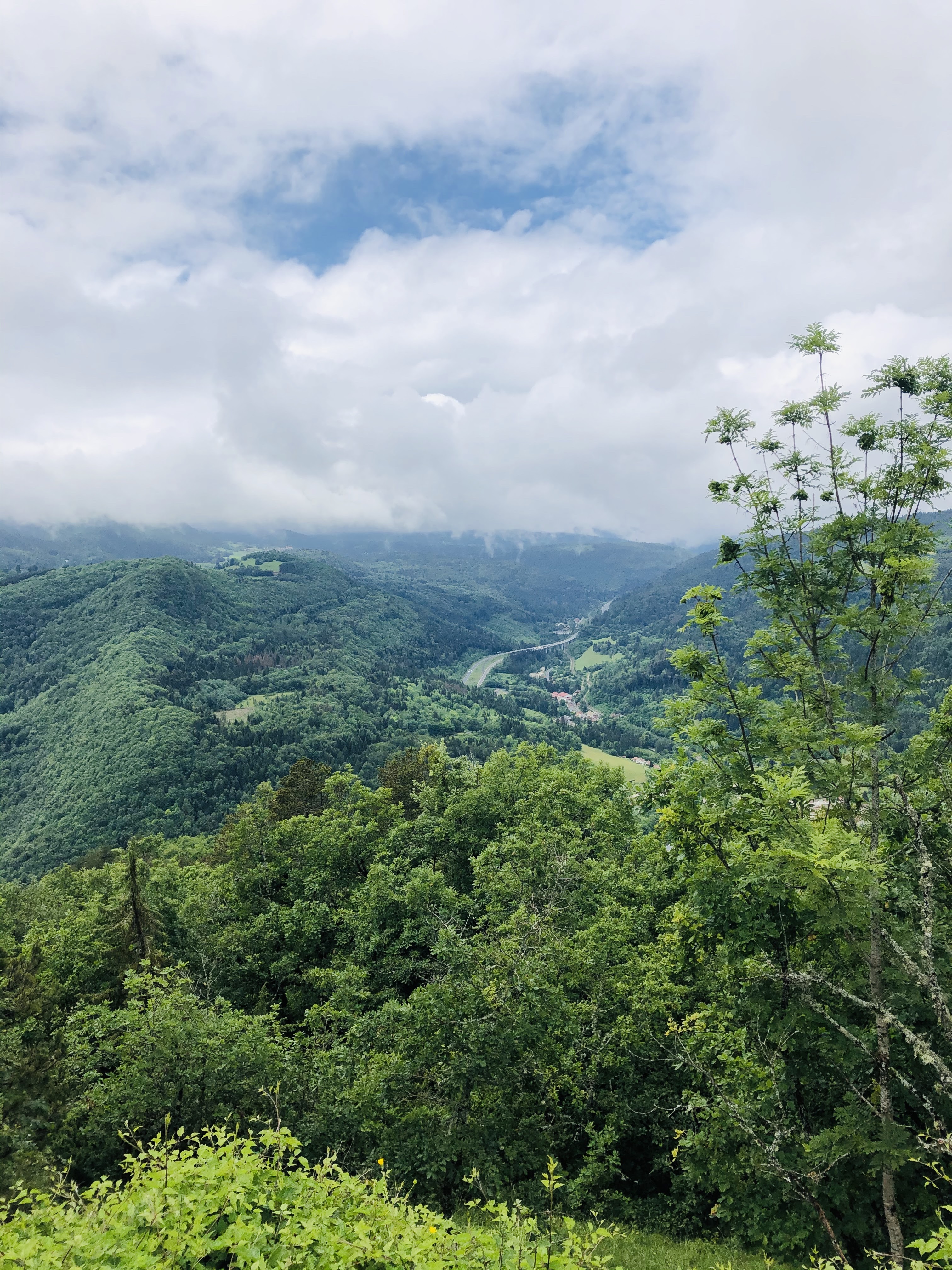
The area around Thoirette offers plenty to see and do. Walking to the Grottes at Corveissiat is a nice little walk. This cave is most of the time closed to the public to protect the bats living there. Since caves are ideal places for bats to go to sleep during the day, it is also the perfect place for them to stay out of reach of their enemies. To save on energy, they also need a slightly colder, but frost-free environment with high humidity. Personally, I am terrified of bats and wouldn’t have entered the cave even if I was allowed, but I spoke to some locals who said the cave is open on Wednesday afternoons, however, I have not found any information that confirms this.

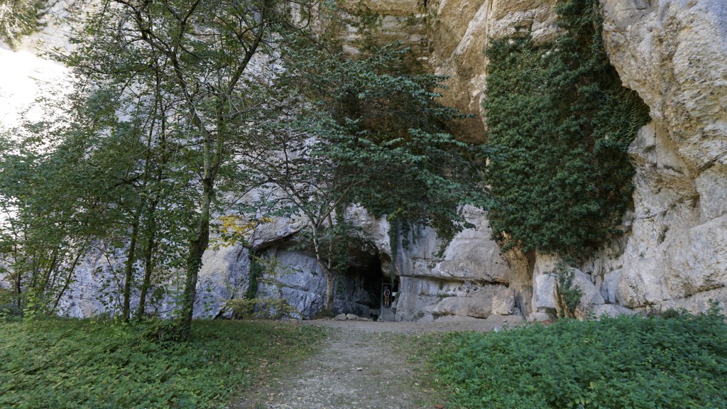
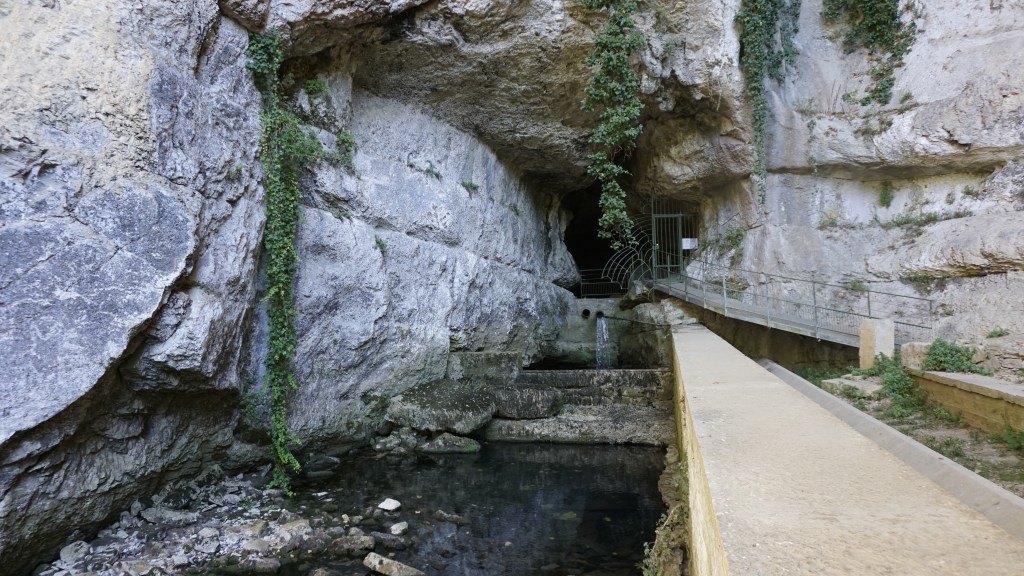
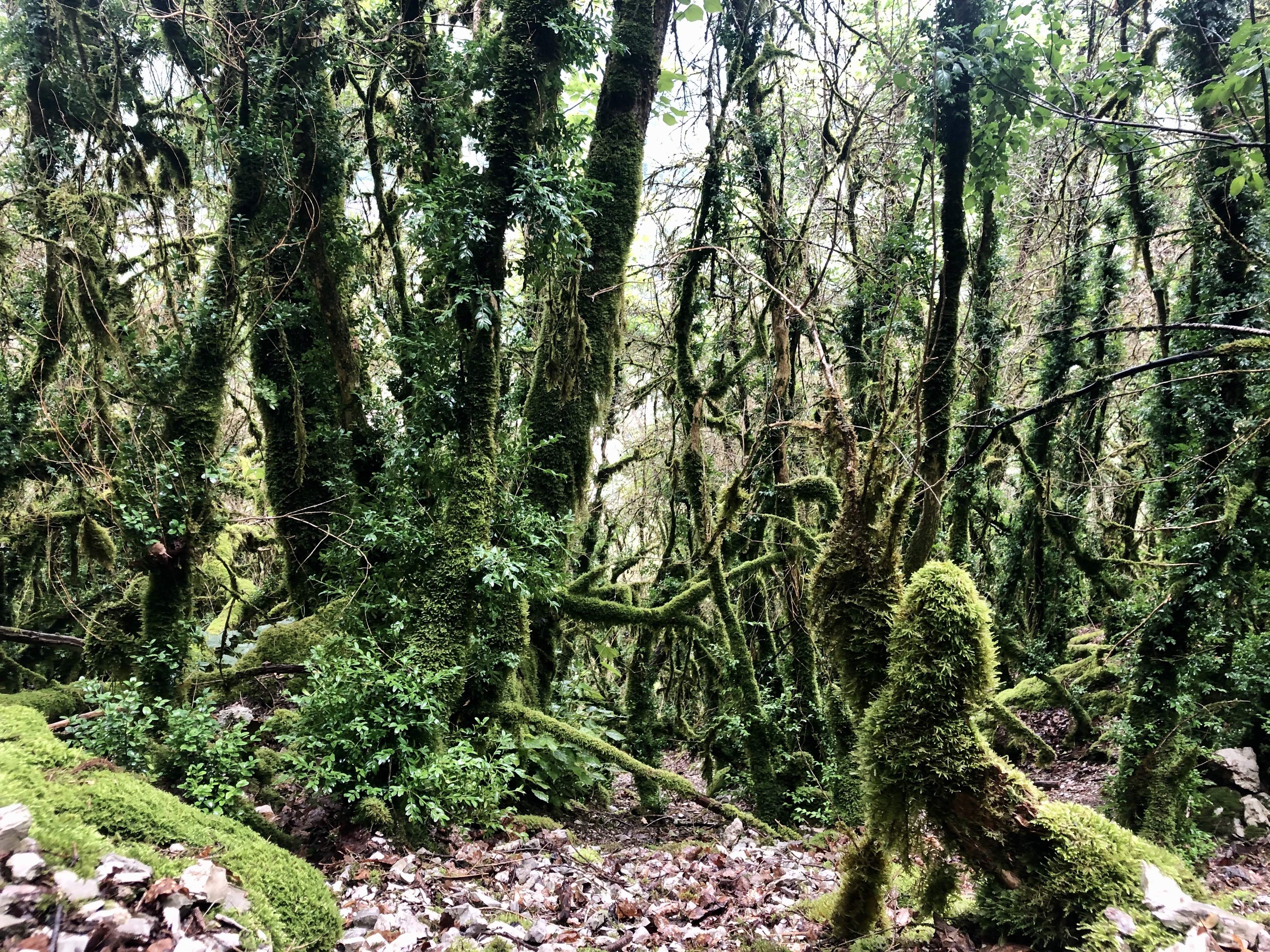
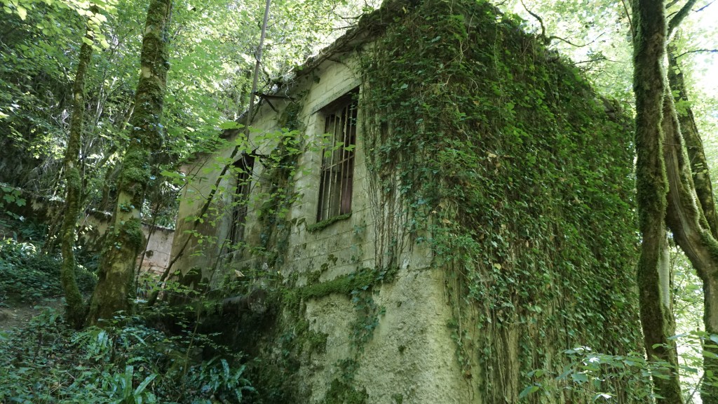
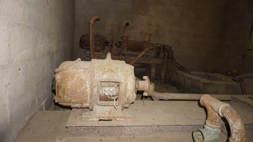
There is a prepared trail starting from the car park which will take you to the cave and further down to the river where you pass some old mills, an old washhouse, drinking water networks, and lots of trees with moss on their trunks due to the high humidity. It will take you around 15-20 minutes to walk all the way down, and 20-25 minutes to walk back up again. Even if you won’t be allowed to visit the bats this trail pretty much makes up for it and children will love all the discoveries along the path.

Another relatively short but pleasant walk can be found if you drive just a few hundred meters to Saint-Maurice-d’Échazeaux.

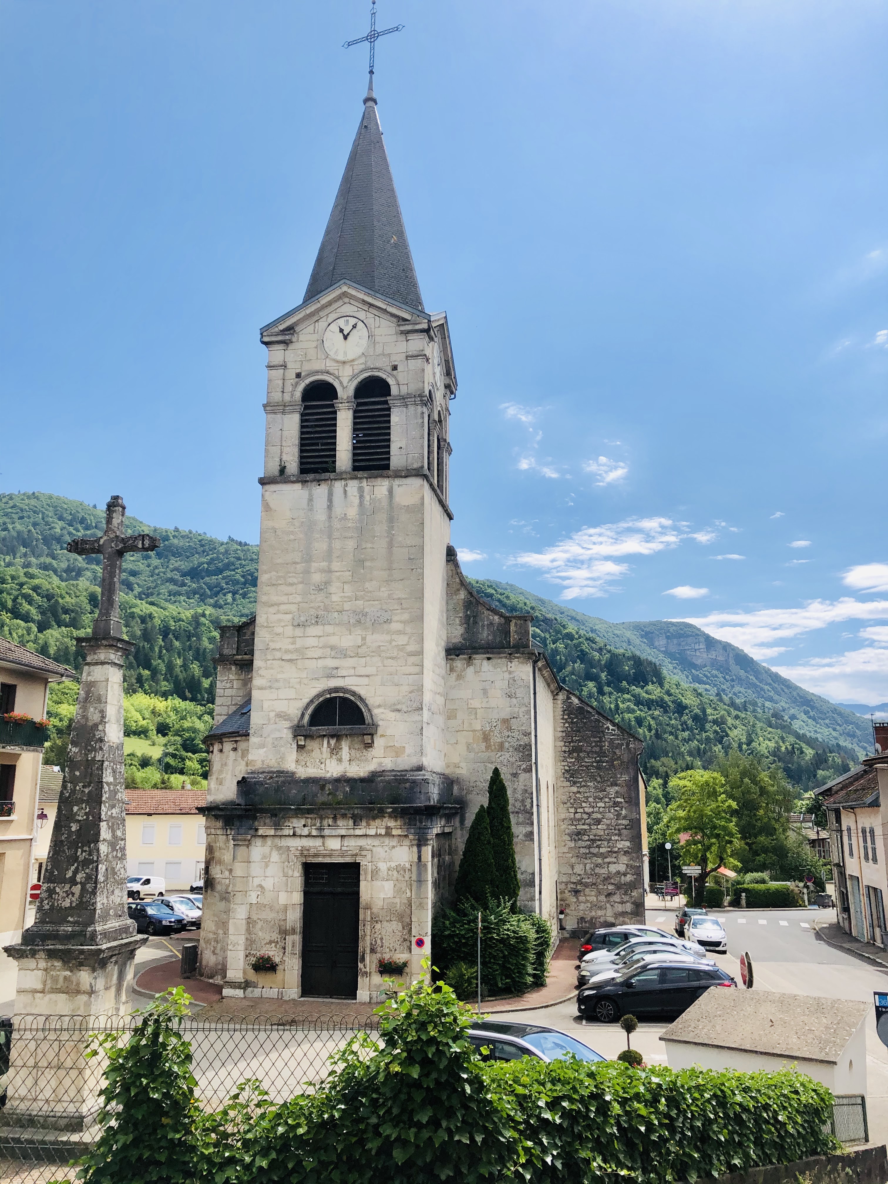
Outside this little hamlet of houses, you will find a newly restored chapel with an incredible panoramic view.

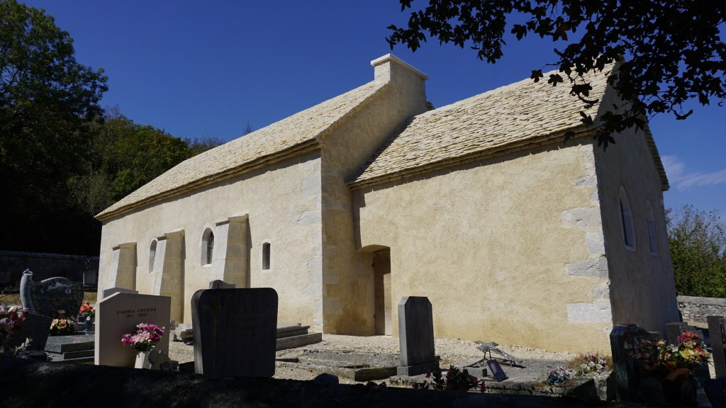
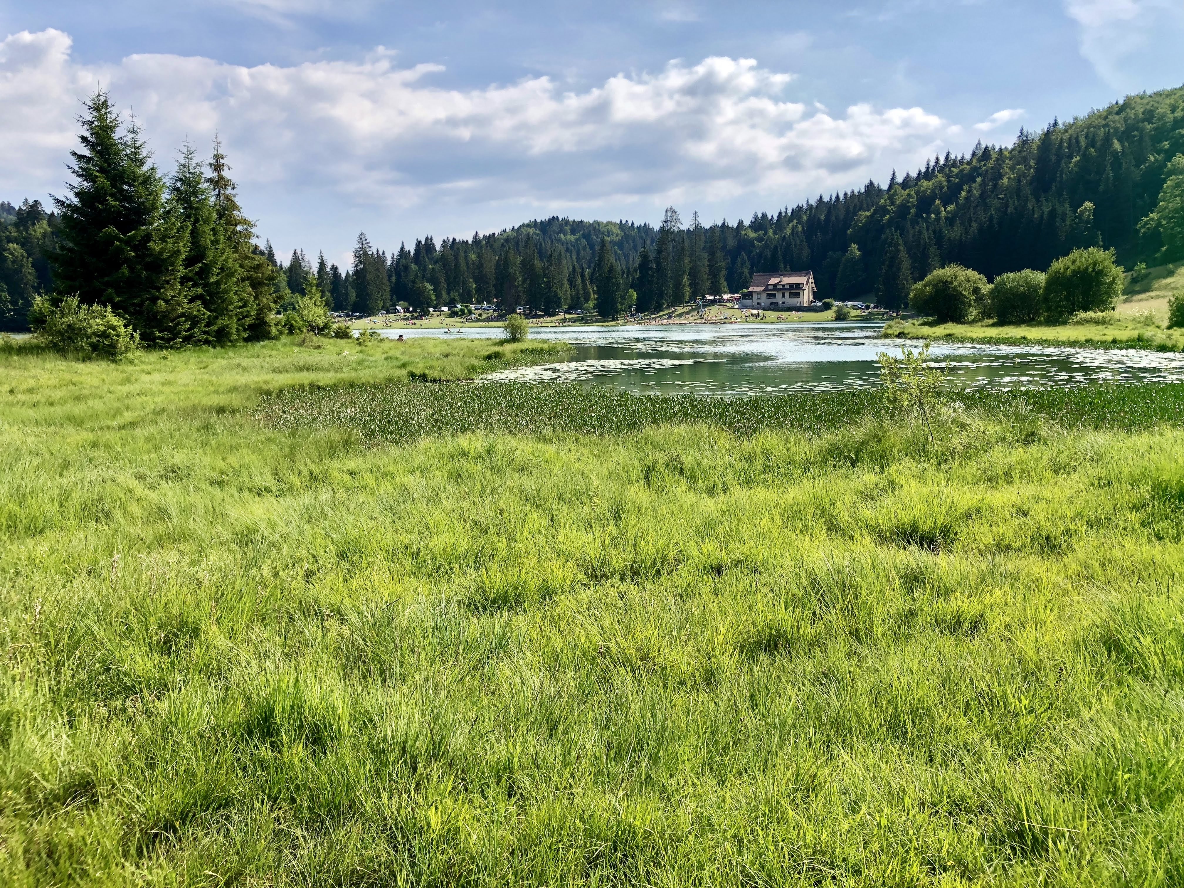
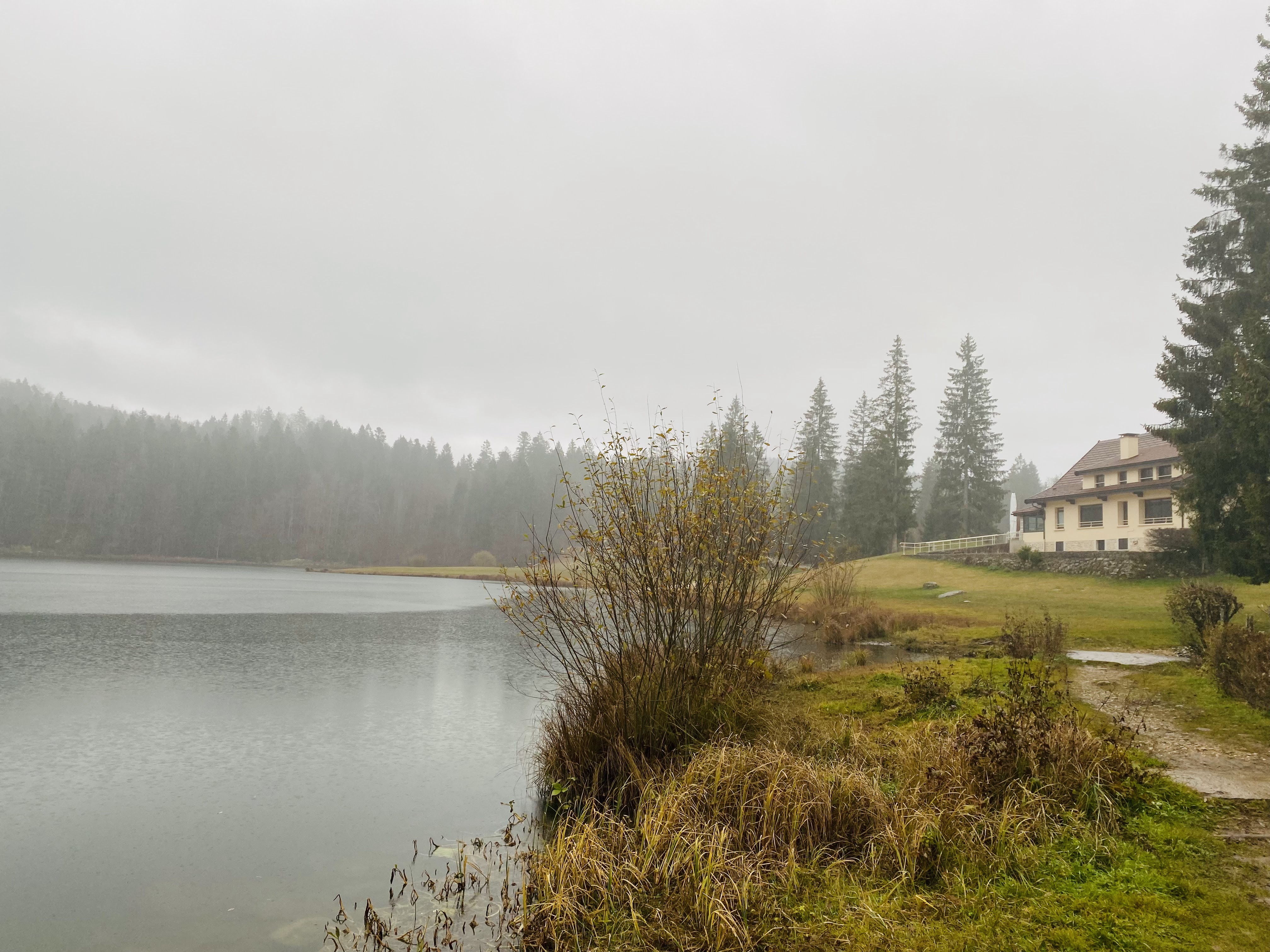
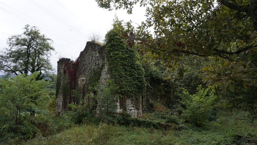
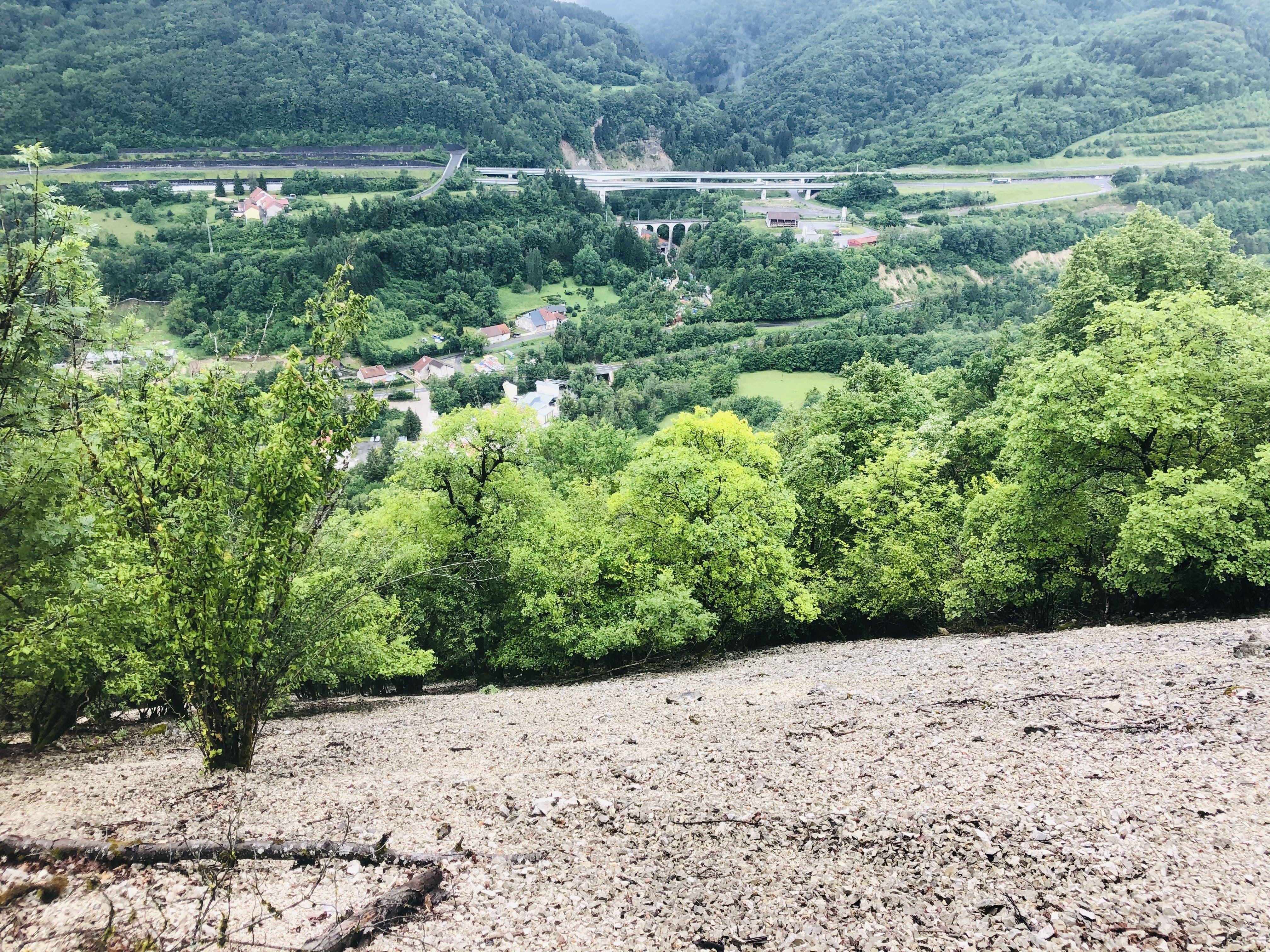
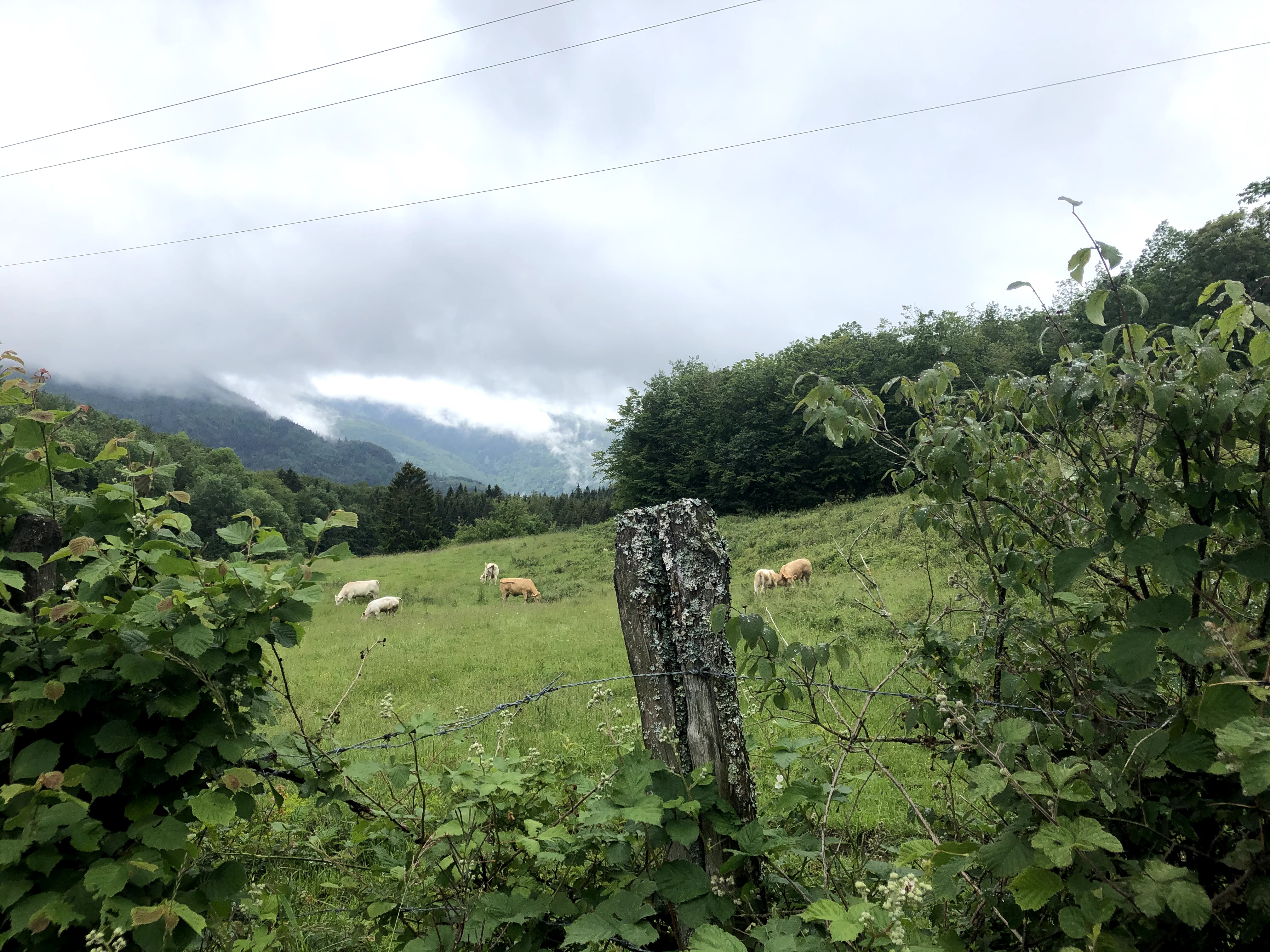
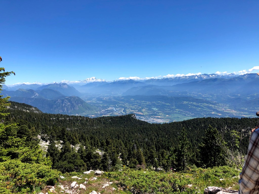
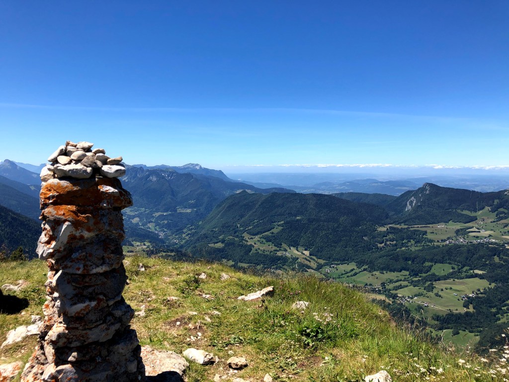
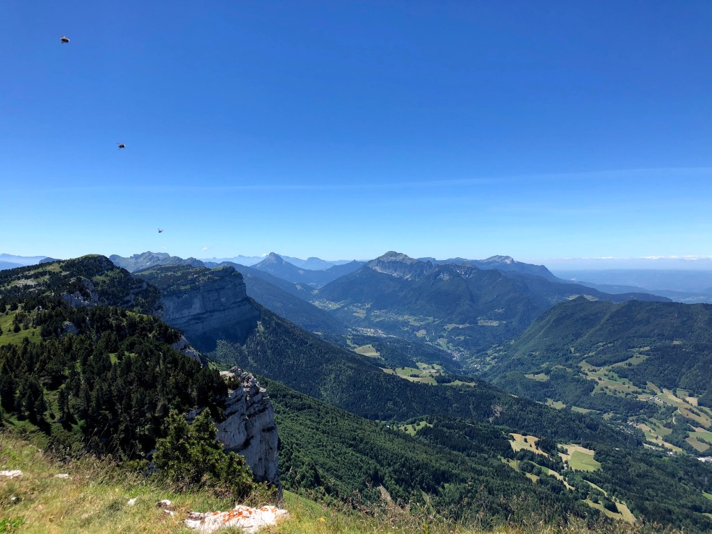
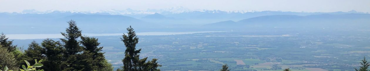
We parked our car at the entrance of this hamlet and enjoyed looking at the beautiful houses and gardens. You’ll easily find the Route de la Chapelle which will take you all the way to the chapel. If you don’t have time for a walk, I still recommend you take this detour (parking can be found next to the chapel). The chapel is built on top of a 250-meter-high cliff, and you will have an amazing view overlooking the river L`Ain, La Valouse, and the Lake of Conflans. For an even better view, it is advisable to follow the footpath on the right side when facing the cliff. This path will lead you to an even better viewpoint where you can admire the Conflans castle and the Bugey mountains. If you don’t want to take the same route back, there is a footpath through the local woods that will take you back to the village.

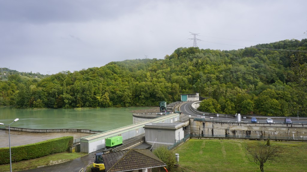
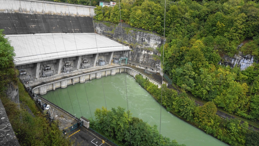
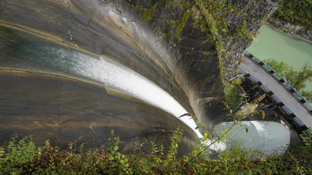
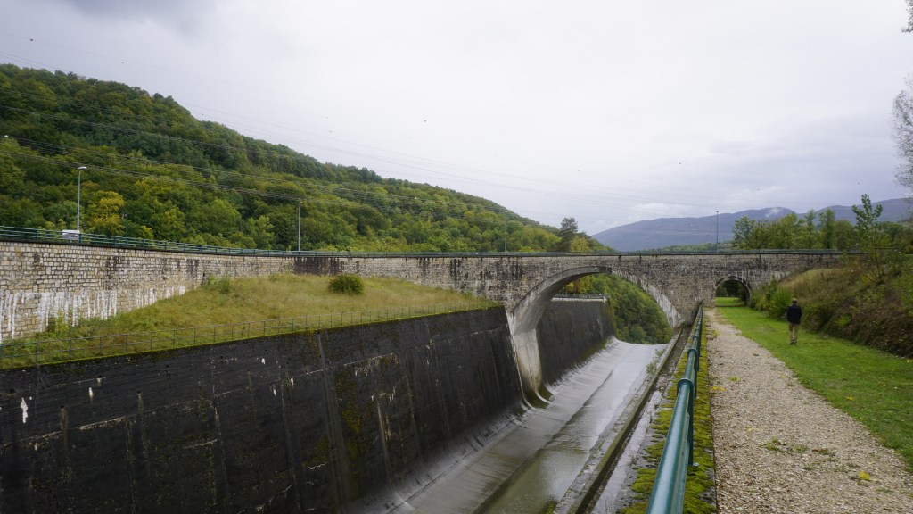
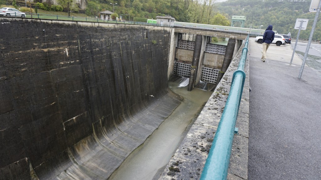
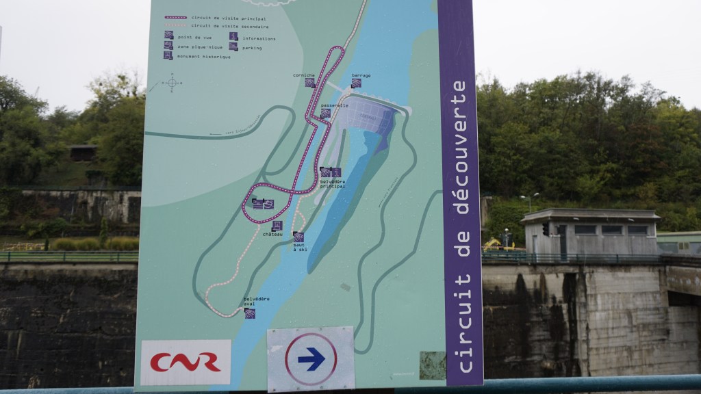
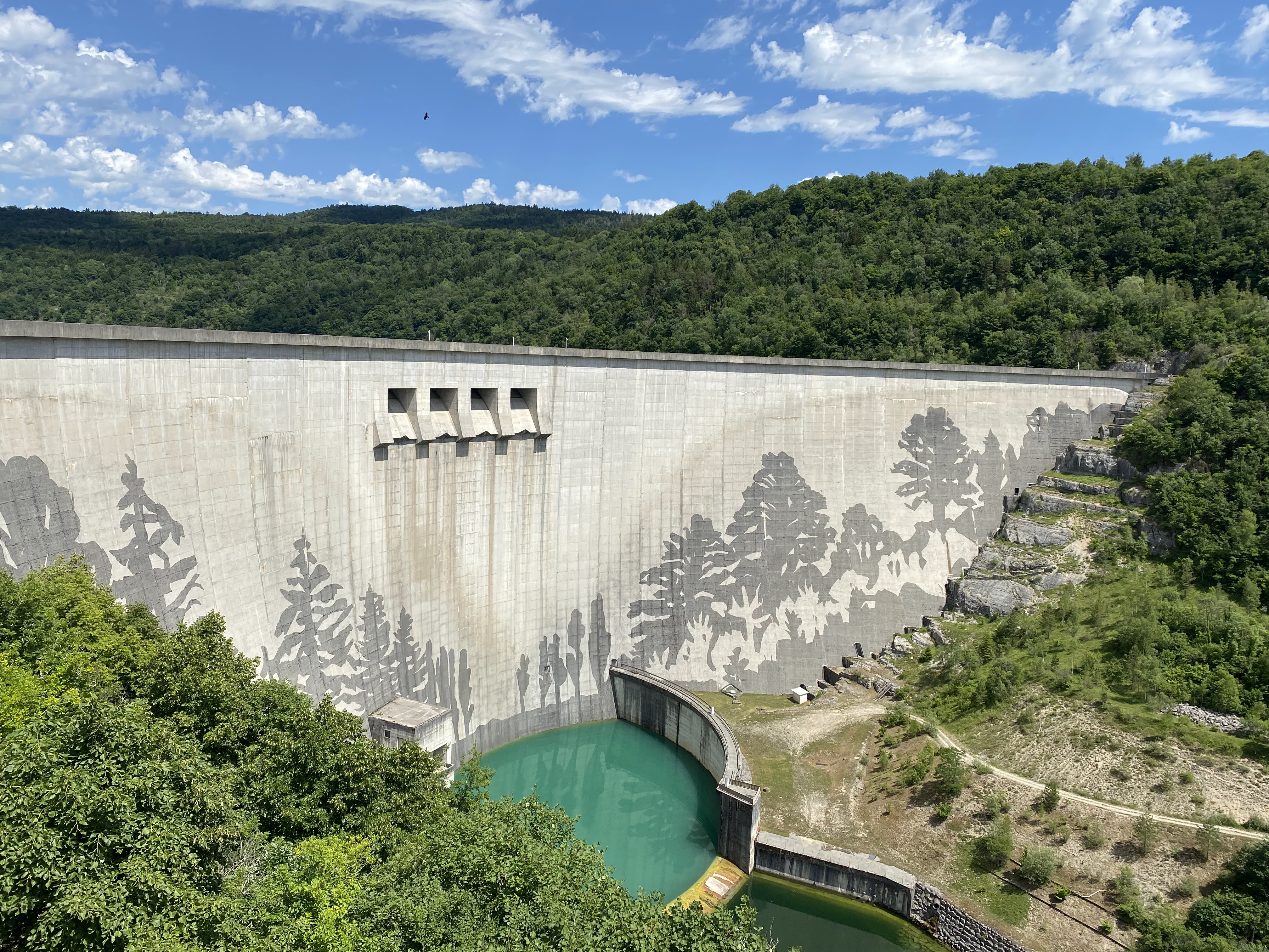
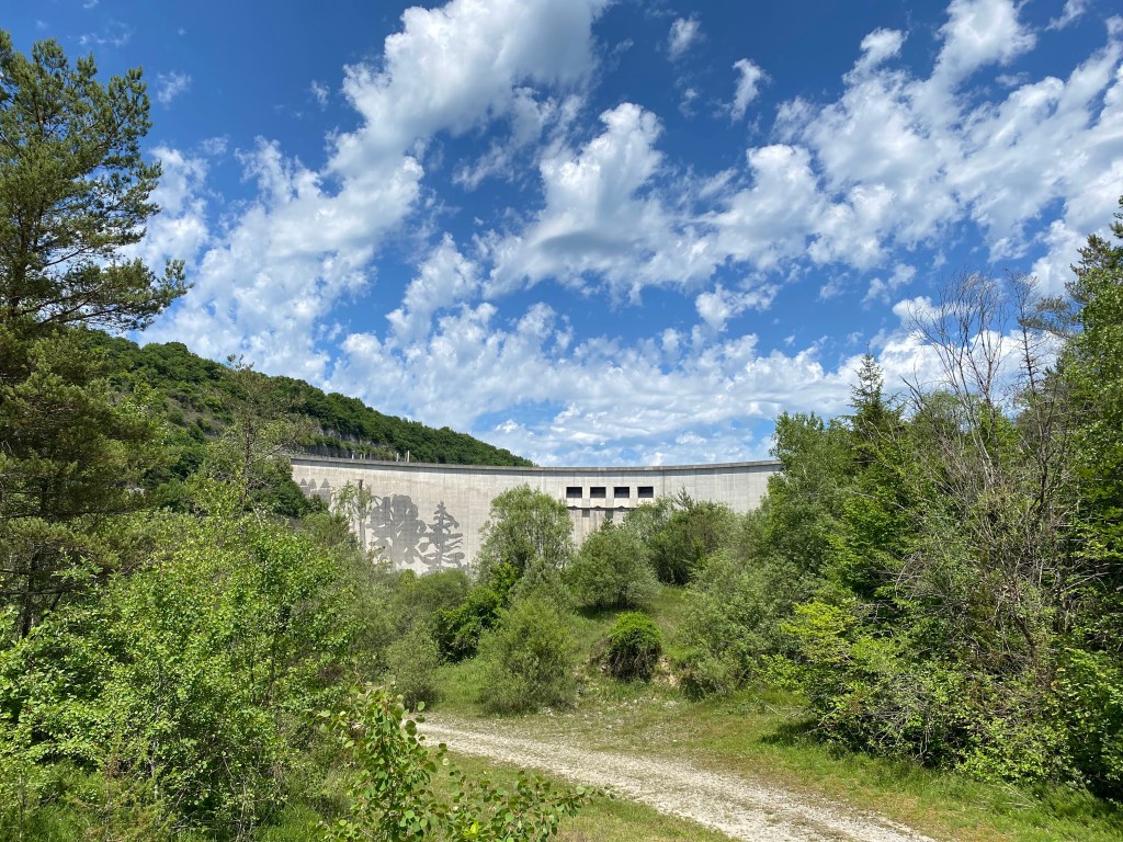
If you still have time and like to explore more, I think you should drive up to the Barrage de Vouglans. With the recent addition of a sand-blown fresco (!) on its front wall, it is truly a sight to behold.  When we visited, there was no water passing so I can only imagine how impressive it will be to visit on a day when they actually produce electricity. On-site you’ll find lots of information on the building of the dam (both in French and English). You can also read about the artist who did the mural sand-blasted painting. There is also a viewpoint on the other side of the river that you can access by car, or if you are sporty, walk up from the village below.

These are just my suggestions; there is much more to see and do, but I am sure these will keep you busy for a day.

Feel free to share with your friends!

France: Lac Genin, the lake to visit whatever the time of the year!

If you have not visited Lake Genin, you should put it on your to-do list. Lake Genin is situated between Bellegarde-sur- Valserine and Nantua. This lake is truly a little gem that I wish someone would have told me about sooner. It is easily accessible from Pays de Gex and Geneva if you have access to a car. It is one of the places that you can visit no matter what season and whatever the weather. In the spring and autumn, it is the perfect place for walking. In the summer you swim in the lake. In the winter you can ice skate, sledge, or go snowshoeing.

I discovered Lac Genin for the first time a few years ago on a nice and hot summer day. I was equipped with a towel and determent to have a swim, even if the water would be really cold. The water was not that cold, and from what I have since learned the normal temperature is around 20 degrees Celsius in the summer.

The lake itself is not very big.  With a length of 380 meters and a width of 330, its size is probably the reason for the nice water temperature in the summer even if the lake gets frozen in the winter.

On the nice summer days, you will not be the only one there. The green grass on one side will be full of colourful bathing towels, and both children and adults will be enjoying the sun and the water. In the summer season, you will normally find lifeguards observing and making sure that everybody is safe. You will find a playground, toilets, a snack bar, a restaurant, and a hotel. I have not tested the restaurant myself, but I have heard that the people come from far away to eat there. The specialities are barbeques and local trout.

For an adult to walk around the lake it will take you around 25-30 minutes if you take it relatively slow.

If you think 30 minutes around the lake is not enough exercise and you are not tempted by a swim in the lake, you have the possibility to walk the 11,5 kilometres from Lac Genin to Oyonnax. This walk should take you around 4-4.30 hours to complete. For map and walking instructions in French, click here.

If you need a walk that is a little shorter, but still a little longer than just around the lake you have the option to do De La Vouivre, or in English, the Wyvern walk. This walk is 3,5 kilometres and takes around 1.30 to 2 hours to complete.

The Wyvern is a two-legged dragon with a barbed tail. The possibility to get a glimpse of this monster should be a good motivator for both children and adults.

The Patrimones de Ain have put together an activity book for children in French that can be downloaded. You will also find a map of the walk there.

If you visit Lake Genin in the autumn, you will see that the forest there must be the perfect place to go mushroom hunting. This year I was unprepared, next year I will be ready in September with my basket and mushroom guide.

Lake Genin is often referred to as “Little Canada”. The reason for this is its location in a clearing surrounded by pine forest and the harsh weather in the winter season.  

During the winter months and on those cold and crisp mornings it is therefore the perfect starting point for snowshoeing. There should be marked trails, but I did not see specific snowshoe trails when I was there yesterday. I only saw the normal hiking trails, but I think they will work for snowshoes to. We followed the trails made by other snowshoers which guided us around the quiet and peaceful landscape. There were lots of kids (and adults) out enjoying sledging in the slopes around the lake. When the lake is frozen it is possible to enjoy ice skating, but before you do so, always check with the hotel if the ice is thick enough and if it is safe to walk on the ice.

For those of you not equipped with snowshoes, sledges, or ice skates the hotel has a renting-out service. On the nice and sunny winter days, you should check availability before you go so that you are not disappointed if it is all rented out.

There’s adventure to found so close to where we live. Lake Genin is just one of these places that are waiting for you to explore.

Feel free to share!

France: Barrage Genissiat – French Niagara Falls

Some Sundays you wake up and know you would like to do something, but you are not exactly sure what. In addition, the weather is not on your side for a long hike in the mountains, and you don’t want to go for a walk just around the block where you live. Today was one of those days; the clouds and fog was hiding the Jura mountains and keeping the Alps out of our view.

I’d seen some advertising of the Barrage de Genissiat and thought it could be interesting to give it a try. Driving there only took us 45 minutes from Pays de Gex (I’ve spent more time driving to work in Geneva).

As you’ve maybe guessed, this outing was not planned at all, and in the rainy weather a picnic was not very tempting. We decided to find a restaurant along the road – sometimes a risky project in the French backwaters, but as it turned out we had no need to worry: in the small village of Billiat, just a few minutes away from the barrier, we saw a sign for an open restaurant and decided to give it a try. The place was very un-assuming on the outside; just a beer sign and a small menu board. Turned out the restaurant is also a bar and a small hotel, apparently mostly catering for local workers. Entering the bar area, we were greeted by three senior citizens clearly working on their Sunday lunch apèro.

We were warmly welcomed, and shouts were made for the owner, who quickly appeared from the kitchen area to show us to a free table. Actually, every one of the dining tables were un-occupied: apart from the before-mentioned clients enjoying their apèro, we were the only customers in for lunch this Sunday. There was no printed menu, but the presumed owner suggested the menu de jour. I have to admit I was a tiny bit sceptical, having visited a good few restaurants where food comes off the shelf (or freezer) of the local supermarket, and where you can taste that the sauce is of the sort that comes out of a bag (just add water and stir…)

As the entrées arrived, we soon realized that everything on our table was home made. We had a terrine for starter (tête de porc – no, I won’t translate, just confirm it tasted great), followed by veal stew and gratin dauphinoise for our main course. And it was delicious! Not the fancy kind of food you get in restaurants that aspire to look twice as expensive, but the type of food your grandmother would have cooked (at least, if she was French and lived somewhere in the Bugey area). It’s really hard to come across this type of local, un-pretentious cuisine in restaurants today. All the meat was locally sourced and was tender and full of flavour. The price for a three-course menu came to only 18 Euros. I’ll surely be back, and hope that you will be visiting this place, too.

A few more words on restaurants before we start our walk (this is important, so I hope you’ll bear with me): when we first arrived in the Pays de Gex in the late 90’s, there were several family-run restaurants like this, but today, they’ve all closed down. We need to support these places, otherwise, in 10-15 years we’ll only have the choice between pizza parlours and kebab joints (apart from the ubiquitous burger places).

On with the trip. After our pleasant restaurant surprise, we rolled down the hill towards the Barrage. Now, you may not find the idea of visiting a hydroelectric dam very enticing, but this is truly a sight to behold. As you start to walk around the site you realize that this is quite a spectacular piece of construction. There’s a visiting centre where you can get a two-hour guided tour of the power plant. Unfortunately it’s not open every day, and you need to pre-register on their site in order to take the tour, so we had to stay on the outside. Still, there is a lot to see even if you cannot do the tour, so you won’t be disappointed. (If you’d like to reserve the guided tour, you can find the available dates for guided tours here, but be aware that children under the age of 8 are not allowed to enter).

The hydroelectric power plant is classified as a monument of industrial heritage of the 20th century. The work started in 1937 but was understandably halted during World War two. When the power plant was finally inaugurated in 1948, it was the biggest hydroelectric dam in Europe, nicknamed the French Niagara. The height of the dam is 104 meters, and the impressive spillway named the “ski jump” has a 65 meters drop. Imaging going down that slope in a kayak (I somehow don’t think that would be allowed, though).

The energy produced here is essential for the region,and today this dam alone represents 10% of the hydroelectricity produced along the river Rhone, allowing 700,000 households to illuminate their houses (and charge their mobiles).

As a sustainable environment project, the Barrage de Genessiat site has been chosen for a pilot project to collect the wood and vegetation floating down the Rhone river. After being collected, the driftwood is transformed into panelling, and the vegetation is transformed into energy. When crossing the dam, you can see huge amounts of wood on the upper side of the barrage (along with all kinds of flotsam and jetsam that people have managed to “loose” in the river…)

There’s a walkable circuit of some 25 minutes along the dam and the environs, with ample opportunities for picnic and rest. Written explanations are provided in several spots, all in French. Ruins of the old chateau (it must have been very small, but with an impeccable view) can be seen close to the “ski jump” waterfall, and a bit further along there’s a large park-like area where kids and adults can play on a sunny day. A trip well worth doing – and you get to learn something, too!

If you have time and more energy there is walk going up the river Rhone towards Bellegarde. The signpost for the walk can be found on the left side when you have the dam to the right. It should take approximately 2,5 hours to walk to the Belvedere des Lades and back. I will hopefully come back with an update on this walk as I did not do it this time.

Enjoy visiting Barrage de Genissiat, and feel free to share!

France: The Giant Kettles in Saint Germain de Joux (Les Marmites de Geant) and Combe Michel

Features: Forest – river – history – panorama view

Overview: I will say it is a medium to difficult walk, mainly because of the crossing of the scree

Time: around 3-4 hours               Km: 10                Hight to climb: 568

You will find the map at the bottom of this page.

This walk brings you to the heart of the Semine valley, and you will be able to explore its hydraulic heritage.

The staring point is in the centre of Saint Germain-de-Joux where it should be relatively easy to find a parking spot for your car. I found ample parking right next to the church.

To find the start of the walking path you’ll have to walk 50 meters down in the direction of Bellegarde on rue de la Gare.

You will soon see the familiar yellow signpost which is right after the petanque area on your left-hand side. The path will take you down to the Giant kettles – but before going there, you should take some time to explore the old sawmill.

The water wheel, which has been completely restored, measures 7,54 meters in diameter and has 96 blades. This makes this water wheel the biggest in the department de l’Ain.

Back in the good old days this little village had no fewer than eight sawmills along the two rivers that connects here, and the last one closed as late as 1998.

One of these sawmills also used to cut stone coming from a neighbouring quarry, and most of the churches in the area were then build with these stones coming from Saint Germain-de-Joux.

When crossing over the bridge you will see a new yellow sign indicating the hiking path. Follow the path down along the river to Les Arcis.

From Les Arcis, follow the signs towards Combe Michel and Marnod,

until you reach this signpost:

The first time I tried to walk this route I was not able to find the path. I admit I was very badly equipped, with no good map, but to my excuse there was also a lot of forest work going on which has changed the original pathway. The trick is to not be tempted to walk down, to walk no longer than 100 meters in a straight line from the sign and keep your eyes to the left. Then, in between the trees, you will see a small path. When you’ve found it, it will take you up into the forest of Beloz.

After some minutes you will reach Pierrier du Rocher de Beloz. This is a mass of loose stones that cover the slope of the mountain. Such masses are also called screes.

Crossing this scree can be daunting. My friend who came along with me was very quick and focused on a rapid crossing, and we were both happy to put our feet back on an earthy path after the approximately 50 meters walking on loose gravel. The forest itself is amazing, with threes overgrown with moss. Bring a camera because with the right light you can take amazing photos here. You will also get a really good view of the motorway and viaducts and witness how it is sculpted into the landscape. I have so many times seen the nature from a car window along the highway. Looking at the highway from another viewpoint enables you to admire the great engineering knowledge that’s made this highway possible.

Moving on along the path takes you up and over to Combe Michel, before you start to descend back to Saint Germain-de-Joux past the small hamlet of houses in Marnod.

In Petit Marnod, we started to wonder if we’d lost track of the path, since we were faced with a barrier across the road. The trick is to walk past it and continue until you see a wall of three logs. The path follows these logs to the left. You will soon be rewarded with another great viewpoint of Saint Germain-de-Joux, the highway, and some small summits.

The Marnod is a really charming hamlet of houses and you will be walking along the road that connected these houses to St. Germain-de-Joux. If you are lucky and find some of the locals out and about enjoying their coffee or a glass of wine, they’ll be happy to talk with you. They also have a really great sense of humour and could end up asking you to watch out for crocodiles and toy cars!

Follow the signs down to Longefand and then back to Saint Germain-de-Joux.

Happy walking, and feel free to share!

France: Mont Granier – one of the highest cliff walls in France

The Chartreuse massif is only just over an hour or so away from Pays de Gex and full of splendid walks.

Altitude to climb: 850 m

Time: 6 hrs

Level: medium/difficult

Mont Granier is a mountain with a horrifying history, positioned at the northern end of the Chartreuse massif. The northern face of Mont Granier overlooks Chambery and Lac de Bourget. This impressive vertical northern face is the result of a catastrophic collapse of a large part of the mountain in 1248.

The rockslide occurred during the night of November 24-25, 1248. A large part of the north-eastern part of the mountain, having been slowly eroded, fell off, swept across the slopes and plains all the way to where the current highway lies, and completely destroyed 5 entire villages. The disaster, which covered 23 square kilometres, killed more than 1,000 people. The mountain is predicted to collapse entirely one day, and the area at the top where the cross can be found is not advised to be approached, after a number of smaller rockslides there in 2016. Even if you leave out the last few meters down to the cross, the walk is spectacular and will be a memory for life.

OK, back to the walk. This walk is quite challenging, especially when descending a steep couloir on the way back, and I would not recommend it for children under 10-12 years of age.

The starting point is La Plagne, which is a small hamlet of houses overlooking the impressive southern summit of Mont Granier and the neighbouring summit of Le Pinet, whose cliff face is equally impressive.

Parking can be found along the road and also on the forestry track that continues after you have passed the hamlet.

This is a fairly steep walk in parts, and because of that it really requires good weather. On the other hand, if the sun is shining there will probably be a crowd about and I’d advise you to arrive relatively early.

The route itself is well marked with yellow signposts all the way from start to finish.

I followed the signs to Mont Granier “par la Balme”. This will take you through the charming hamlet of houses in La Plagne.

The path then ascends steeply through a beech forest and levels out when reaching the crest. When above the trees, you’ll see the entrance to a cave. Follow the path straight into it. The cave opens up when inside (10 meters wide by 4 meters high), and you will see that the path continues through an exit to the right. If you brought a flashlight, take some time to explore the cave. In the late 1980’s several new passages into the cavernous system beyond the main cave were found, and bones from over a thousand cave bears were found. Some of these are exhibited in theMusée de l’Ours des Cavernesin Entremont-le-Vieux. Cave bears were ferocious monsters, way larger than bears of our time…

After emerging from the cave exit, the path follows a grassy traverse before ascending a gully through the cliffs. Relax, You’ve now done most of the climbing. Just a small traverse of about 20 minutes along the ridge of the mountain, and you are at the top of Mont Granier.

You will have an amazing overview of Chambery, Lac de Bourget, massif de la Chartreuse, Les Bauges and Mont Blanc.

From here, you can continue another 300 meters or so to the Cross of Granier which is situated at the top of the northern cliff for an even more spectacular view of the town of Chambery. Attention: don’t pass the signpost located 10 meters or so from the cross; it advises you to not approach the edge of the cliff due to possible new landslides.

For the descent, you have two options. The easiest – and recommended if you suffer from vertigo, is to walk down the same path you used for the ascent. However, I would recommend you return via Pas des Barres and Col de l’Alpette. This path will start off leisurely for the first 30 minutes or so, and then zig-zag you down the cliff (not the main wall, mind you, but the eastern side, which is a lot gentler). Although there’s no real climbing involved, there are a couple of chimneys (Pas des Barres) that may be a little challenging (10-20 meters). This part of the descent is made easier by fixed iron steps and railings, almost like a miniature Via Ferrata. Honestly, if you’re in decent shape you can handle it well, but it may not be the best idea if accompanied by kids younger than 10-12 years of age.

When safely down at Col de l’Alpette you will be walking past a pair of giant boulders, and it’s a nice place to take a photo of Mont Blanc. The path continues to the right past some other boulders (one is really impressive – just imagine these things coming off the cliffs above) and to an easy but relatively long descent that takes you back to La Plagne and the car. Fun fact: this descent is apparently used when ferrying cows up and down for the summer pastures…

If you’re like me and you love French cheese, there’s a farm selling the goods in La Plagne. It is not in the center of the hamlet but a few hundred meters further down. It was closed when we passed and we went to the Cooperative laitiere des Entremonts instead, another 5 minutes down towards the center of Entremonts-le-Vieux. Here, you’ll find a big selection of locally produced cheese, wine and other regional products. They also have locally made ice cream – in case your car is equipped with a portable freezer (or you remembered to bring a spoon!)

Happy walking, and feel free to share!