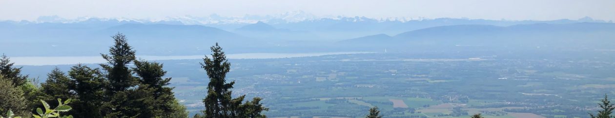
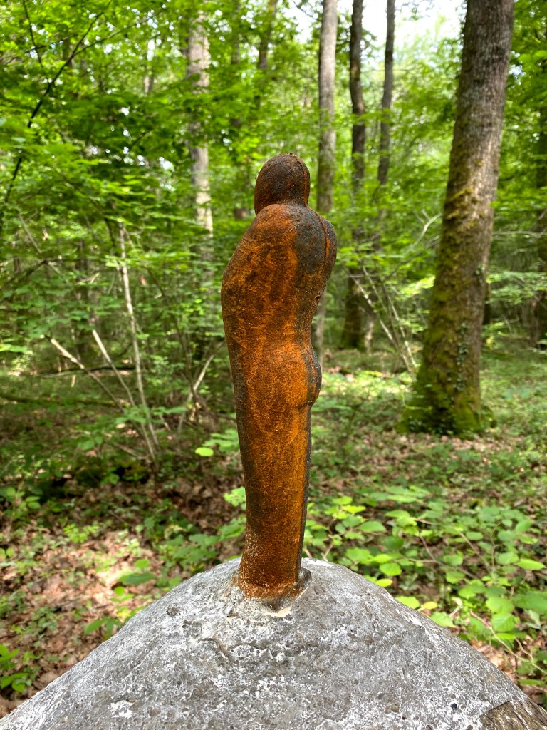
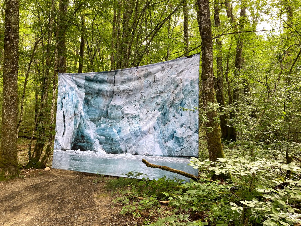
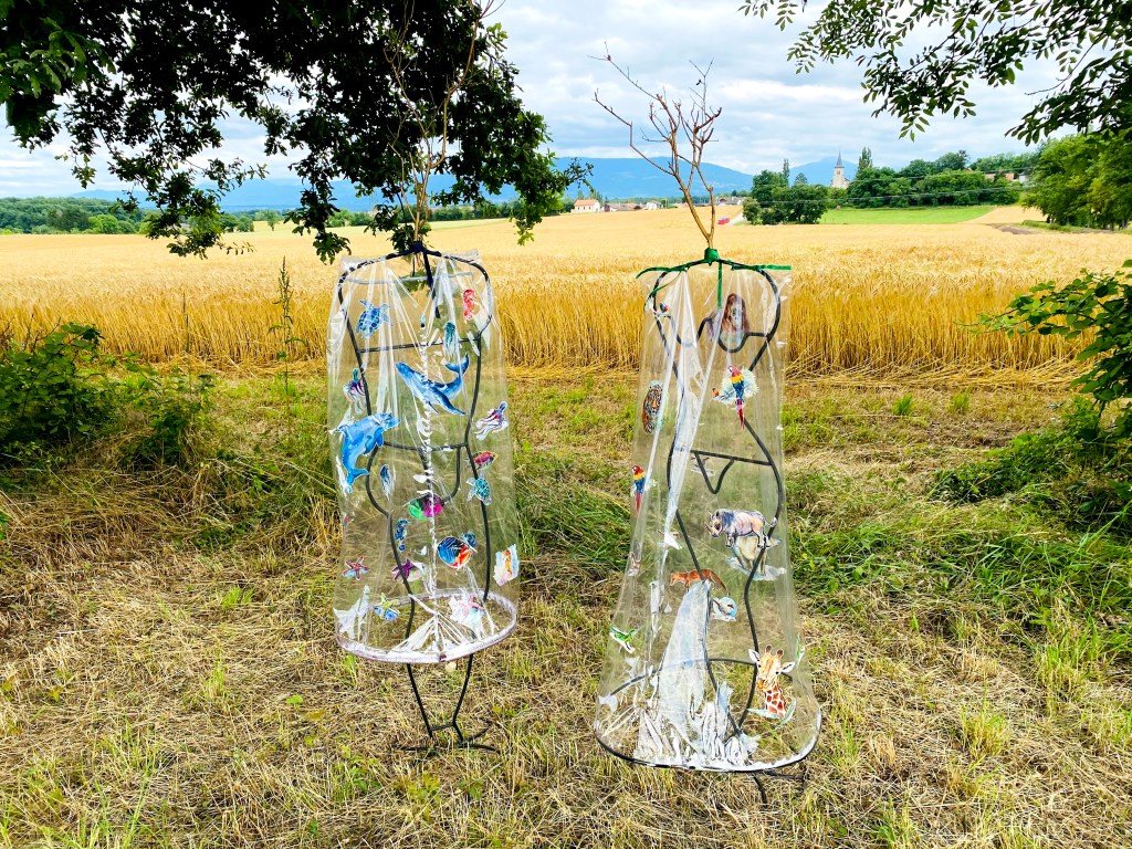
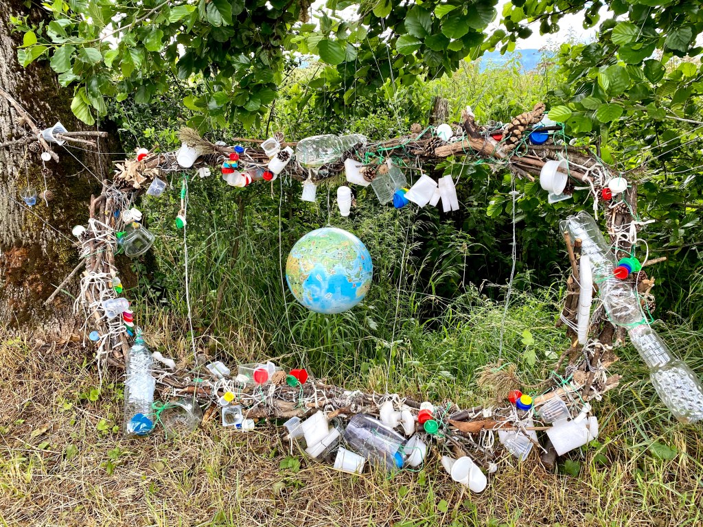
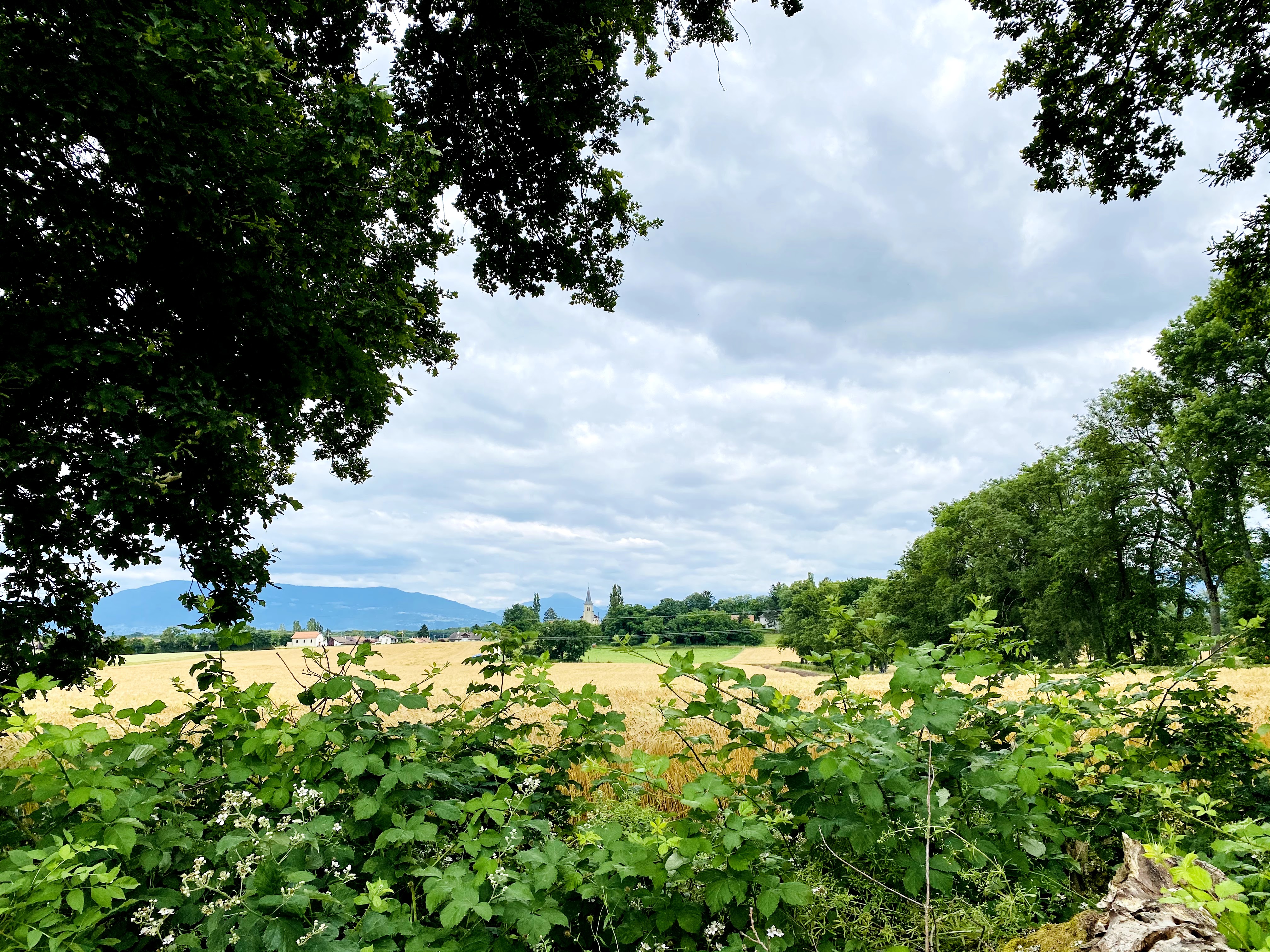
If you are lucky enough to be in Geneva or neighbouring France between the 26th of June and 5th September, you have to experience the Art en Campagne.
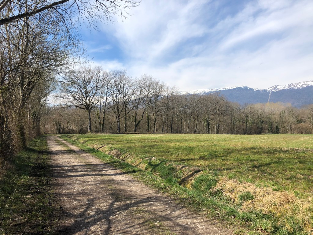
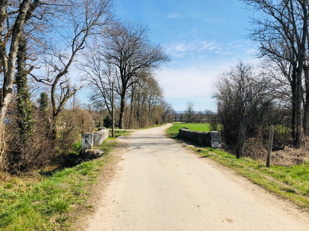
The 4,8-kilometre circular trail takes you across the fields between Ornex in France and Collex-Bossy in Switzerland. For a walk that already offers a beautiful view of Mont Blanc on one side and the more relaxed and greener Jura Mountain on the other side, the art installations just take the walking experience to a new level.
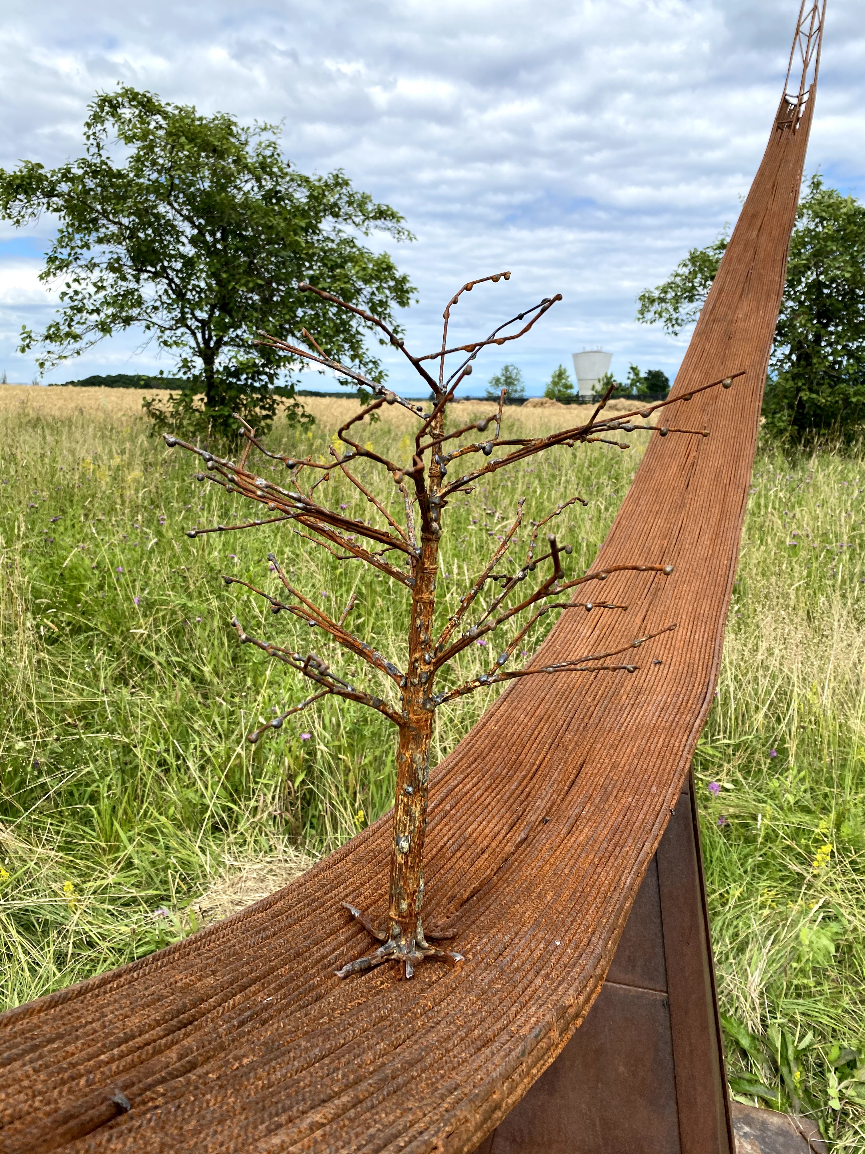
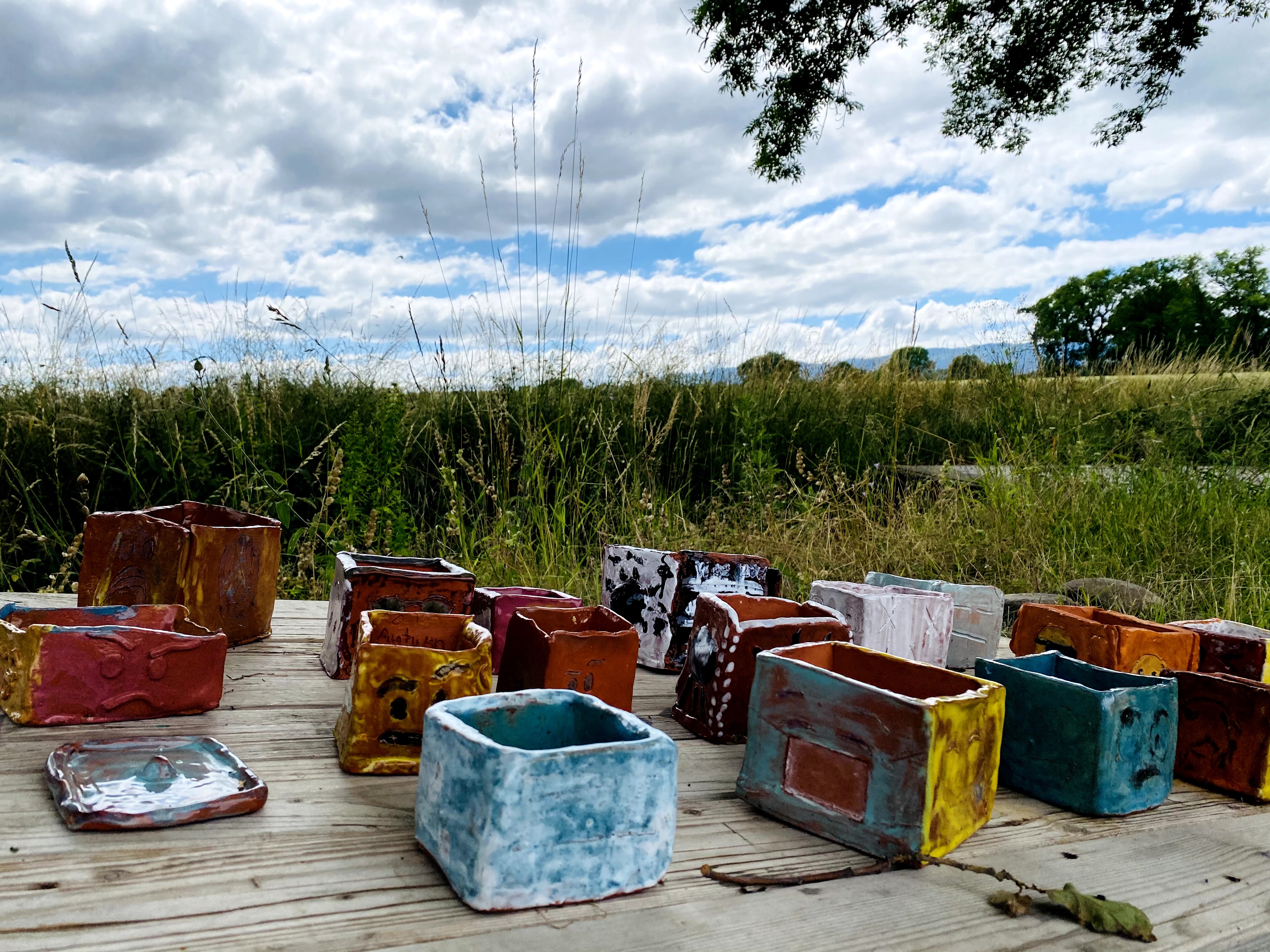
The trail is available and accessible the whole year round but is especially beautiful when you have a multitude of artworks displayed. The majority of the artists live locally but come from all over the world, and have connections to the many arts institutions in the region. In addition, several schools also get to present and display their art creation.
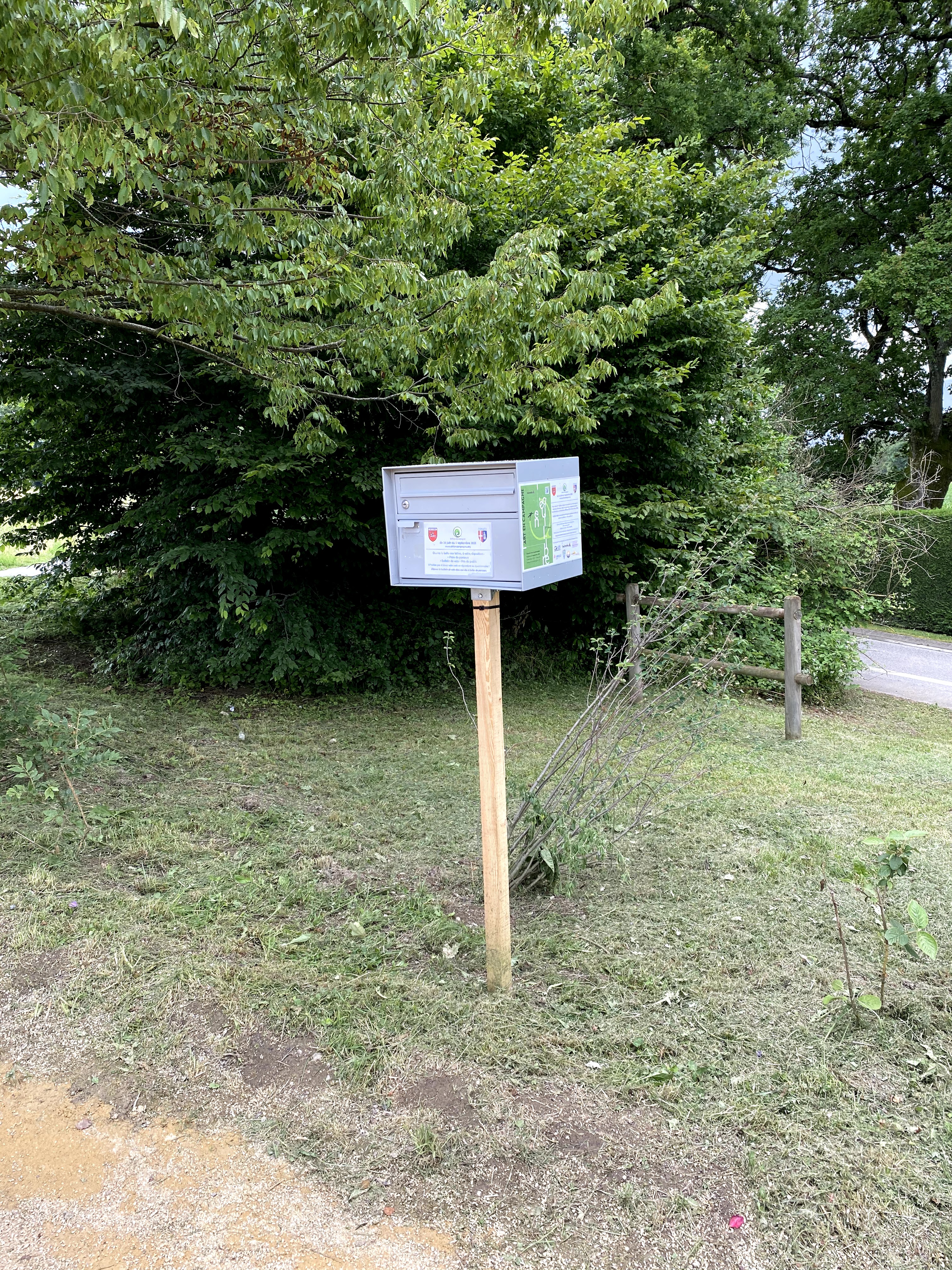
For the 2021 edition, the trail has no less than 47 installations along the short trail. You can pick up a map from one of the many mailboxes that have been put up.
You can also vote for the installation you liked the most. The voting can be done online or by using the sheet you will find in one of the many mailboxes.
The philosopher Jean-Jacques Rousseau famously said, “I can only meditate when I am walking. When I stop, I cease to think; my mind works only with my legs”. I can assure you that on this art trail you will stop. But you will not cease to think. You will look, read, and admire the fantastic installations. The walk will take you around 1 to 1,5 hours to complete, depending on your walking pace and how many stops you make to admire and take photos of the art installations.
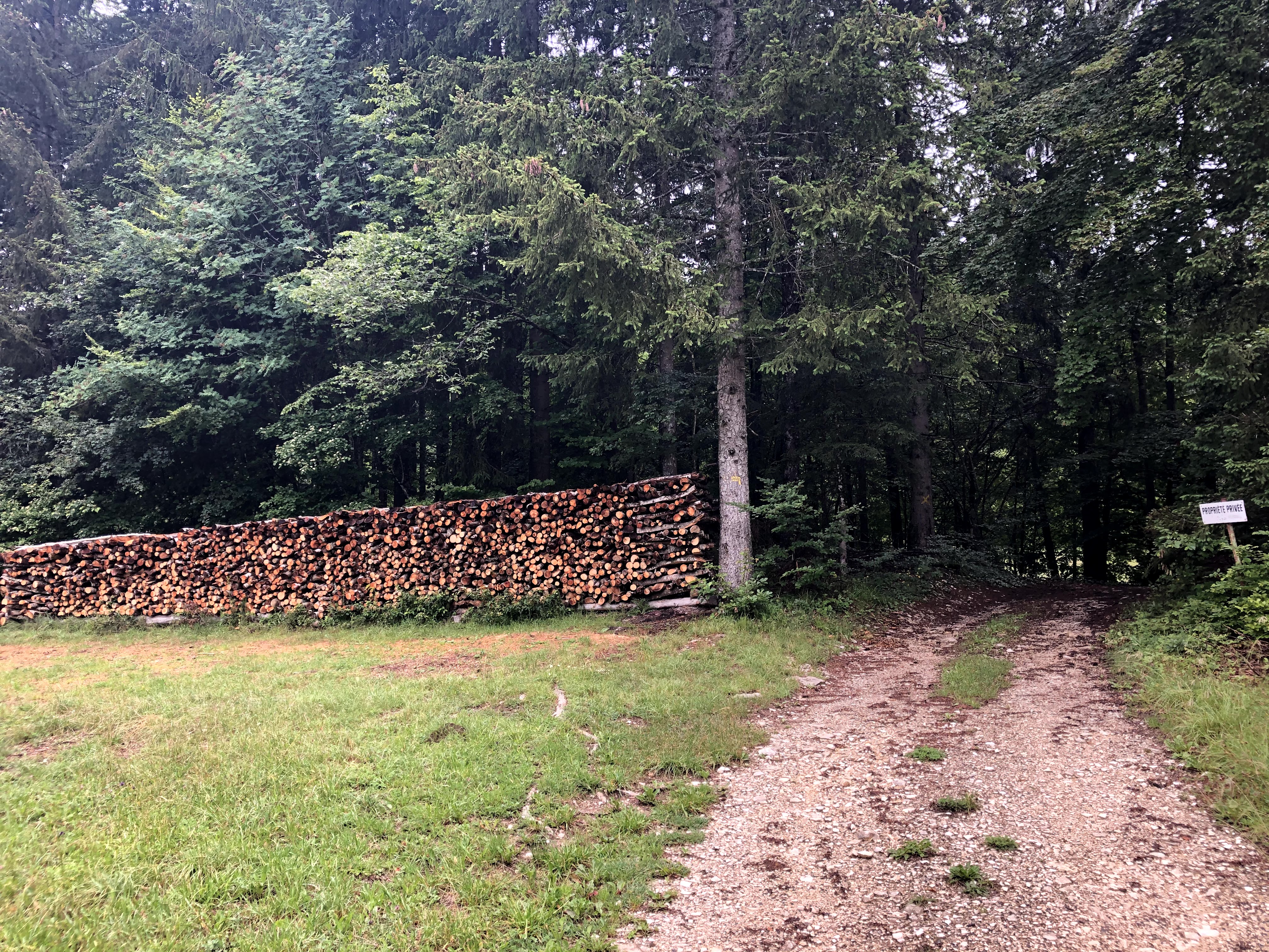
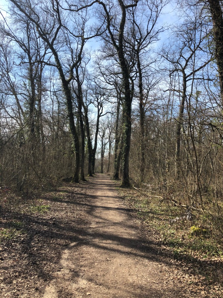
The trails are fairly flat and can be enjoyed by old and young. There was a little stretch in the woods that was a little muddy when I did the walk. But I do not think it would be too complicated to pass even if you have a baby in a pram with you.
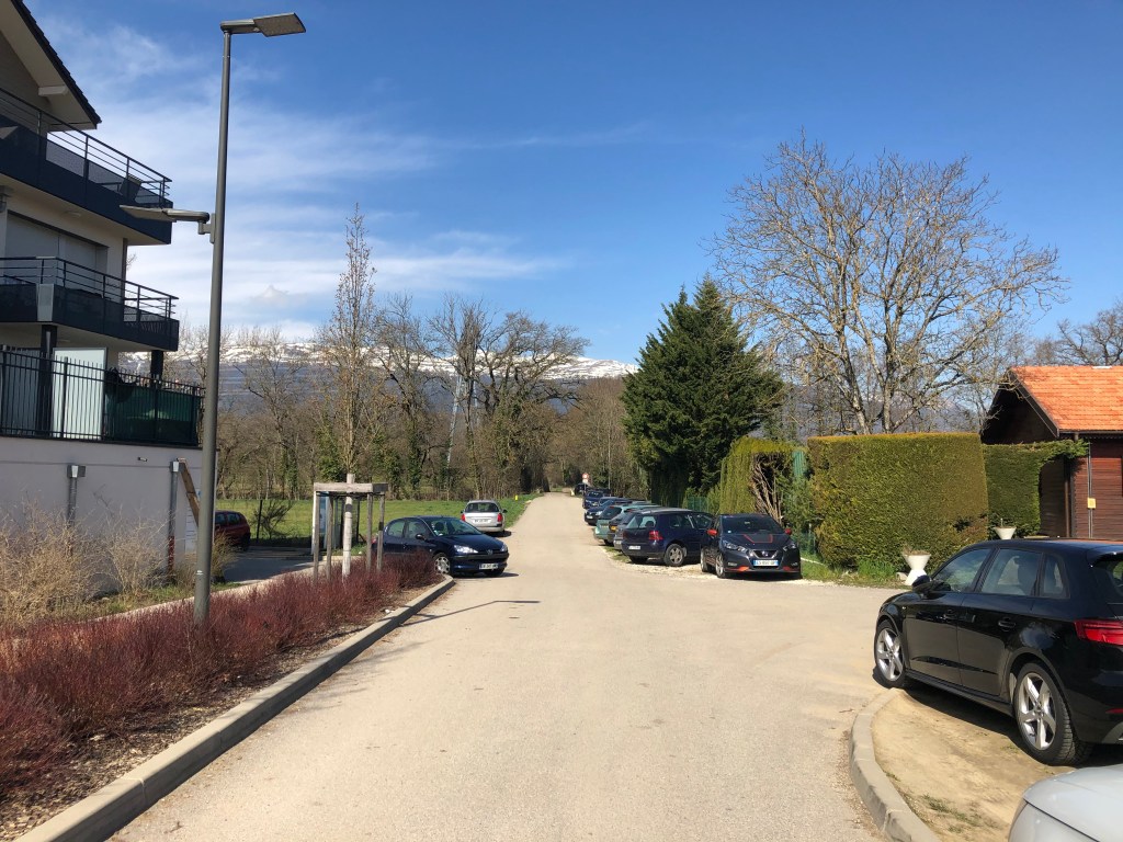
The walk can be done in both directions, and you can start from anywhere along the trail. There are several parking opportunities on both sides if you come by car. If you come by bus the TPG will take you to Ornex-Prenepla or Ornex-Fruitiere on the French side. From the Suisse side, the 52 bus stops in Collex-Centre and Bossy. All bus stops are just a few minutes away from the trail.
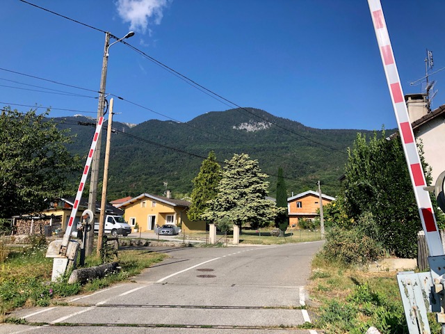
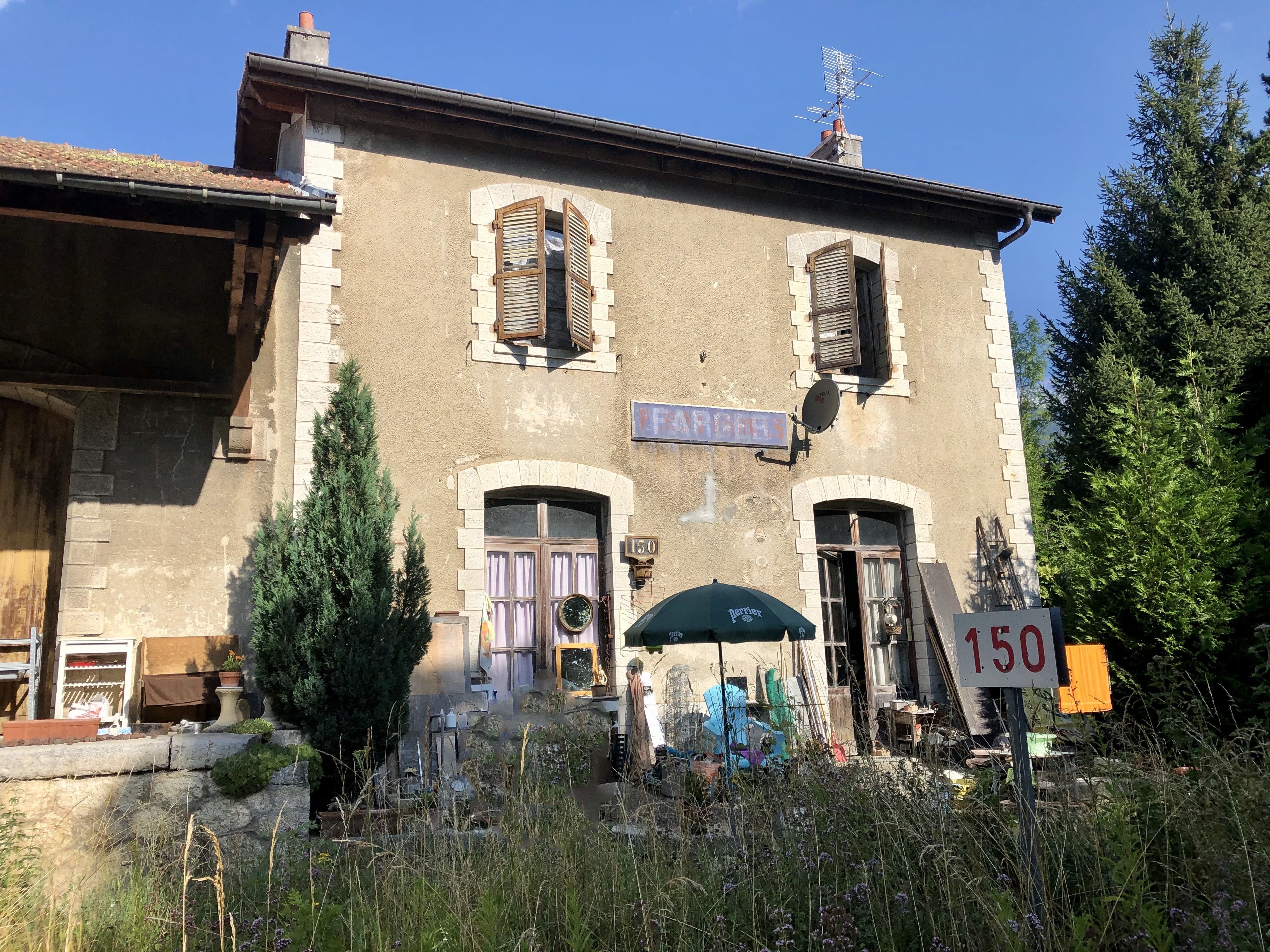
I am sure a lot of people in the Pays de Gex area still remember the Collonges- Fort-l’Ecluse – Divonne-les-Bains railway line passing through Pays de Gex.
I arrived here for the first time in the late nineties, and to start with I was always careful when approaching a train crossing. I was soon told there was no need to worry about being hit by trains since the line had already been closed for many years.
Later, I remember hearing people claiming to have seen recent trains, and I remember we tried (after giving them incredulous glances at first) to work out how that could at all be possible. You’re probably laughing right now because information is so easy to get hold of these days. Twenty years ago, there were no Facebook groups, and the information on Wikipedia was scarce (especially in French). Exploring this train line has therefore provided me lots of new knowledge about the train line that runs from one side of the Pays de Gex to the other.
Here are some historic facts:
The railway line between Collonges-Fort-l’Ecluse and Divonne-les-Bains was inaugurated in 1899, at the height of the railway craze sweeping through most of Europe. The length of this railway line was at the outset 38 kilometres. Five years later, you could travel all the way to Nyon in Switzerland from Collonges-Fort-l’Ecluse, however, this part was closed and removed in the early 1960’s when the highway was built.
During the second world war the line was closed for traffic.
The last passenger train on the Collonges to Divonne line ran in 1980. I assume this had to do with the proliferation of individual transportation that has changed so many other aspects of our lives: constructions of motorways and more and more households having access to a car. With institutions like CERN and the United Nation setting up offices in Geneva, the traffic patterns had also changed, and the need for travelling into Geneva was probably now much larger than the need for going to exotic places like Bellegarde and Lyon.
In hindsight, I think you could say that the local politicians were short-sighted, because closing this railway line made public transport within Pays de Gex almost impossible for many years. There used to be three to four train services per day, and the communes in Pays de Gex fought to keep their beloved train line, but it was just not profitable enough.
With the large influx of people into the area in the last 20-30 years, and the difficulties we now face going from one village to another, this train service would probably have been very useful today. My own kids very quickly found out that it was easy enough to use public transport to go into Geneva, but using public transport to see their friends around Pays de Gex was impossible for them for a very long time.
Reading up a bit on the history also shed light on these ghost trains I’d heard about and proved that those friends of mine were indeed not delirious or mad after all. From 2001 to 2014, part of the railway line was actually used to transport household waste from Chevry to Bellegarde to be incinerated twice a week.
In 2014, the railway line was closed for good.
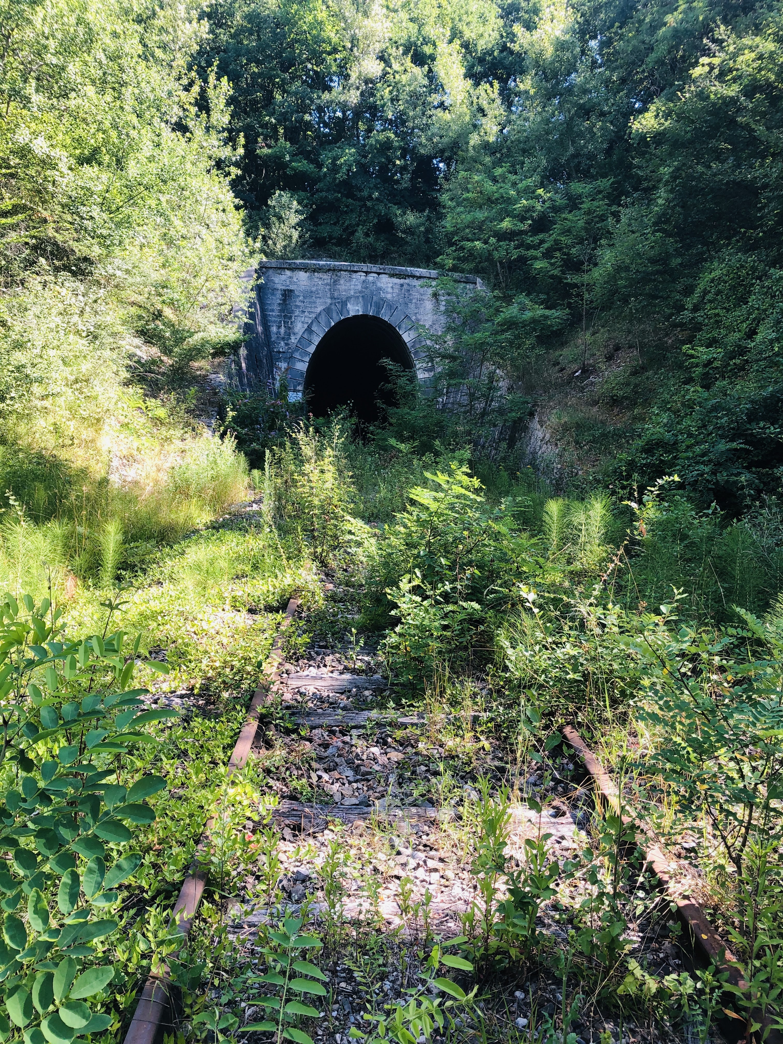
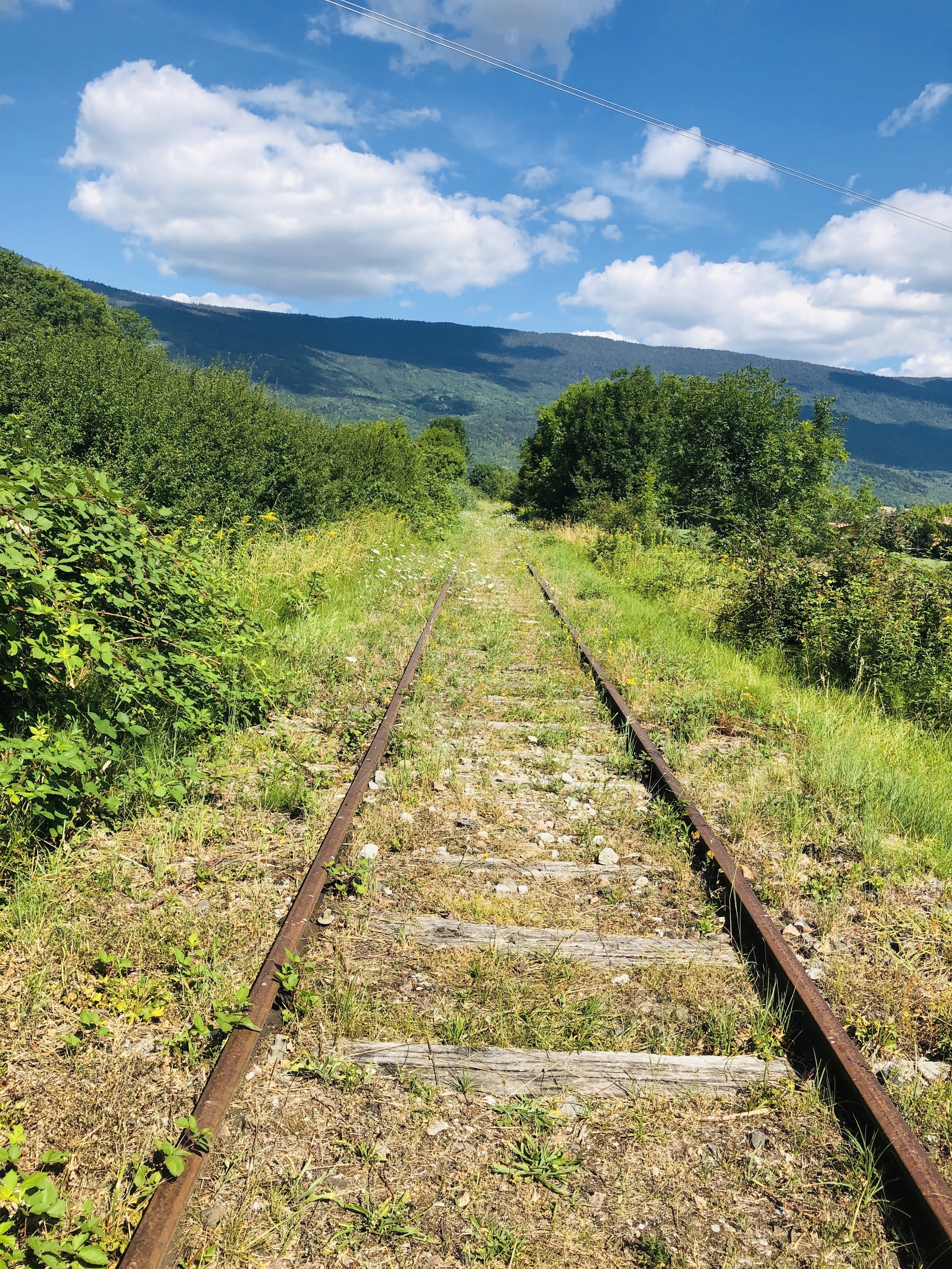
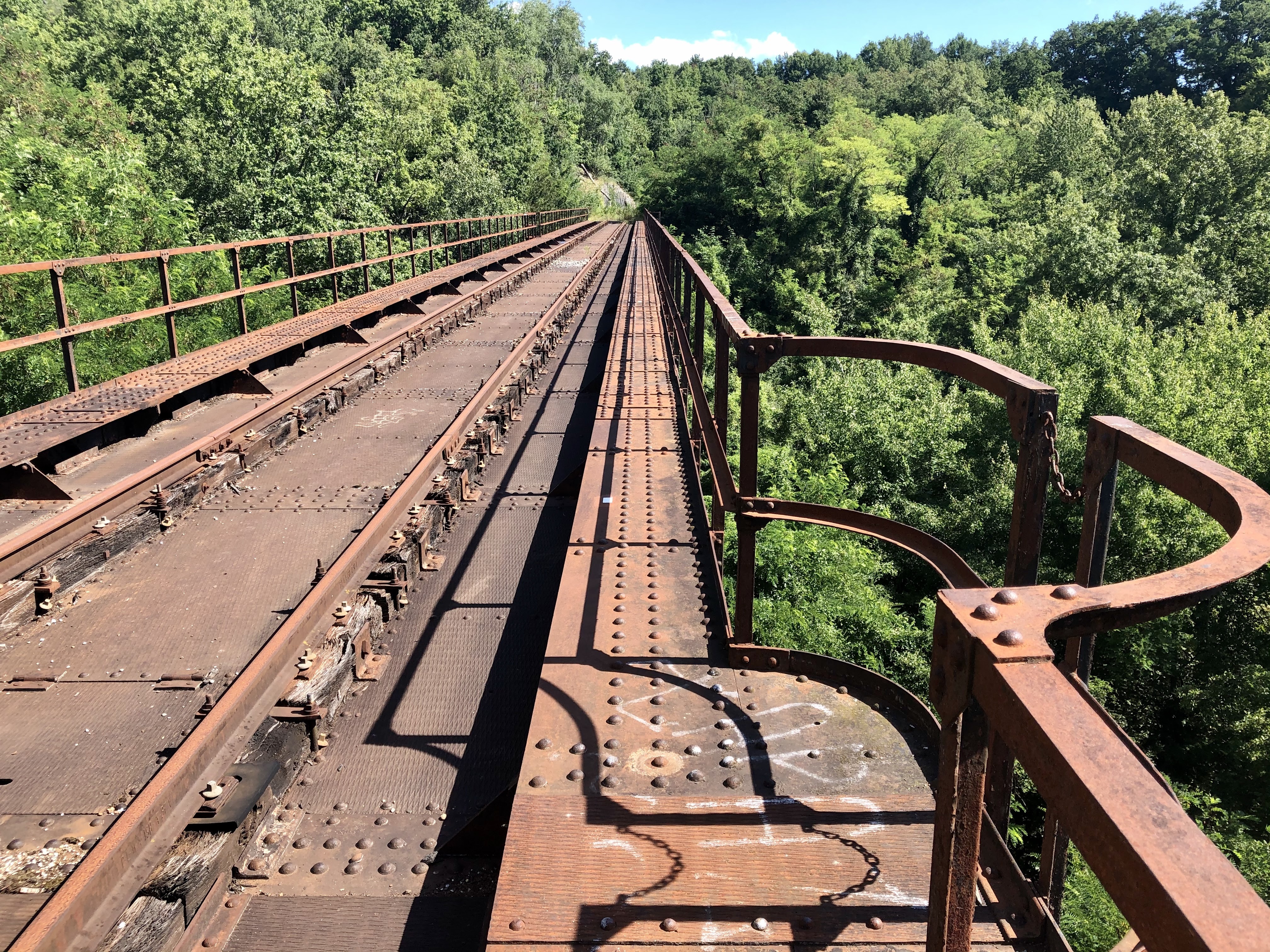
From Divonne to Gex, the old railway lines have been transformed into a very nice walking and cycling path.
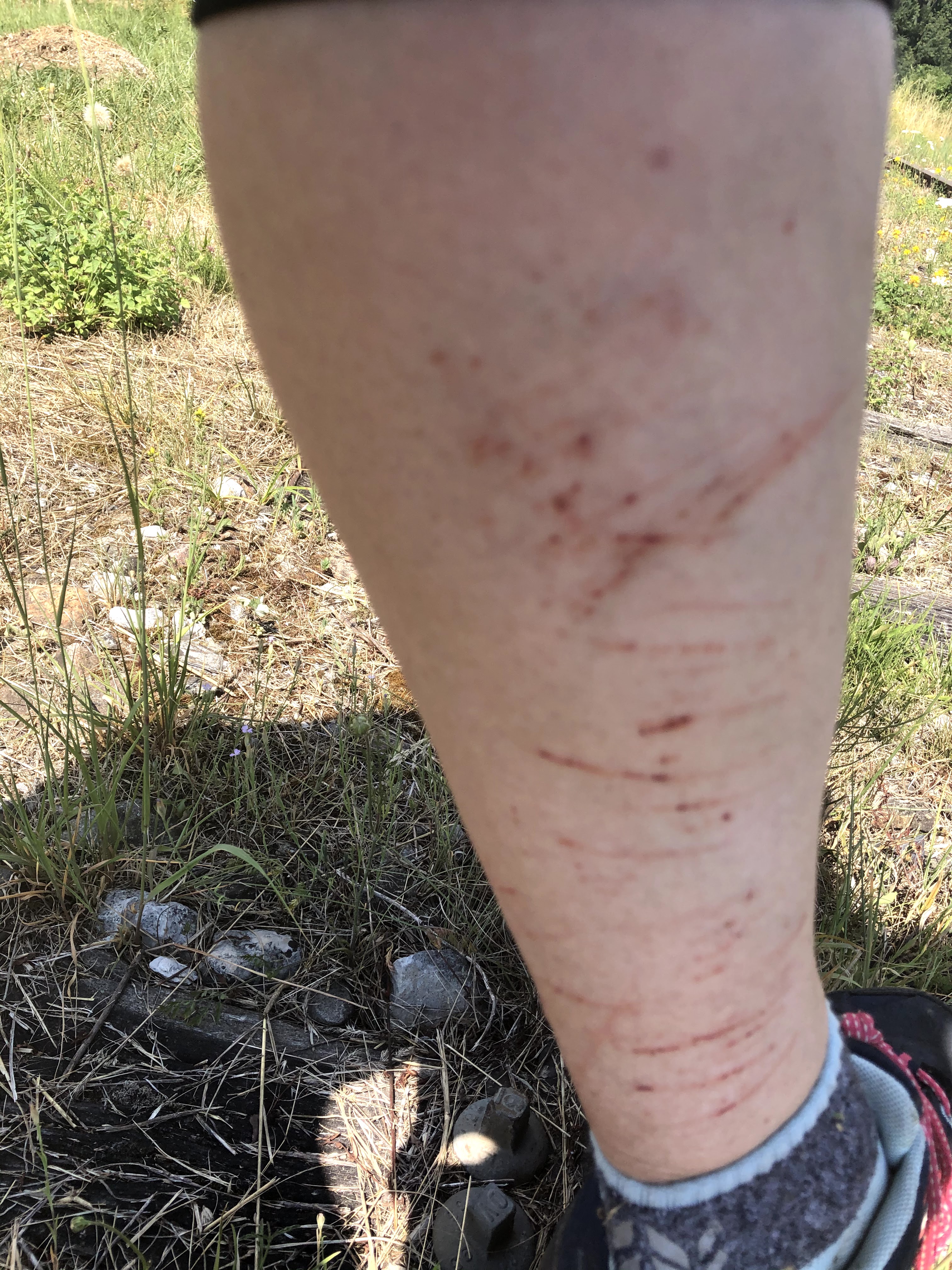
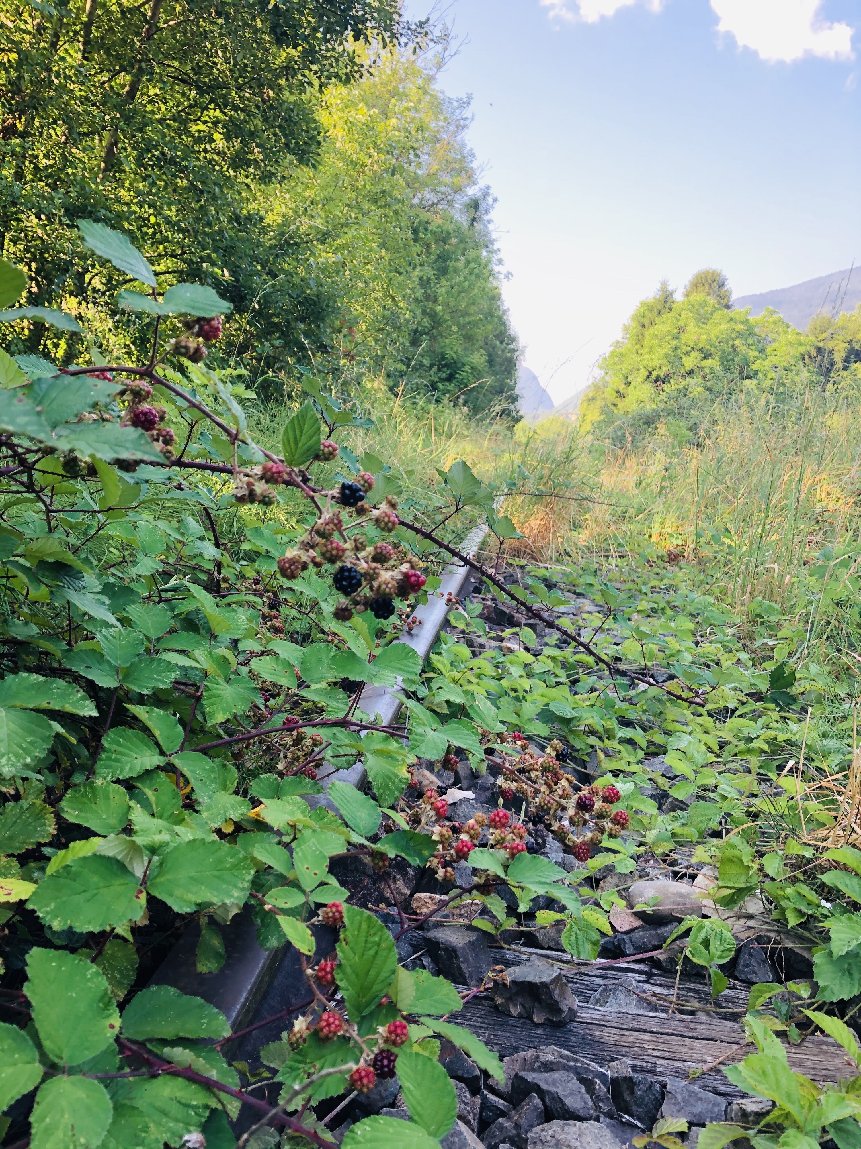
However, today we’ll focus on walking on the real tracks. A railway walk is perfect whatever the weather. However, if you want to explore the parts that have not been transformed into a walking path, I will recommend long socks and trousers. Speaking from experience, I can say that wearing a pair of shorts and short socks is not ideal on overgrown paths with thorn bushes and nettles. But on the upside, from July to September you don’t need to bring a snack with you as you can feast on the delicious blackberries growing in and around the tracks.
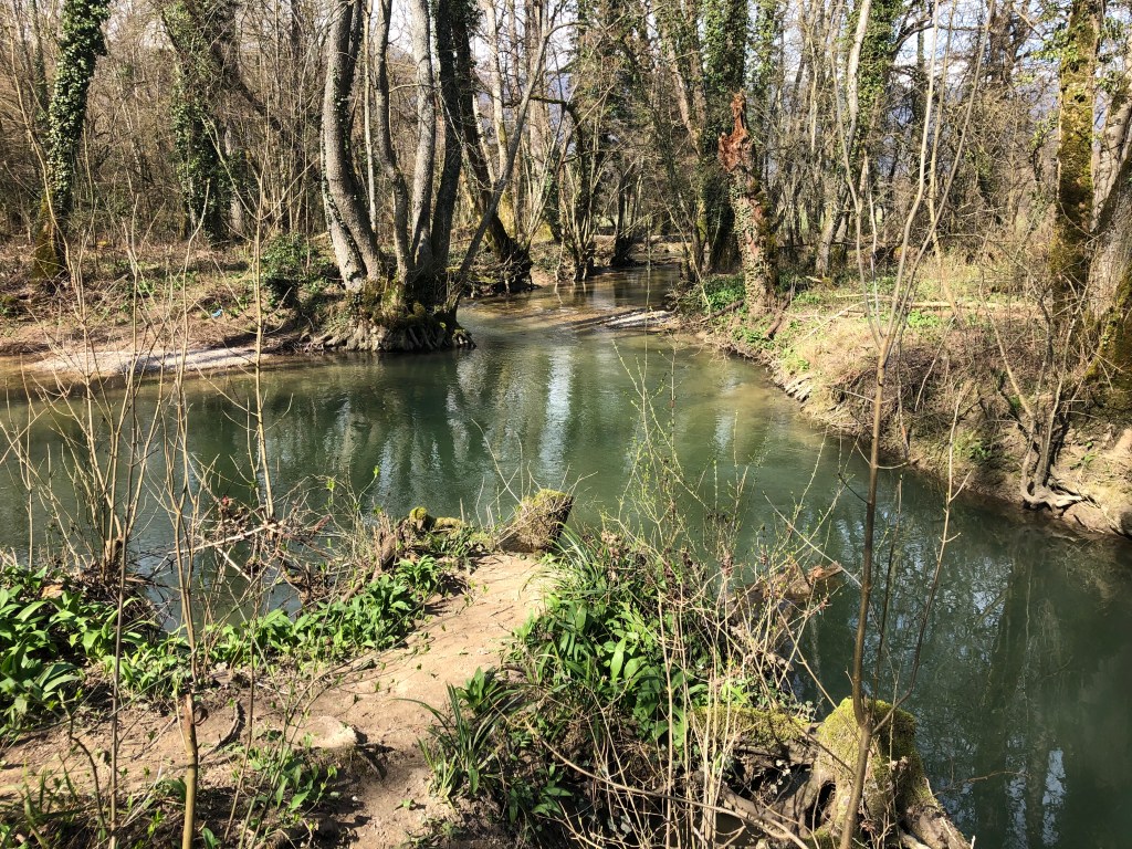
I have done two outings walking on the railway line, for both walks I started in Asserans where I literally parked on the railway lines. I then walked from Asserans to Peron and back and from Asserans to Collonges and back. You will need plan around two and a half to three hours for both walks.
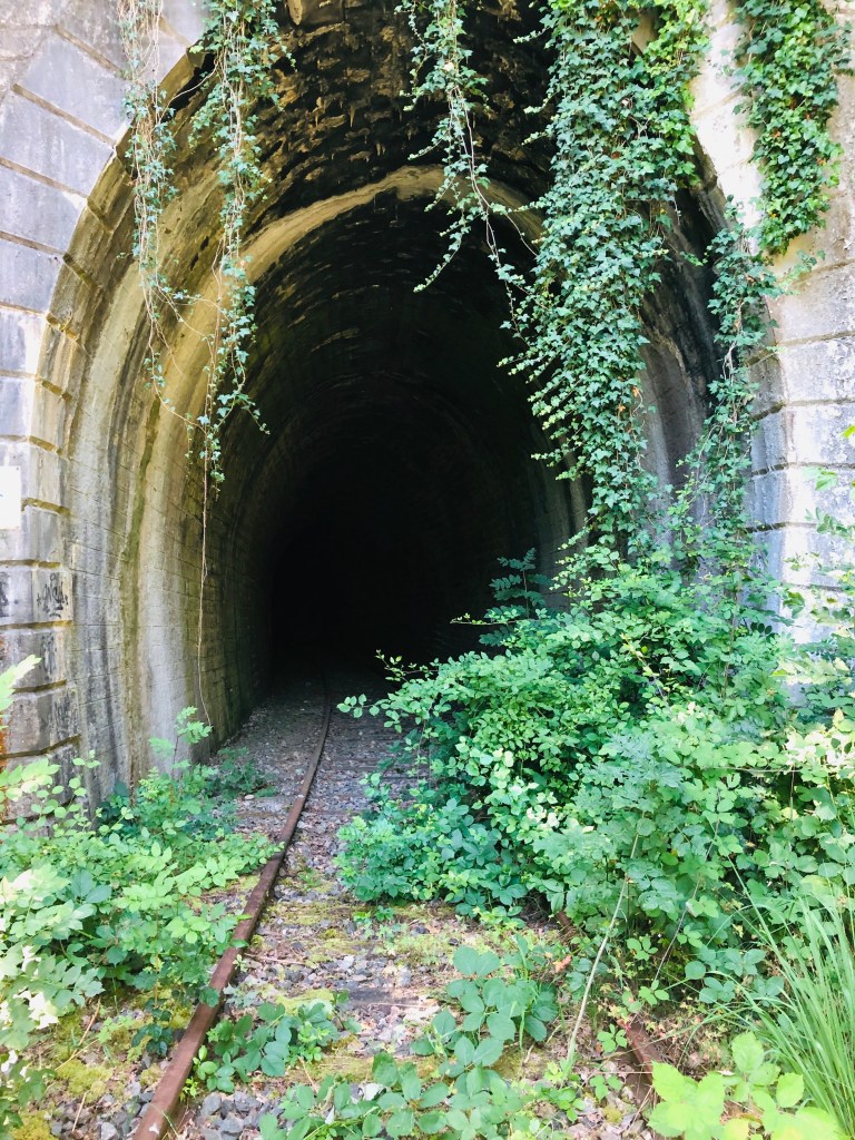
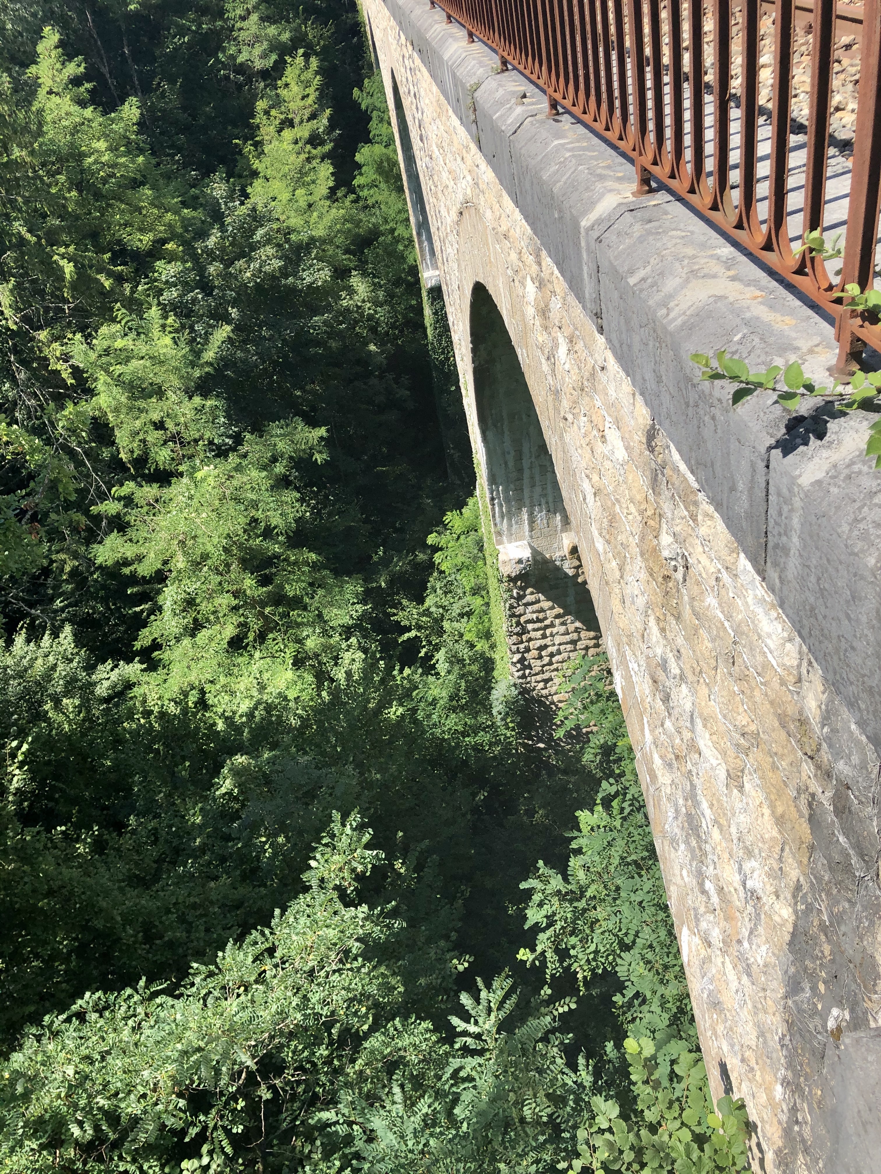
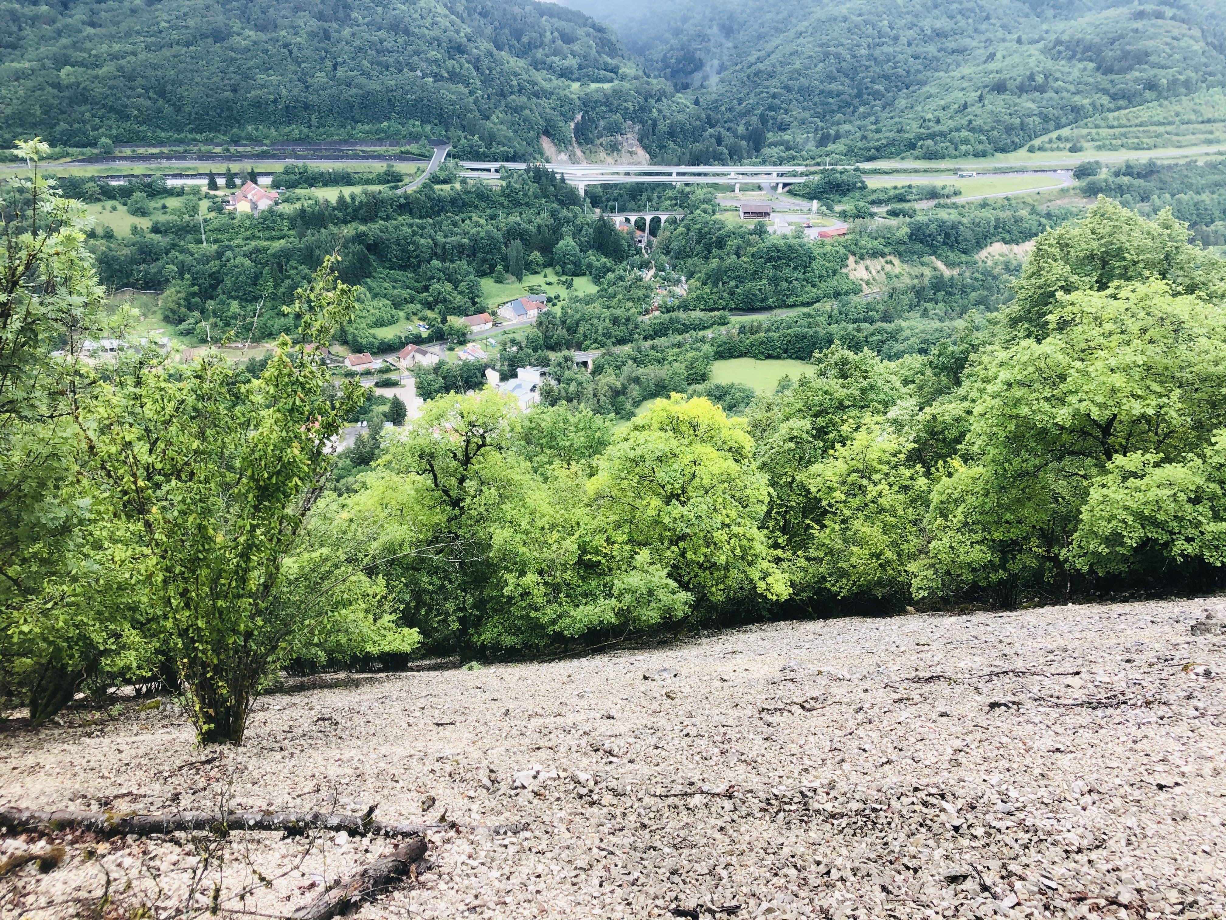
The most scenic walk was from Asserans going west, to Collonges. Here you will be walking through two tunnels and across two spectacular train bridges.
The first is tunnel is Grand Echaud which is 258 meters, followed by the Tunnel des Isles which is 149 meters. In both tunnels, having a flashlight available is handy. Luckily most phones these days have this tool built in.
The two impressive bridges, or viaducts, are the Viaduct de Grand Echaud and Viaduct d’Almogne.
The old station building in Collonges Fort-l’Ecluse is not a very interesting sight and you will probably be better off enjoying the nature, pretty views, tunnels and viaducts on your return to Asserans.
Features: Forest – river – history – panorama view
Overview: I will say it is a medium to difficult walk, mainly because of the crossing of the scree
Time: around 3-4 hours Km: 10 Hight to climb: 568
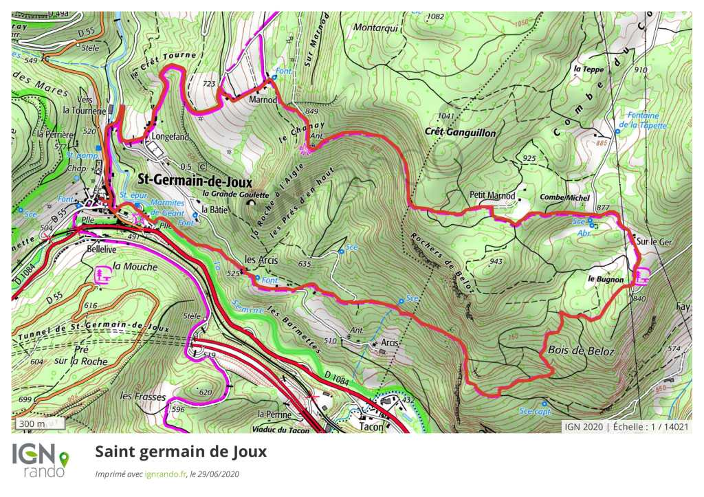
You will find the map at the bottom of this page.
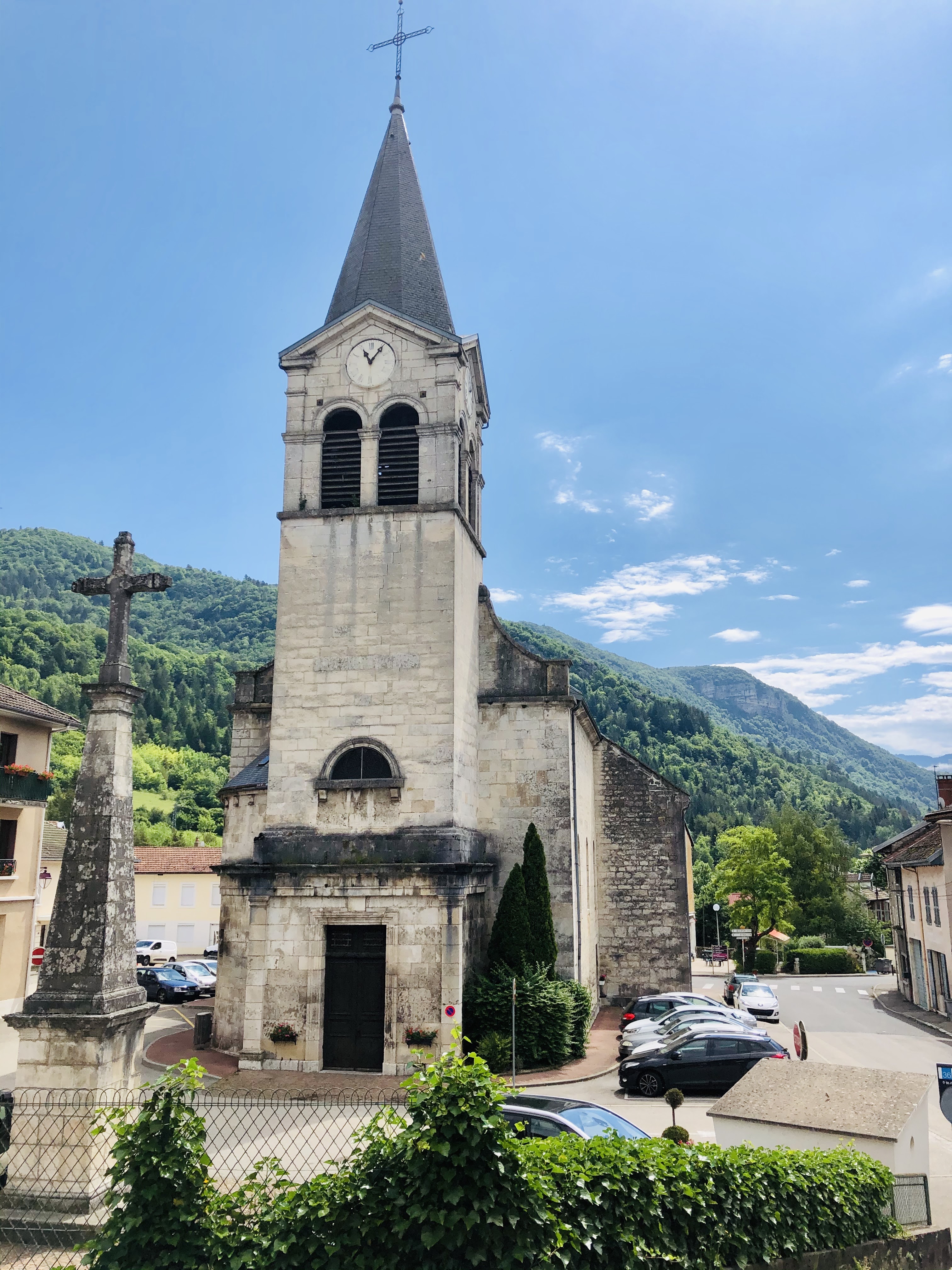
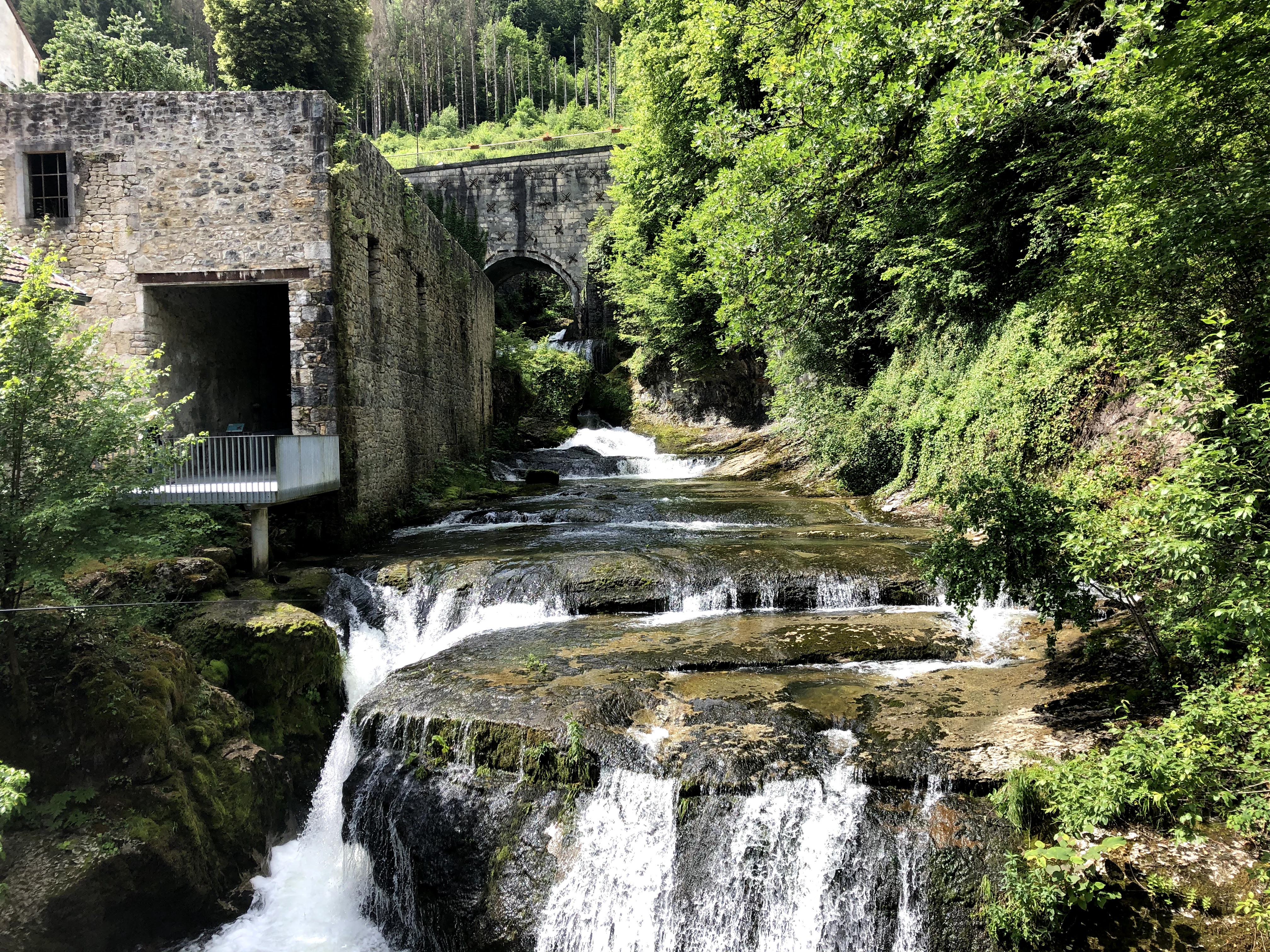
This walk brings you to the heart of the Semine valley, and you will be able to explore its hydraulic heritage.
The staring point is in the centre of Saint Germain-de-Joux where it should be relatively easy to find a parking spot for your car. I found ample parking right next to the church.
To find the start of the walking path you’ll have to walk 50 meters down in the direction of Bellegarde on rue de la Gare.
You will soon see the familiar yellow signpost which is right after the petanque area on your left-hand side. The path will take you down to the Giant kettles – but before going there, you should take some time to explore the old sawmill.
The water wheel, which has been completely restored, measures 7,54 meters in diameter and has 96 blades. This makes this water wheel the biggest in the department de l’Ain.
Back in the good old days this little village had no fewer than eight sawmills along the two rivers that connects here, and the last one closed as late as 1998.
One of these sawmills also used to cut stone coming from a neighbouring quarry, and most of the churches in the area were then build with these stones coming from Saint Germain-de-Joux.
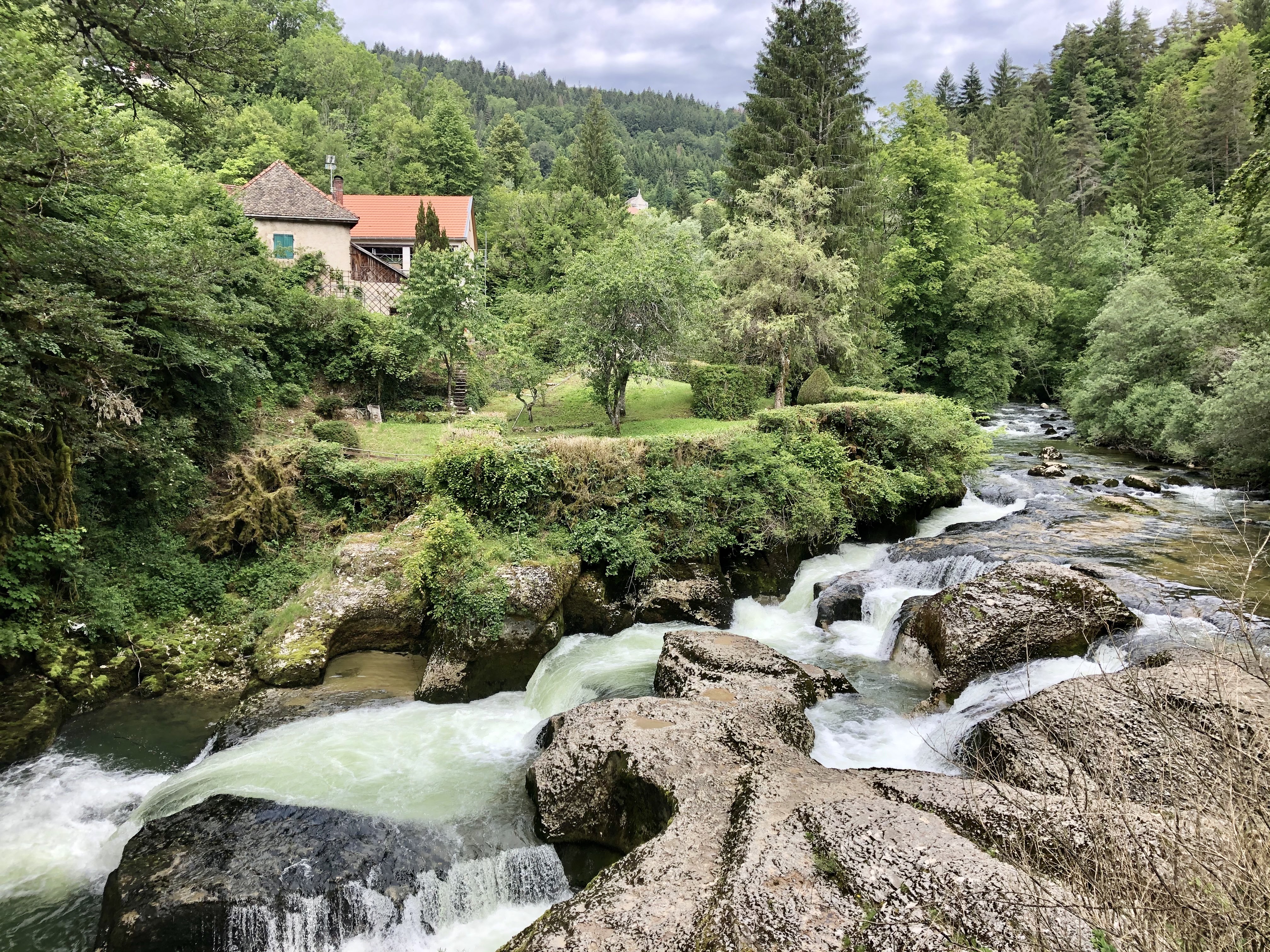
When crossing over the bridge you will see a new yellow sign indicating the hiking path. Follow the path down along the river to Les Arcis.
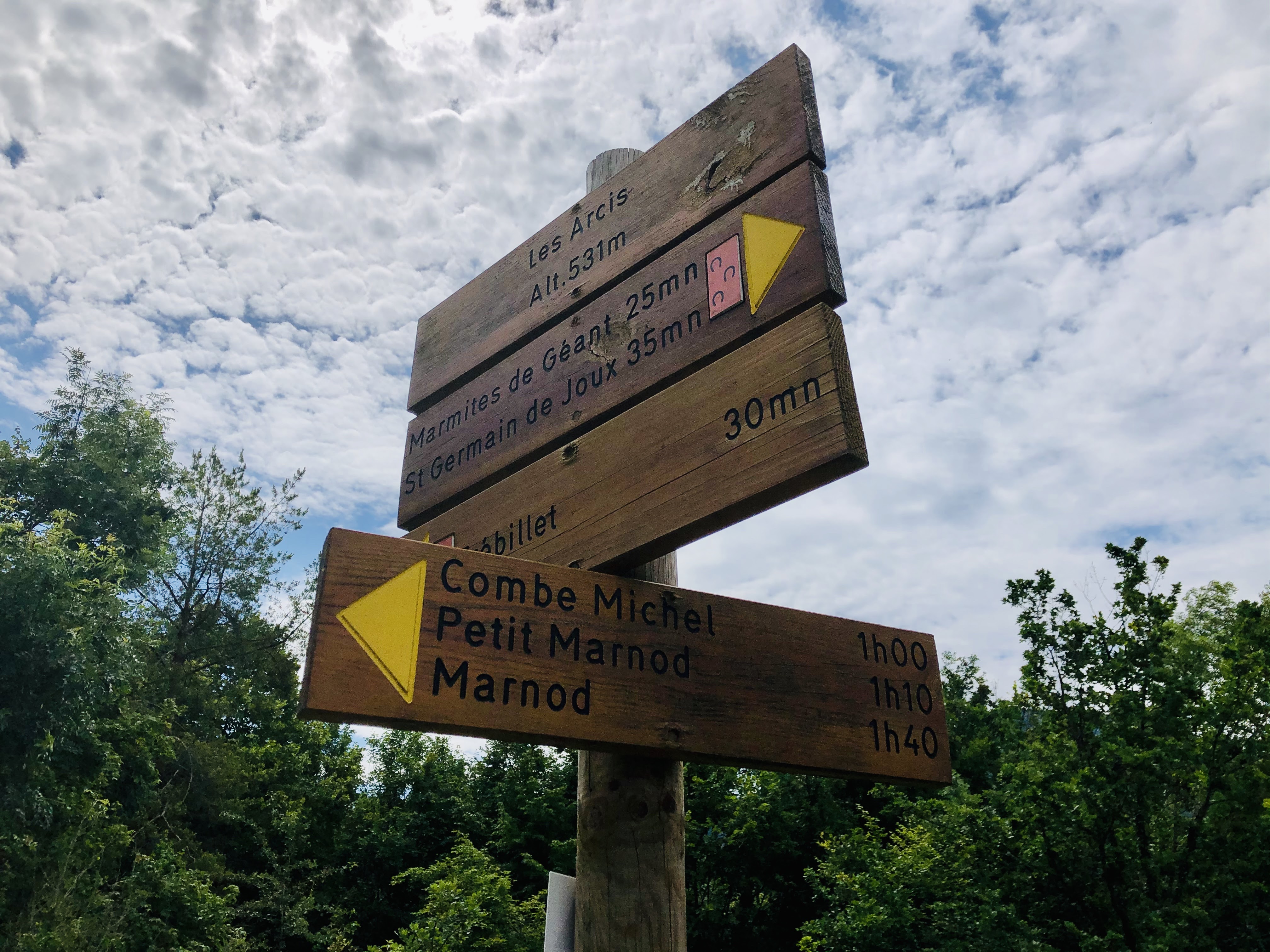
From Les Arcis, follow the signs towards Combe Michel and Marnod,
until you reach this signpost:
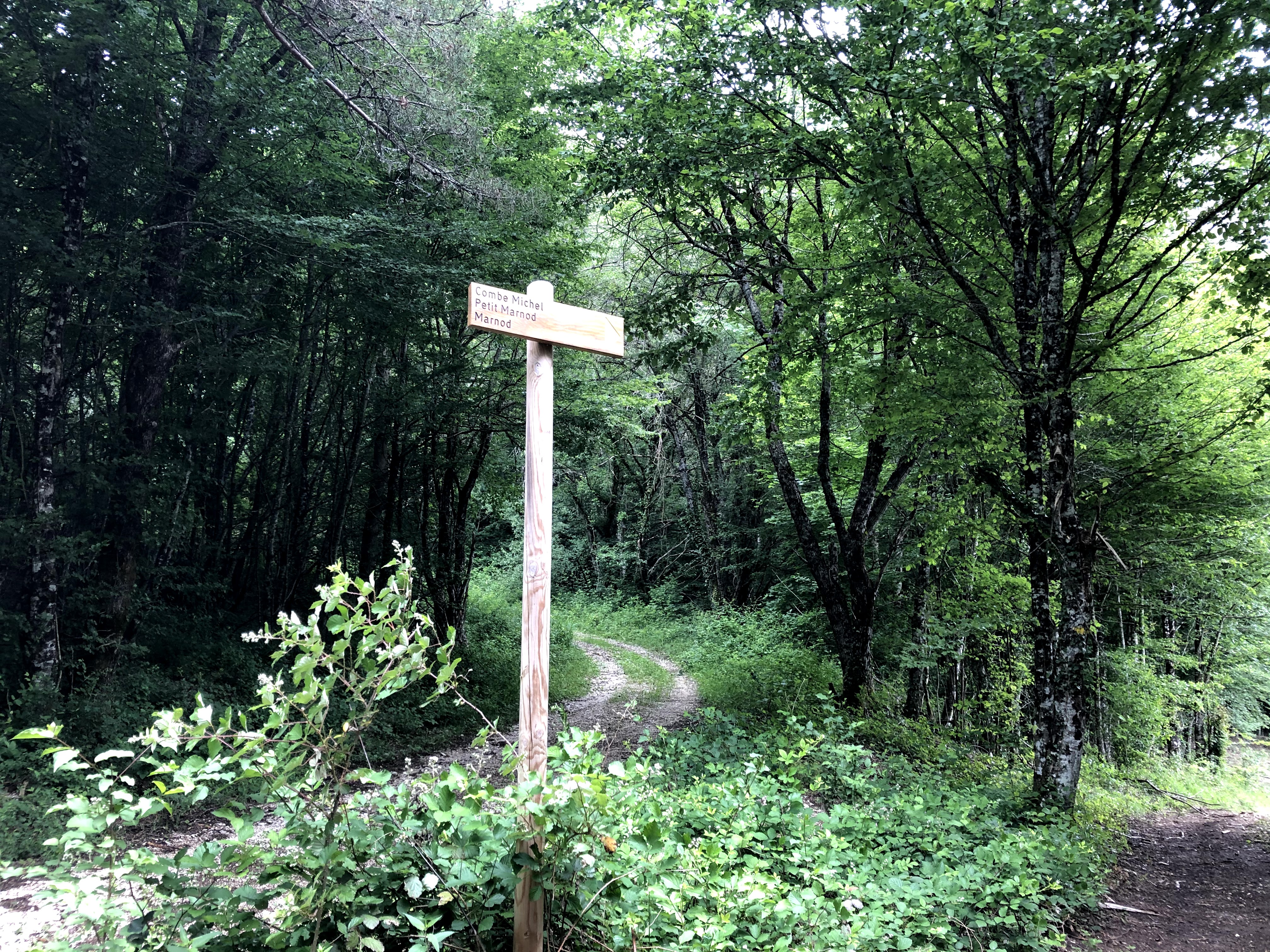
The first time I tried to walk this route I was not able to find the path. I admit I was very badly equipped, with no good map, but to my excuse there was also a lot of forest work going on which has changed the original pathway. The trick is to not be tempted to walk down, to walk no longer than 100 meters in a straight line from the sign and keep your eyes to the left. Then, in between the trees, you will see a small path. When you’ve found it, it will take you up into the forest of Beloz.
After some minutes you will reach Pierrier du Rocher de Beloz. This is a mass of loose stones that cover the slope of the mountain. Such masses are also called screes.
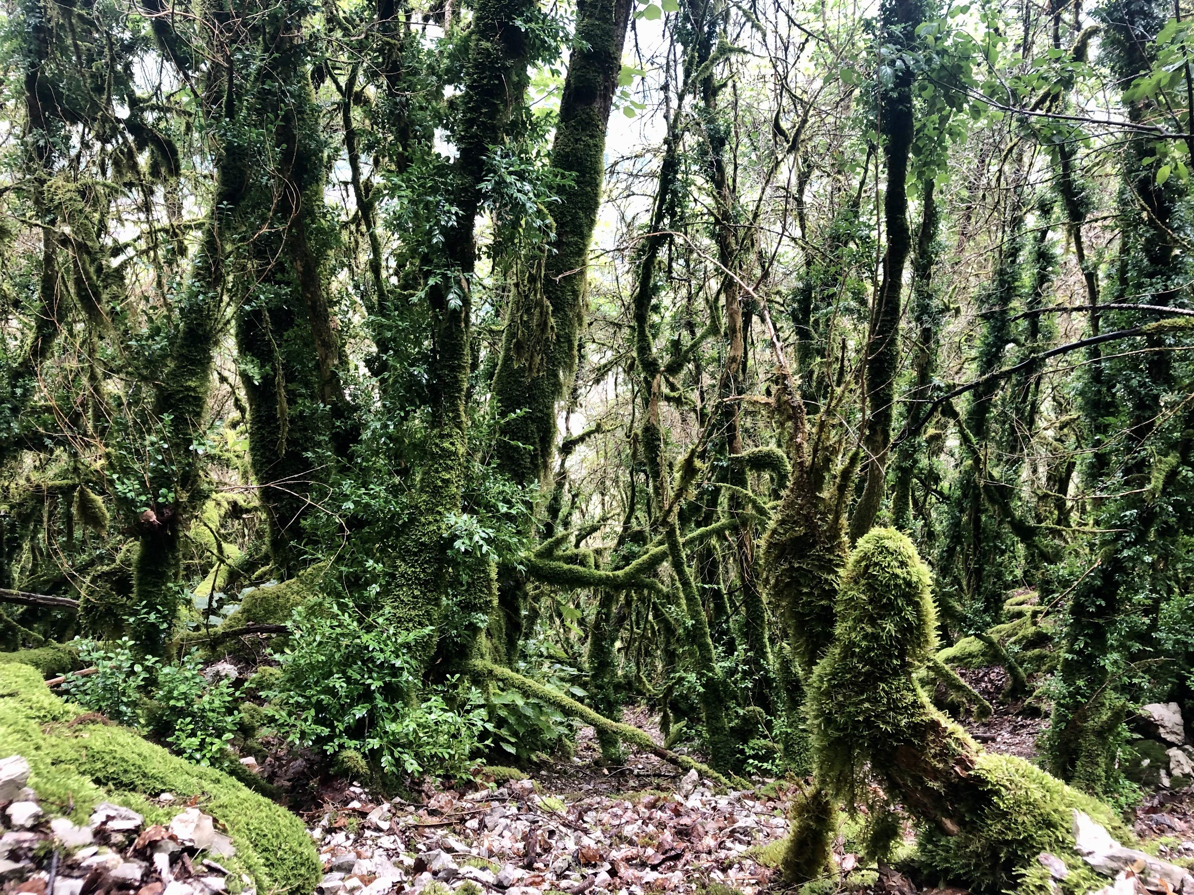
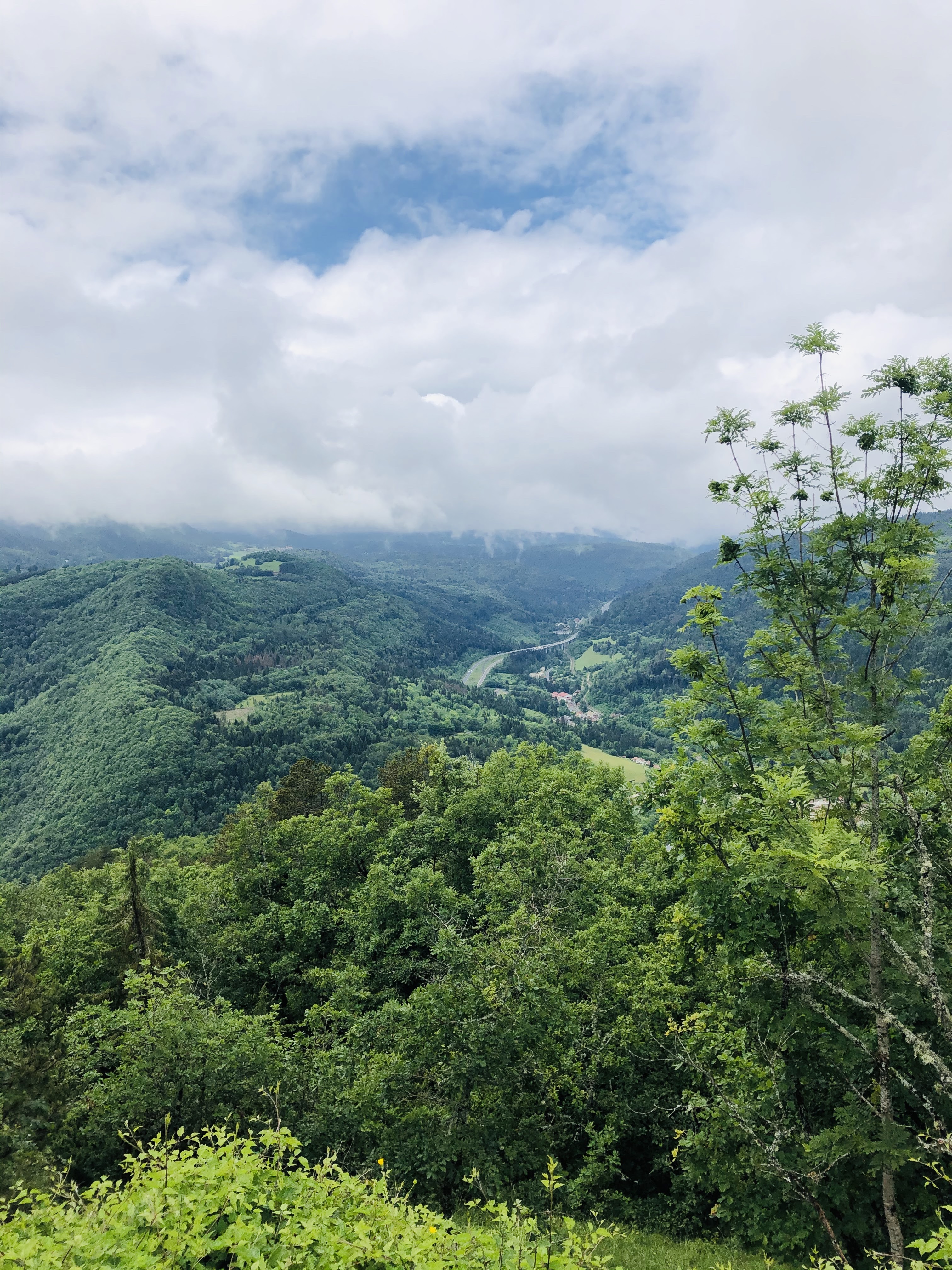
Crossing this scree can be daunting. My friend who came along with me was very quick and focused on a rapid crossing, and we were both happy to put our feet back on an earthy path after the approximately 50 meters walking on loose gravel. The forest itself is amazing, with threes overgrown with moss. Bring a camera because with the right light you can take amazing photos here. You will also get a really good view of the motorway and viaducts and witness how it is sculpted into the landscape. I have so many times seen the nature from a car window along the highway. Looking at the highway from another viewpoint enables you to admire the great engineering knowledge that’s made this highway possible.
Moving on along the path takes you up and over to Combe Michel, before you start to descend back to Saint Germain-de-Joux past the small hamlet of houses in Marnod.
In Petit Marnod, we started to wonder if we’d lost track of the path, since we were faced with a barrier across the road. The trick is to walk past it and continue until you see a wall of three logs. The path follows these logs to the left. You will soon be rewarded with another great viewpoint of Saint Germain-de-Joux, the highway, and some small summits.
The Marnod is a really charming hamlet of houses and you will be walking along the road that connected these houses to St. Germain-de-Joux. If you are lucky and find some of the locals out and about enjoying their coffee or a glass of wine, they’ll be happy to talk with you. They also have a really great sense of humour and could end up asking you to watch out for crocodiles and toy cars!
Follow the signs down to Longefand and then back to Saint Germain-de-Joux.
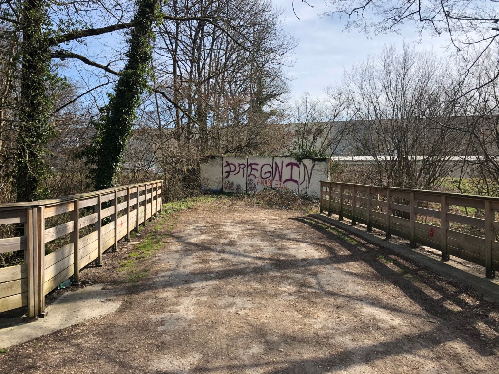
Description: I started this walk from the small car park in the centre of Vesegnin, next to the Domaine de la Boissière. You can find the exact starting point on the map further down if you don’t know the area. Further away, next to the elementary school of Grand Chènes, there’s a bigger car park and also a play area for those kids who still have some energy left to burn after the walk.
Starting from the Vesegnin car park, you walk along Route de Vesegnin through the small hamlet of buildings. After about 500 meters, take left onto Promenade de la Manchette.
Continue straight on. After another 500 meters, take left and follow the promenade de la Manchette. Keep walking straight on, after yet another 500 meters you again keep to the left and walk through a small barrier and continue straight on.
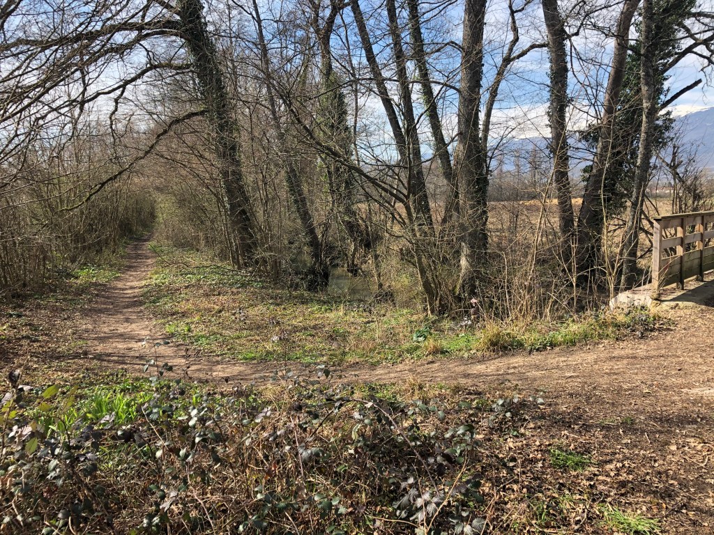
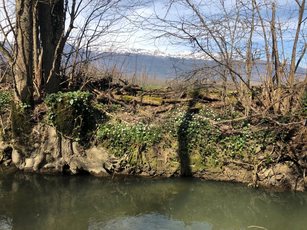
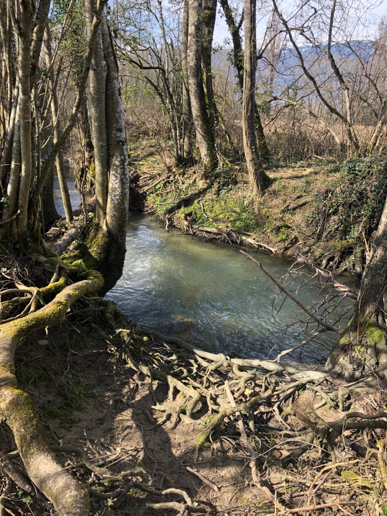
Now, walk until you see a bridge on your left side. Cross the bridge and you will see a small pathway that takes you along the river Le lion. In the springtime when there is plenty of water you may come across one or two people fishing.
If you are the proud owner of a fishing rod and would like to try catching a nice trout or two, don’t forget to buy the fishing licence before you start fishing. You can get this at the tourist information. Fun fact: women pay less for these licences in France, as a way to promote fishing as a less gender-specific activity!
Walking along Le Lion is peaceful, and you won’t meet a lot of people. In the springtime, you will be sure to smell the wild garlic that grows here in large quantities.
If you pay attention to the river you will also see the point where the rivers Le Lion and Le Grand Journans meet.
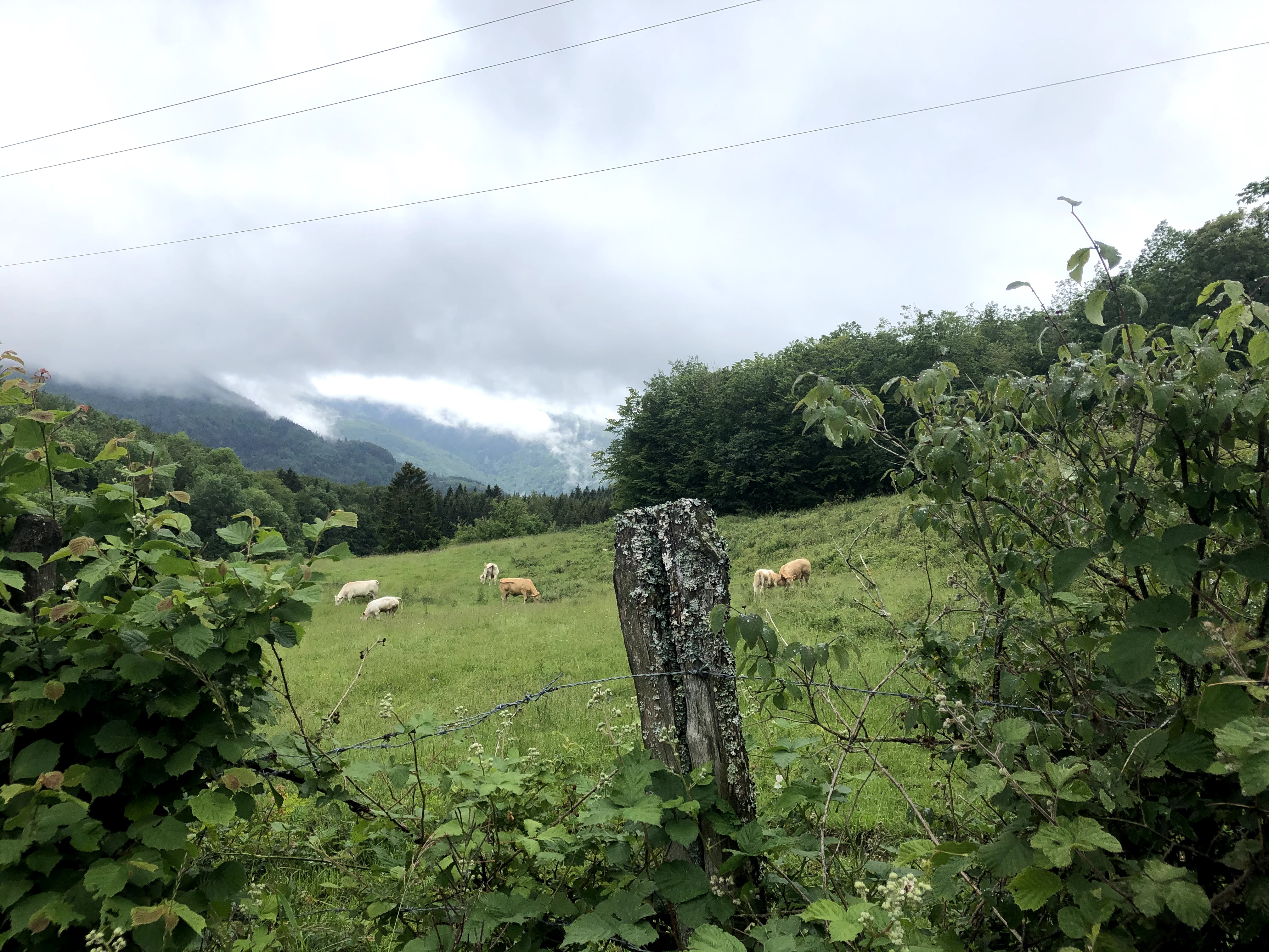
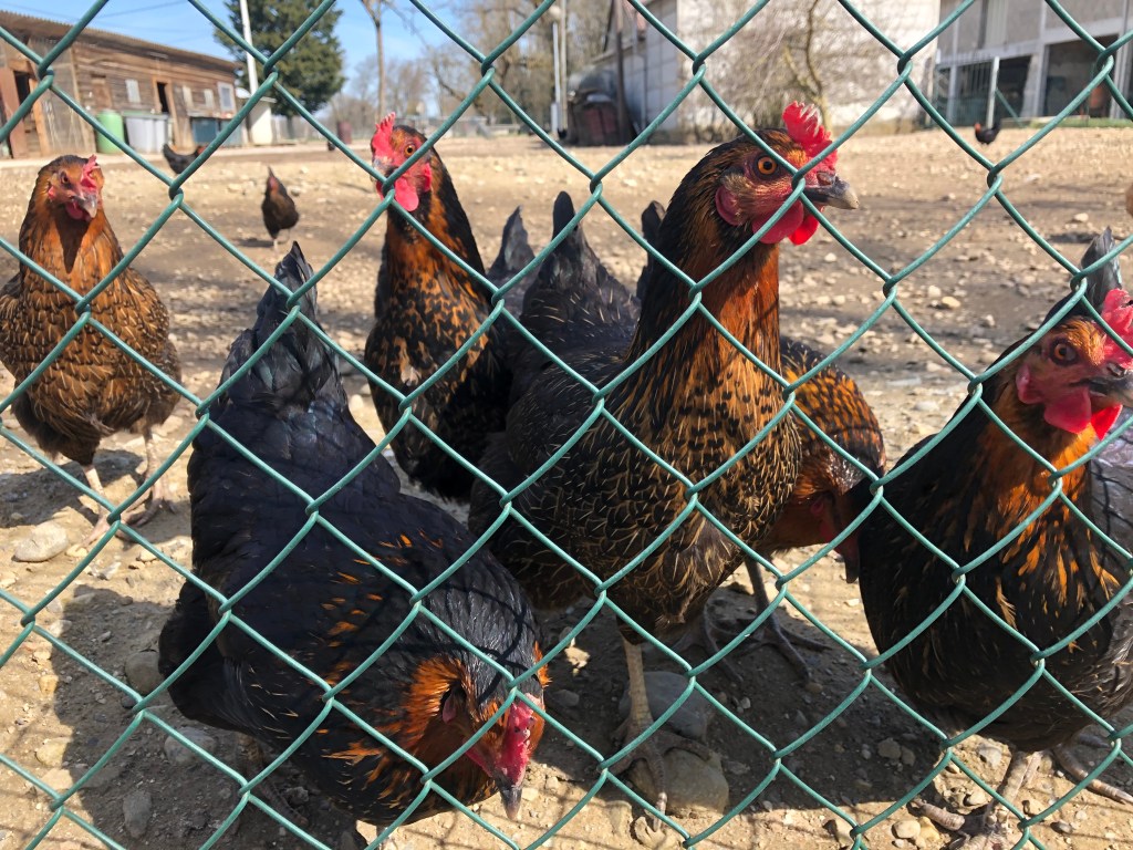
Where the pathway joins the road, continue to the right, and soon you will be walking past a small farm with chickens, horses and cows.
Continue along this road until you reach a roundabout. Here, keep right and walk on the Vie Detraz through another roundabout. When you reach the third roundabout, take right and you’ll soon be on the carriage road again.
When you are back at the bridge where you found the pathway, you now take left and continue back to Vesegnin.
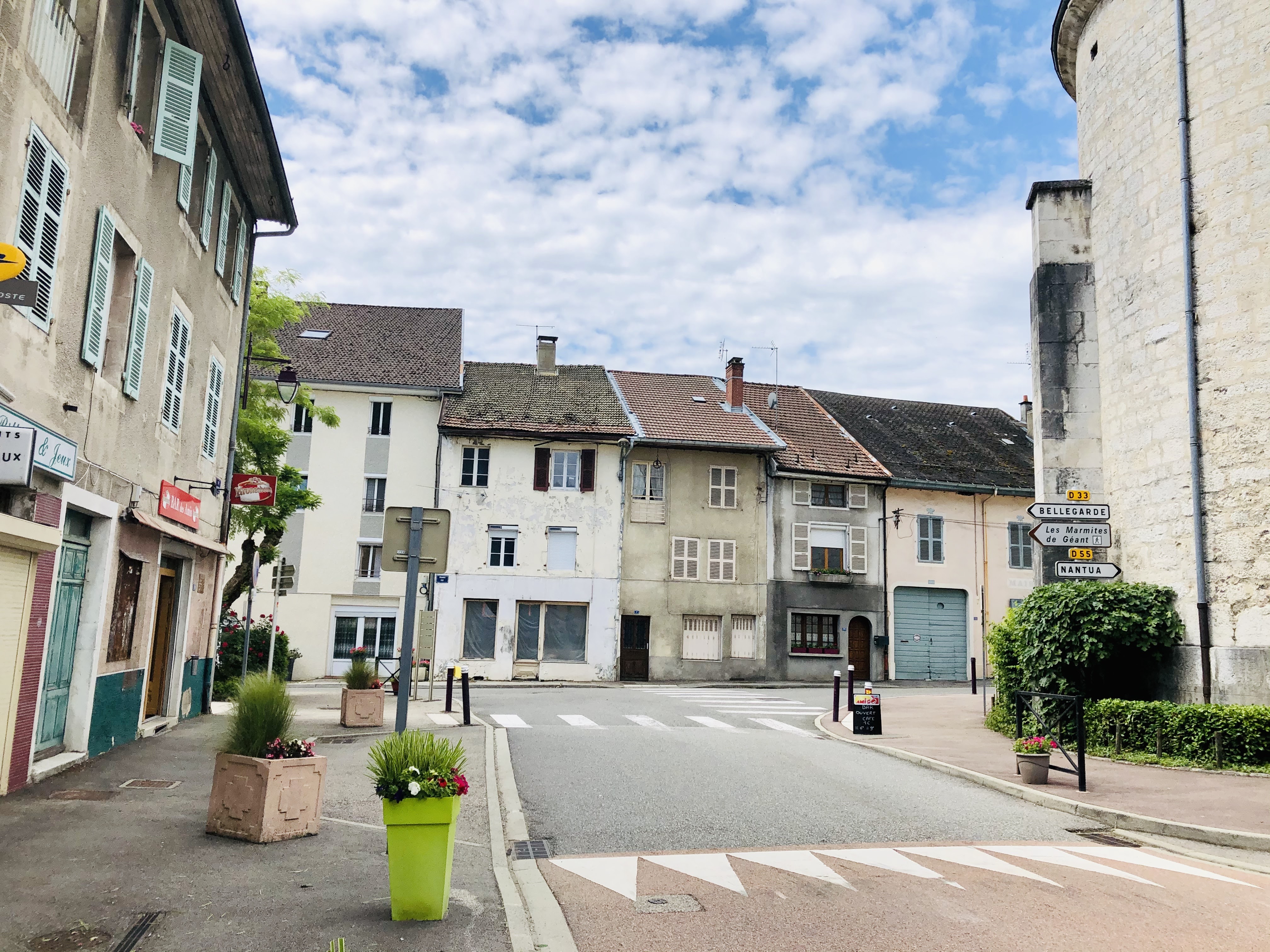
This is a town people usually drive past, either on their way up into the Jura mountains, or towards Geneva in the other direction. Until recently, the main road passed right through the town centre, but now skirts around it, making Gex even easier to overlook.
Courthouse and prison – in the middle ages the prison was located inside the caste. It was moved out of the castle in 1616. Later it became to small (or maybe there were just too many criminals around) and it was moved outside of town. The new prison had twenty-four cells divided between two floors: twelve on the ground floor for men, and twelve on the first floor for women.
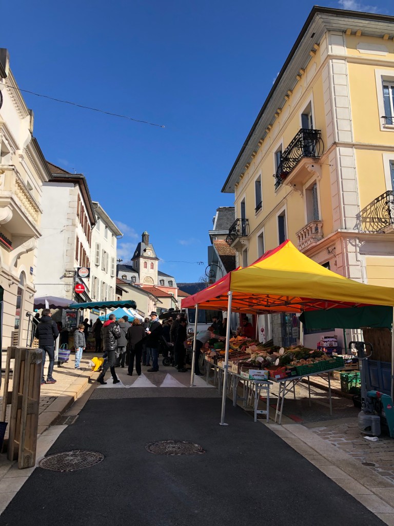
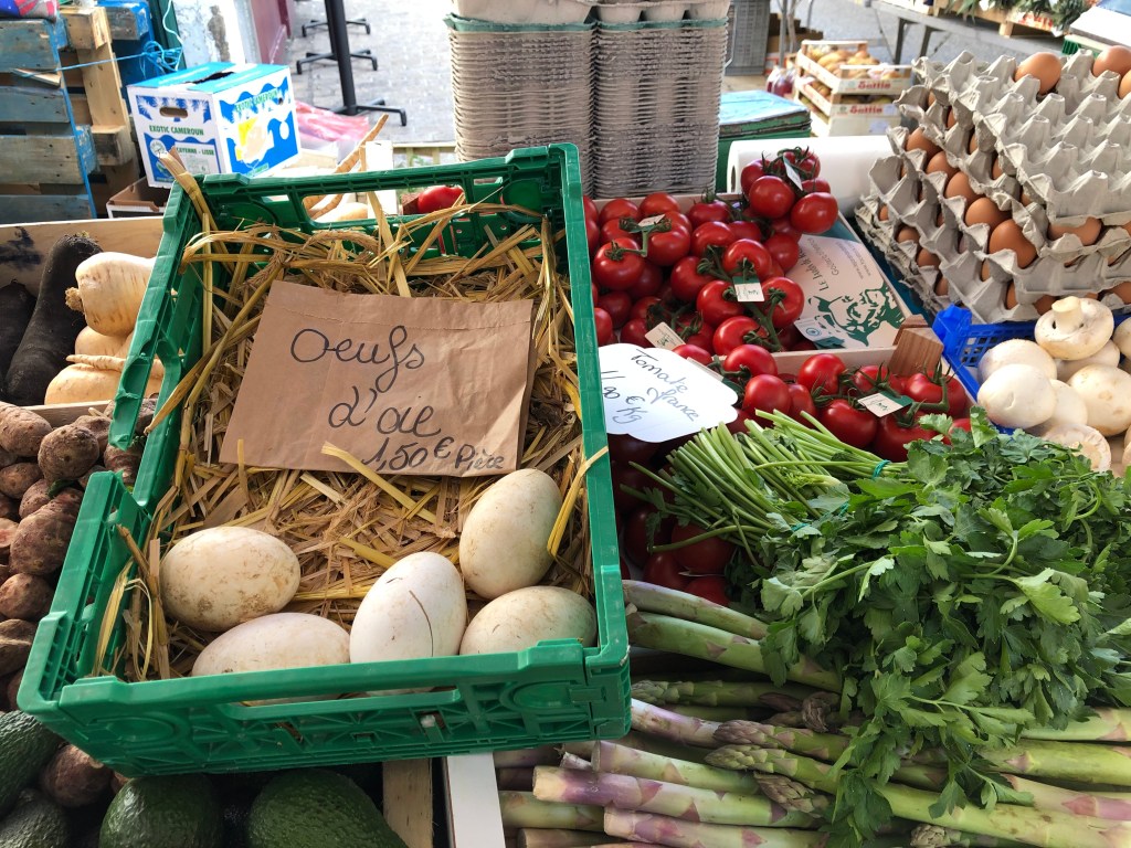
Having lived in the Pays de Gex area for almost 20 years I decided that doing the historic walk around Gex was well overdue. Knowing that there is a weekly market on Saturdays, I decided that it would be a good occasion to combine visiting the market stalls with exploring some history. As the walk took me around Gex I realized how little I knew about the history of the area I live in.
You can almost feel the different epochs of history when walking around. In the little “bourg” (town centre) just below the castle ruins you are taken back to the middle ages and you can imagine how crowded it must have been in medieval times, with lots of noise and family life around the small square.
In other parts of Gex you feel taken back only a couple of hundred years, when Gex was an important and prosperous town in the region, with its small yet majestic town hall and courthouse.
Town hall – you will see on the doors that the coat of arms shows the Sire de Joinville
With all the contemporary architecture and large supermarkets and shopping centres that the influx of people to this area has brought in recent years, it’s easy to overlook the small local towns like Gex. I really recommend that you take some time to explore this small and charming town in the near future.
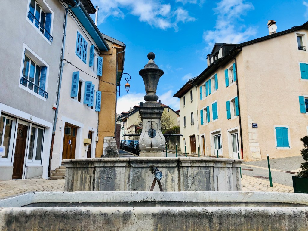
Fountain – built in 1746 with stones from Samoëns in Savoie.
You will find the walking route further down in the article but it’s always useful to have the printed map. You can get it from the local Tourist Office, located in Rue des Terreau.
In the summer months the tourist office also offers guided tours. To contact the Tourist information:
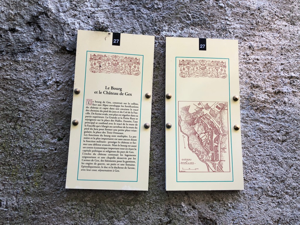
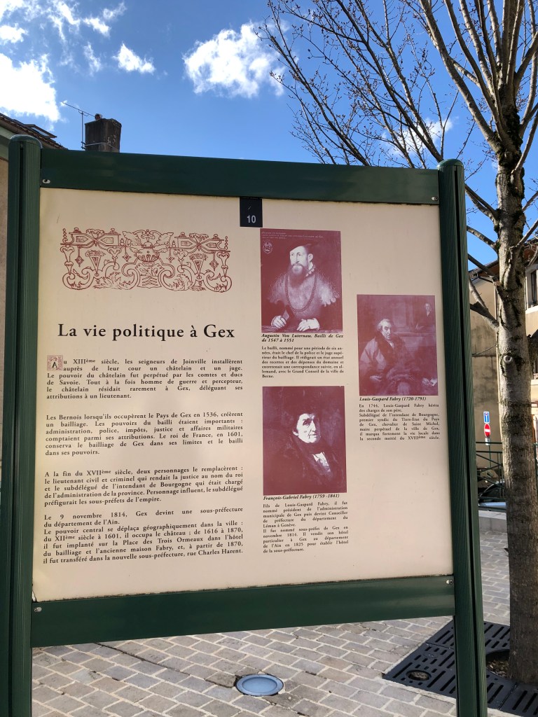
Each stop on the route has a panel of historic facts. Since these panels are unfortunately only in French, here are some historic facts about Gex and Pays de Gex:
Le Pays de Gex was called “Gaium” in the very old Latin charters, which is a word the old Romans used to describe a thick forest.
Gex has been inhabited since at least 1800 years before Christ.
In the 11th century, the Lordship of Gex became a Barony under the authority of the Count of Geneva.
Castle – built in 1353 by the Savoyards to guard the passagewayover La Faucille and the Jura mountain. In 1590 the Swiss decided it was time to attack and destroy it.
The geographical surface stretched from Fort l’Écluse in the west all the way to Versoix in current Switzerland, before being split between Geneva and Gex. In 1353 the Duke of Savoy sized the Barony and it became part of the Duchy of Savoy.
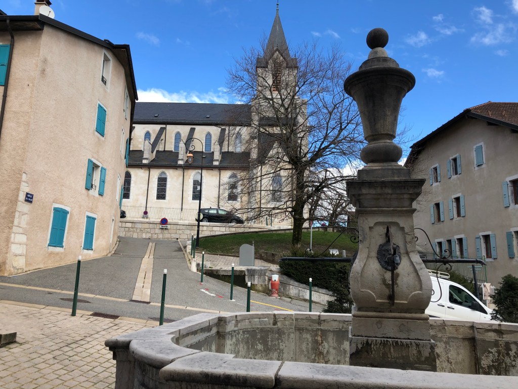
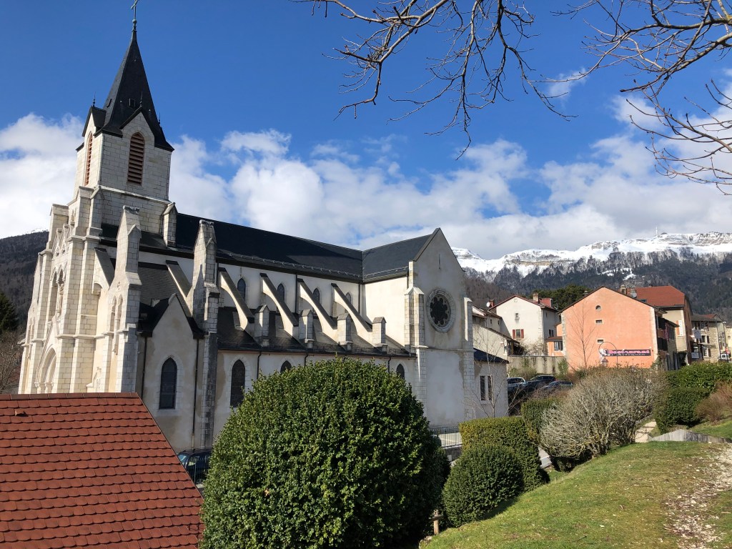
Church – built in 1860 and replacing the old church which was located where you today will find the Perdtemps primary school.
Gex and the Pays de Gex remained a political entity under the rule of the Dukes of Savoy for the next two hundred years until 1536, when the Bernese moved in to snatch control over the region. From 1563 Pays the Gex was torn between the Swiss, the Savoyards and the French and their respective religious convictions, with Catholicism in France and the Protestant reform going on in Switzerland. In 1601 Pays de Gex became attached to the Kingdom of France.
Tanneries – The tanneries used the water from the river Journans along with the tree bark that the nearby forest provided for the treatment of leather. The varying levels of water in the river forced the tanneries to stop the work for four months of the year. The last of the tanneries closed during the economical downturn of 1929.