
The Chartreuse massif is only just over an hour or so away from Pays de Gex and full of splendid walks.
Altitude to climb: 850 m
Time: 6 hrs
Level: medium/difficult
Mont Granier is a mountain with a horrifying history, positioned at the northern end of the Chartreuse massif. The northern face of Mont Granier overlooks Chambery and Lac de Bourget. This impressive vertical northern face is the result of a catastrophic collapse of a large part of the mountain in 1248.
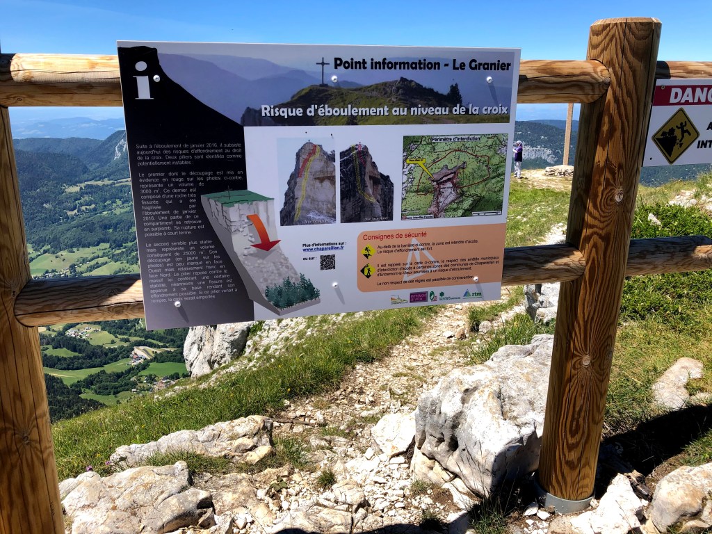
The rockslide occurred during the night of November 24-25, 1248. A large part of the north-eastern part of the mountain, having been slowly eroded, fell off, swept across the slopes and plains all the way to where the current highway lies, and completely destroyed 5 entire villages. The disaster, which covered 23 square kilometres, killed more than 1,000 people. The mountain is predicted to collapse entirely one day, and the area at the top where the cross can be found is not advised to be approached, after a number of smaller rockslides there in 2016. Even if you leave out the last few meters down to the cross, the walk is spectacular and will be a memory for life.

OK, back to the walk. This walk is quite challenging, especially when descending a steep couloir on the way back, and I would not recommend it for children under 10-12 years of age.
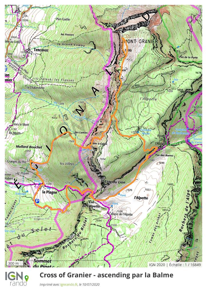
The starting point is La Plagne, which is a small hamlet of houses overlooking the impressive southern summit of Mont Granier and the neighbouring summit of Le Pinet, whose cliff face is equally impressive.
Parking can be found along the road and also on the forestry track that continues after you have passed the hamlet.
This is a fairly steep walk in parts, and because of that it really requires good weather. On the other hand, if the sun is shining there will probably be a crowd about and I’d advise you to arrive relatively early.
The route itself is well marked with yellow signposts all the way from start to finish.
I followed the signs to Mont Granier “par la Balme”. This will take you through the charming hamlet of houses in La Plagne.

The path then ascends steeply through a beech forest and levels out when reaching the crest. When above the trees, you’ll see the entrance to a cave. Follow the path straight into it. The cave opens up when inside (10 meters wide by 4 meters high), and you will see that the path continues through an exit to the right. If you brought a flashlight, take some time to explore the cave. In the late 1980’s several new passages into the cavernous system beyond the main cave were found, and bones from over a thousand cave bears were found. Some of these are exhibited in theMusée de l’Ours des Cavernesin Entremont-le-Vieux. Cave bears were ferocious monsters, way larger than bears of our time…


After emerging from the cave exit, the path follows a grassy traverse before ascending a gully through the cliffs. Relax, You’ve now done most of the climbing. Just a small traverse of about 20 minutes along the ridge of the mountain, and you are at the top of Mont Granier.
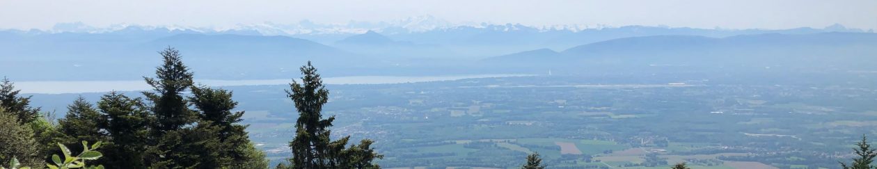
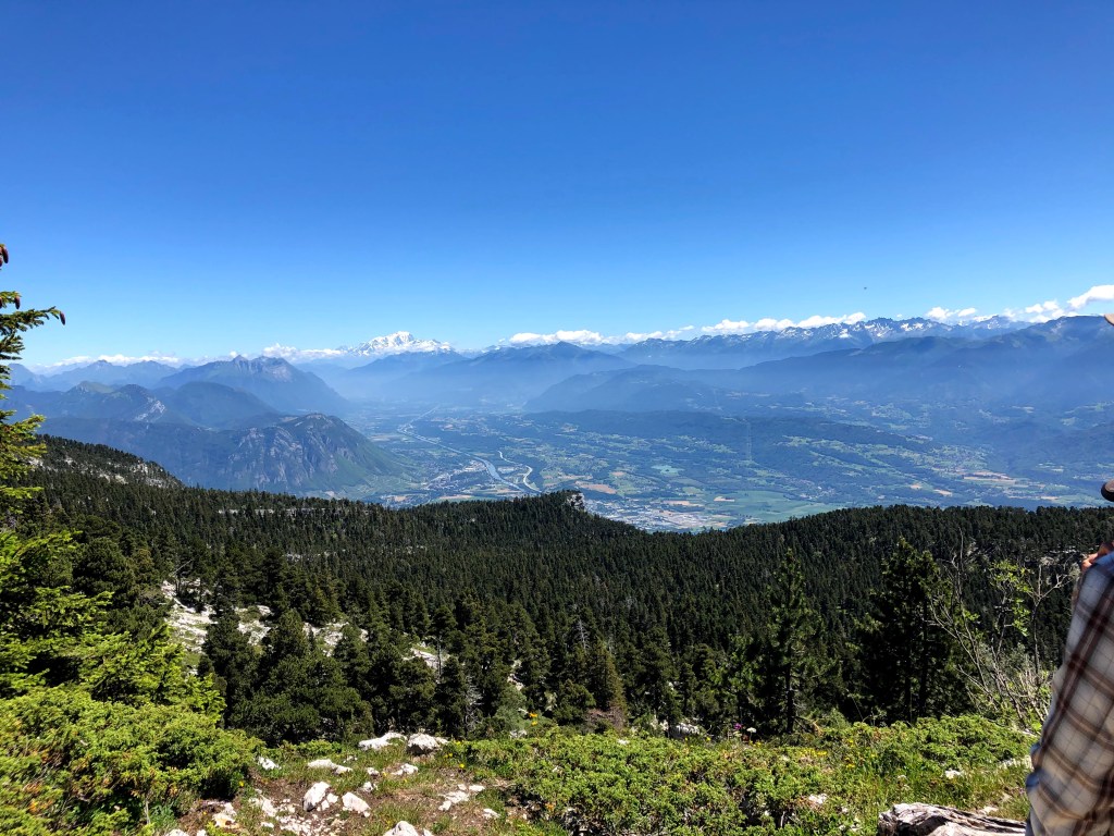
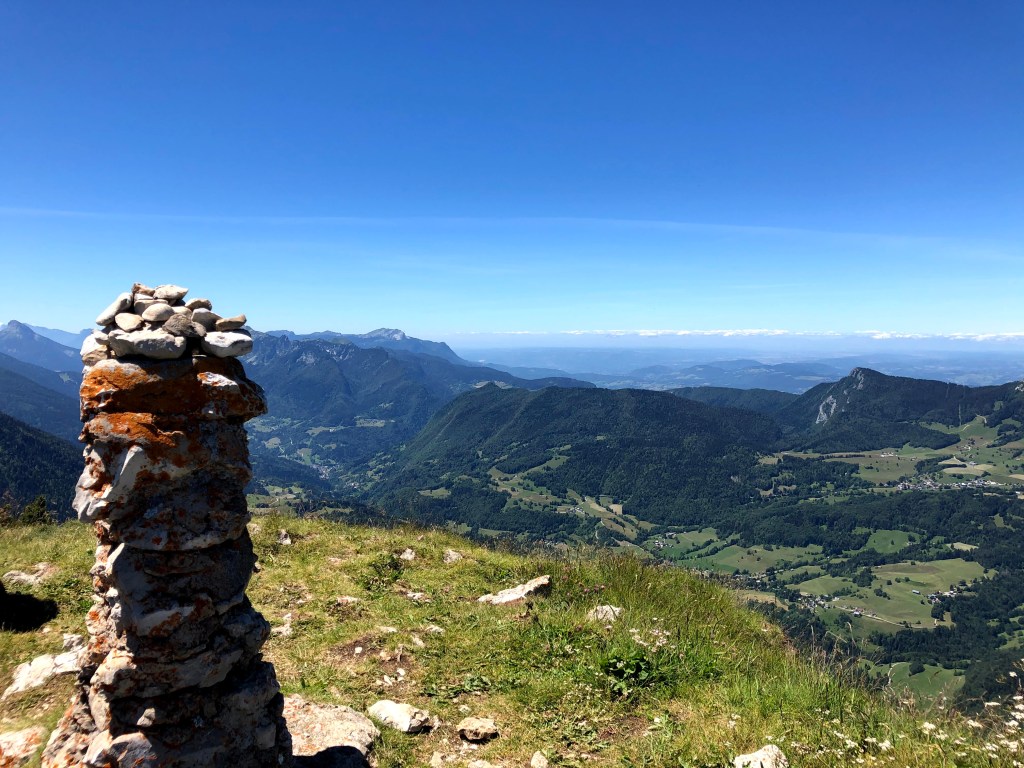
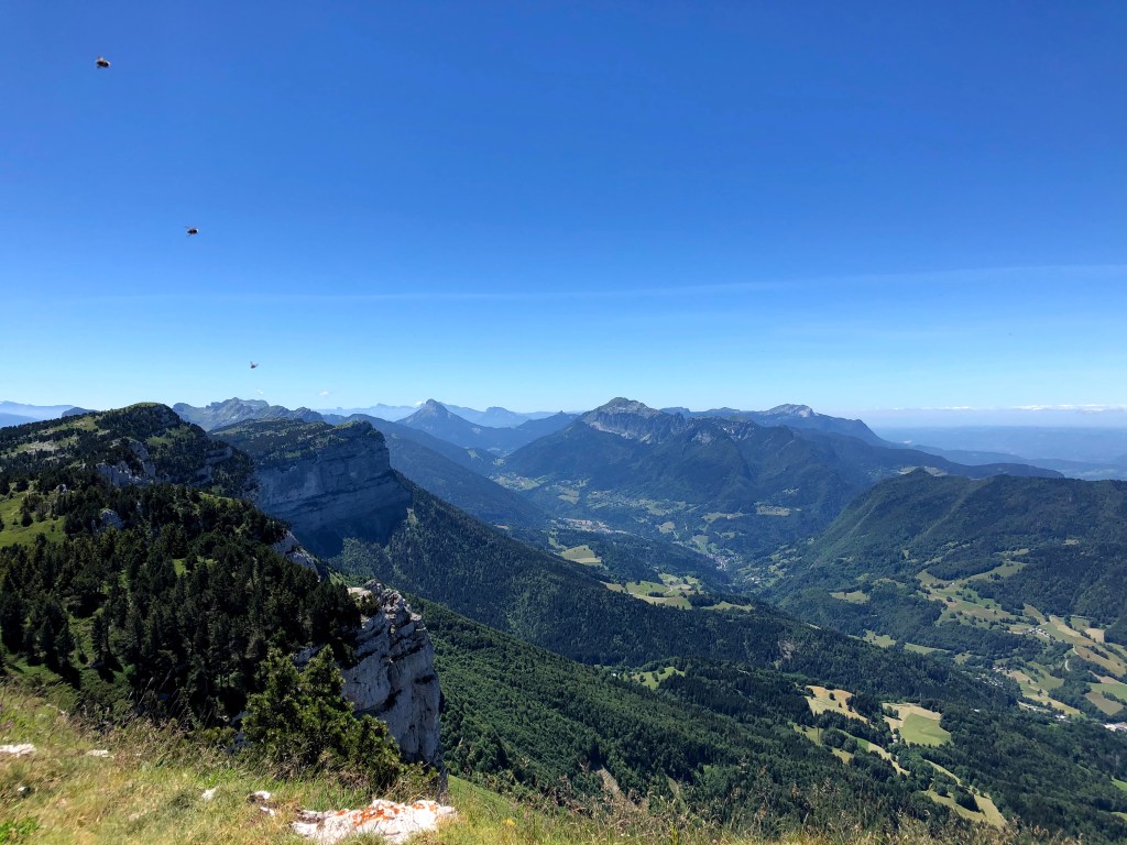
You will have an amazing overview of Chambery, Lac de Bourget, massif de la Chartreuse, Les Bauges and Mont Blanc.

From here, you can continue another 300 meters or so to the Cross of Granier which is situated at the top of the northern cliff for an even more spectacular view of the town of Chambery. Attention: don’t pass the signpost located 10 meters or so from the cross; it advises you to not approach the edge of the cliff due to possible new landslides.

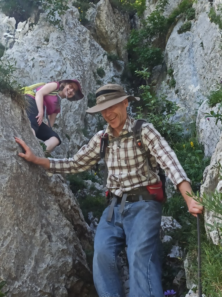
For the descent, you have two options. The easiest – and recommended if you suffer from vertigo, is to walk down the same path you used for the ascent. However, I would recommend you return via Pas des Barres and Col de l’Alpette. This path will start off leisurely for the first 30 minutes or so, and then zig-zag you down the cliff (not the main wall, mind you, but the eastern side, which is a lot gentler). Although there’s no real climbing involved, there are a couple of chimneys (Pas des Barres) that may be a little challenging (10-20 meters). This part of the descent is made easier by fixed iron steps and railings, almost like a miniature Via Ferrata. Honestly, if you’re in decent shape you can handle it well, but it may not be the best idea if accompanied by kids younger than 10-12 years of age.

When safely down at Col de l’Alpette you will be walking past a pair of giant boulders, and it’s a nice place to take a photo of Mont Blanc. The path continues to the right past some other boulders (one is really impressive – just imagine these things coming off the cliffs above) and to an easy but relatively long descent that takes you back to La Plagne and the car. Fun fact: this descent is apparently used when ferrying cows up and down for the summer pastures…
If you’re like me and you love French cheese, there’s a farm selling the goods in La Plagne. It is not in the center of the hamlet but a few hundred meters further down. It was closed when we passed and we went to the Cooperative laitiere des Entremonts instead, another 5 minutes down towards the center of Entremonts-le-Vieux. Here, you’ll find a big selection of locally produced cheese, wine and other regional products. They also have locally made ice cream – in case your car is equipped with a portable freezer (or you remembered to bring a spoon!)
Happy walking, and feel free to share!
